SUMMARY
This is AI generated summarization, which may have errors. For context, always refer to the full article.
What’s the weather like in your area? Report the situation through Rappler’s Agos or tweet us at @rapplerdotcom.
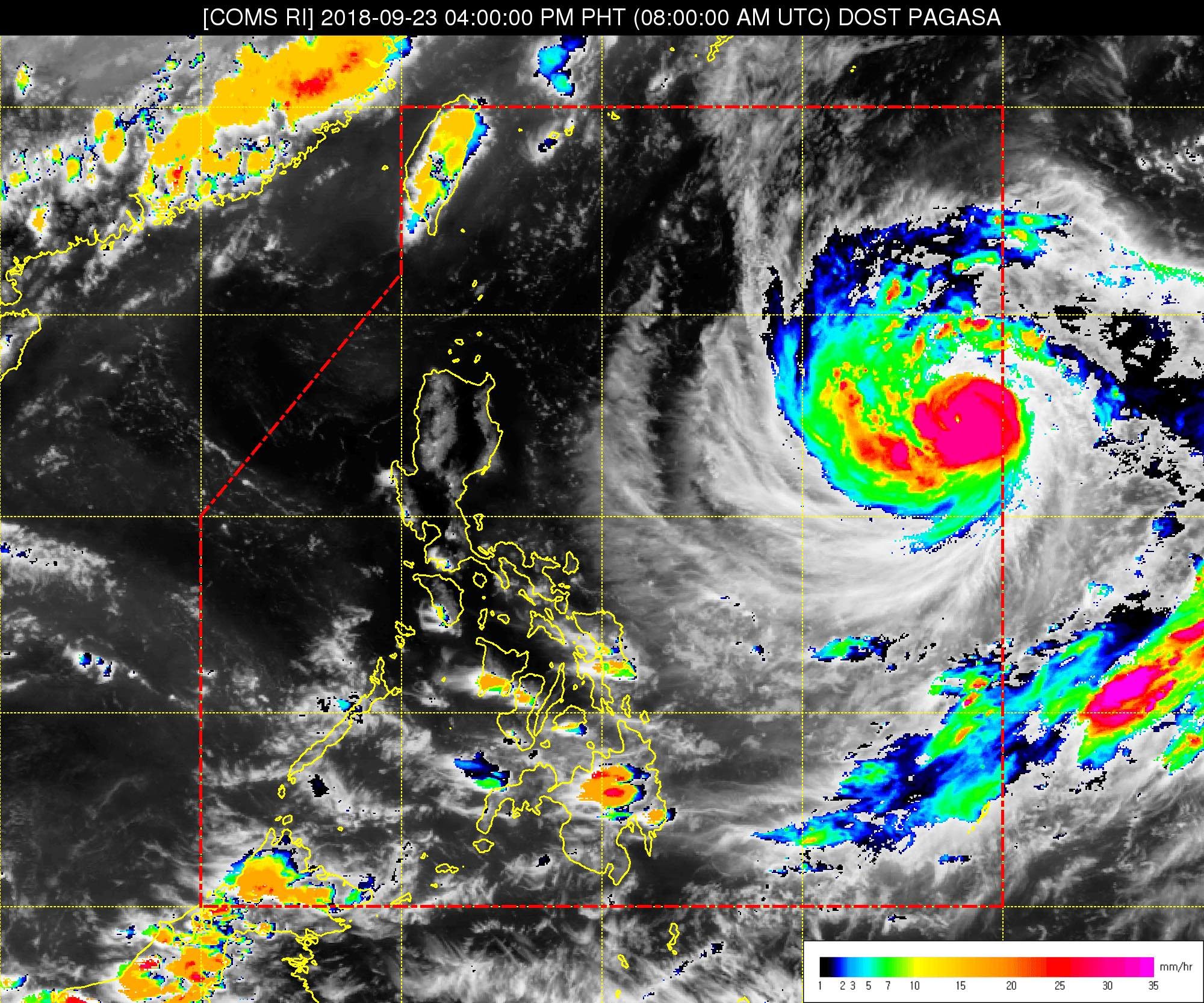
MANILA, Philippines – The typhoon with the international name Trami entered the Philippine Area of Responsibility (PAR) on Sunday, September 23, becoming the country’s 16th tropical cyclone for 2018. It has been given the local name Paeng.
In a bulletin issued 5 pm on Sunday, the Philippine Atmospheric, Geophysical, and Astronomical Services Administration (PAGASA) said Typhoon Paeng is already 1,290 kilometers east of Tuguegarao City, Cagayan. It is still too far to have a direct effect on any part of the Philippines.
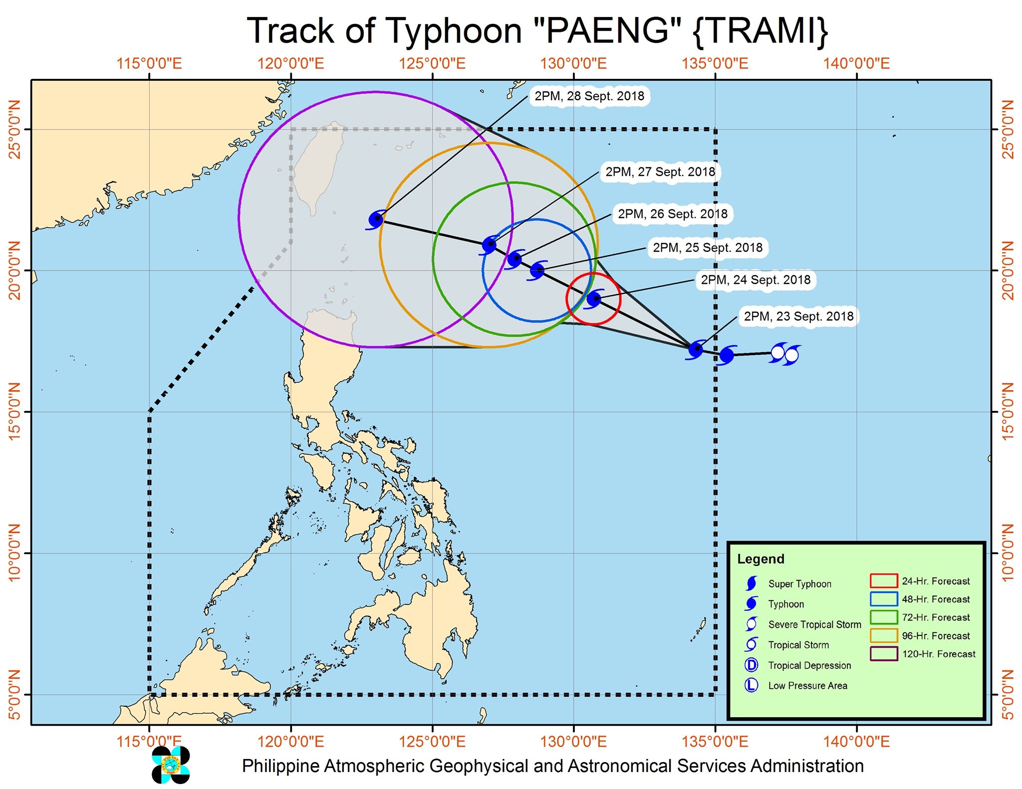
Paeng is now moving west northwest at a slightly slower 20 kilometers per hour (km/h) from the previous 25 km/h.
The typhoon entered PAR with maximum winds of 125 km/h and gustiness of up to 155 km/h.
There are no areas under tropical cyclone warning signals yet, and Paeng is unlikely to make landfall in the country. It is also not expected to significantly enhance the southwest monsoon or hanging habagat.
But PAGASA warned that the typhoon might affect extreme Northern Luzon, or Batanes and the Babuyan Group of Islands, on Friday, September 28.
Tropical cyclone warning signals could be raised in extreme Northern Luzon as early as Thursday, September 27.
A gale warning could also be issued for the seaboards of Northern Luzon as Paeng approaches. This means fishermen and others with small sea vessels may be warned about rough to very rough seas.
But PAGASA emphasized that since the typhoon is still too far away from land, the forecast could still change. The public should continue monitoring updates.
After Paeng, around 4 more tropical cyclones are expected in 2018. The Philippines usually gets an average of 20 tropical cyclones per year. (READ: LIST: PAGASA’s names for tropical cyclones in 2018)
Parts of Luzon are still reeling from the impact of Typhoon Ompong (Mangkhut), which left at least 95 people dead and caused destruction in provinces up north. (READ: Areas under state of calamity due to Typhoon Ompong)
Meanwhile, the whole country will only have localized thunderstorms on Monday, September 24, mostly in the afternoon or evening. But flash floods and landslides are also possible if the thunderstorms bring heavy rain. (READ: FAST FACTS: Tropical cyclones, rainfall advisories)
PAGASA declared the start of the rainy season last June 8. – Rappler.com
Add a comment
How does this make you feel?
There are no comments yet. Add your comment to start the conversation.