SUMMARY
This is AI generated summarization, which may have errors. For context, always refer to the full article.
What’s the weather like in your area? Report the situation through Rappler’s Agos or tweet us at @rapplerdotcom.
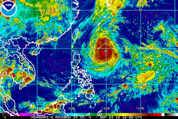
MANILA, Philippines – Typhoon Paeng (Trami) intensified further on Monday afternoon, September 24, as it maintained its speed and direction.
In a Facebook Live video at 5 pm on Monday, the Philippine Atmospheric, Geophysical, and Astronomical Services Administration (PAGASA) said Paeng now has maximum winds of 185 kilometers per hour (km/h) from the previous 170 km/h and gustiness of 225 km/h from the previous 210 km/h.
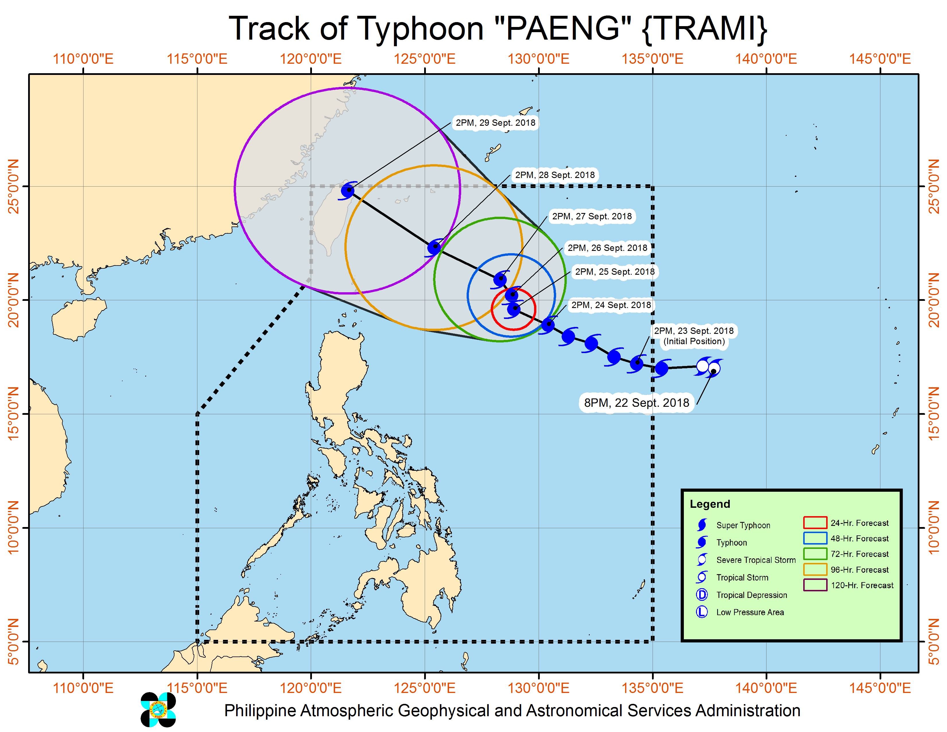
The typhoon is already 905 kilometers east of Aparri, Cagayan, still moving west northwest at 20 km/h.
Paeng does not have a direct effect on any part of the Philippines at the moment, due to its distance from land. There are no areas under tropical cyclone warning signals yet.
But Paeng is expected to affect extreme Northern Luzon, or Batanes and the Babuyan Group of Islands, on Friday, September 28. Tropical cyclone warning signals could be raised in extreme Northern Luzon as early as Thursday, September 27.
The typhoon is also expected to enhance the southwest monsoon or hanging habagat, which could bring light to moderate rain starting Thursday.
Based on its latest forecast track, Paeng could leave the Philippine Area of Responsibility on Saturday, September 29. (READ: FAST FACTS: Tropical cyclones, rainfall advisories)
After Paeng, around 4 more tropical cyclones are expected in 2018. The Philippines usually gets an average of 20 tropical cyclones per year. (READ: LIST: PAGASA’s names for tropical cyclones in 2018)
Parts of Luzon are still reeling from the impact of Typhoon Ompong (Mangkhut), which left nearly a hundred people dead and caused destruction in provinces up north. Dozens of people remain missing. (READ: Areas under state of calamity due to Typhoon Ompong)
On Tuesday, September 25, the whole country will only have localized thunderstorms, mostly in the afternoon or evening. But flash floods and landslides are also possible if the thunderstorms bring heavy rain.
PAGASA declared the start of the rainy season last June 8. – Rappler.com
Add a comment
How does this make you feel?
There are no comments yet. Add your comment to start the conversation.