SUMMARY
This is AI generated summarization, which may have errors. For context, always refer to the full article.
What’s the weather like in your area? Report the situation through Rappler’s Agos or tweet us at @rapplerdotcom.
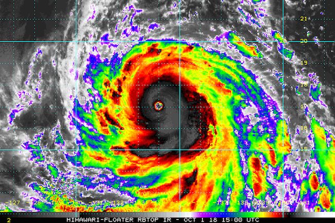
MANILA, Philippines – Typhoon Queenie (Kong-rey) strengthened further and slightly accelerated on Monday evening, October 1.
In a bulletin issued 11 pm on Monday, the Philippine Atmospheric, Geophysical, and Astronomical Services Administration (PAGASA) said Queenie now has maximum winds of 180 kilometers per hour (km/h) from the previous 160 km/h and gustiness of up to 220 km/h from the previous 195 km/h.
The typhoon is already 1,280 kilometers east of Casiguran, Aurora, moving northwest at a slightly faster 20 km/h from the previous 15 km/h. (READ: FAST FACTS: Tropical cyclones, rainfall advisories)
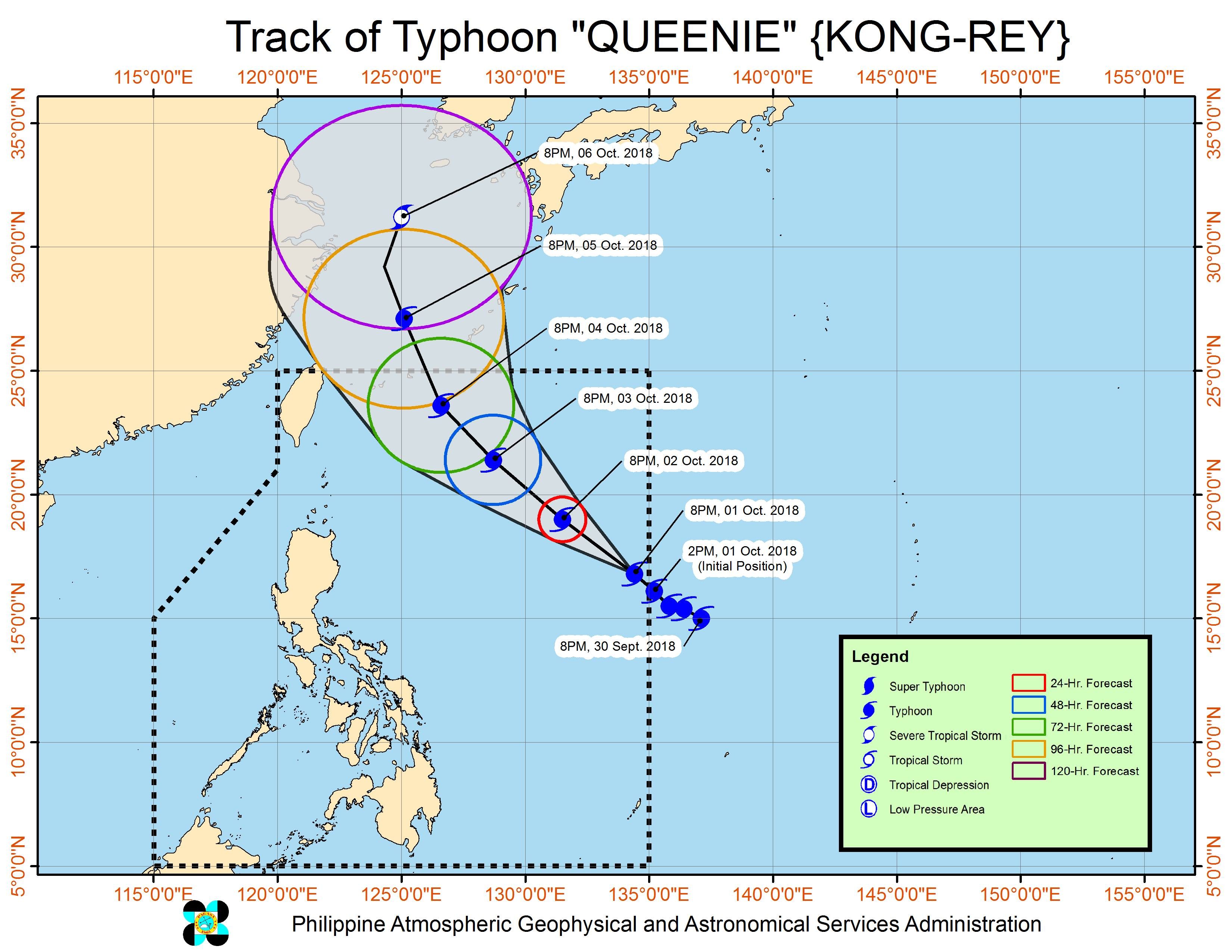
Queenie is not expected to make landfall in the Philippines, and will instead head for the southern part of Japan. There are also no areas under tropical cyclone warning signals.
But PAGASA warned that Queenie’s trough or extension will bring light to moderate rain to eastern parts of the country. It earlier said that Benguet, Nueva Vizcaya, Quirino, and Aurora may be affected until Thursday, October 4.
Sea travel is also risky in the northern seaboard of Northern Luzon.
A gale warning was issued at 5 pm on Monday for Batanes, Calayan, the Babuyan Group of Islands, the northern coast of Cagayan, and the northern coast of Ilocos Norte.
Seas off those areas are rough to very rough, with wave heights reaching 2.8 meters to 4.5 meters.
PAGASA advised fishermen and others with small vessels not to set sail in areas covered by the gale warning. Larger vessels should watch out for big waves.
Based on its latest forecast track, Queenie is expected to leave the Philippine Area of Responsibility on Friday, October 5.
Queenie is the Philippines’ 17th tropical cyclone for 2018. The country usually gets an average of 20 tropical cyclones per year.
For October alone, PAGASA said there could be 2 to 3 tropical cyclones. (READ: LIST: PAGASA’s names for tropical cyclones in 2018)
Meanwhile, the southwest monsoon or hanging habagat is weakening, as the Philippines will shift to the period of the northeast monsoon or hanging amihan in October.
The southwest monsoon is characterized by warm, moist winds which cause rain in the western part of the country, while the northeast monsoon is characterized by cold winds which bring rain to the eastern side of the country.
PAGASA declared the start of the rainy season last June 8. – Rappler.com
Add a comment
How does this make you feel?
There are no comments yet. Add your comment to start the conversation.