SUMMARY
This is AI generated summarization, which may have errors. For context, always refer to the full article.
What’s the weather like in your area? Tweet us at @rapplerdotcom.
MANILA, Philippines – Tropical Storm Hanna (Lekima) maintained its strength on Monday night, August 5, but a low pressure area outside the Philippine Area of Responsibility (PAR) developed into a tropical depression.
In a briefing past 11 pm on Monday, the Philippine Atmospheric, Geophysical, and Astronomical Services Administration (PAGASA) said Hanna is already 810 kilometers east of Aparri, Cagayan, or 825 kilometers east of Calayan, Cagayan.
It is slowly moving west, even slower than its previous speed of 10 kilometers per hour (km/h).
Hanna still has maximum winds of 85 km/h and gustiness of up to 105 km/h. But it is expected to intensify into a severe tropical storm within 24 hours, and then into a typhoon while inside PAR.
There are no areas under tropical cyclone wind signals, since Hanna is far from land. It is also unlikely to make landfall in the country.
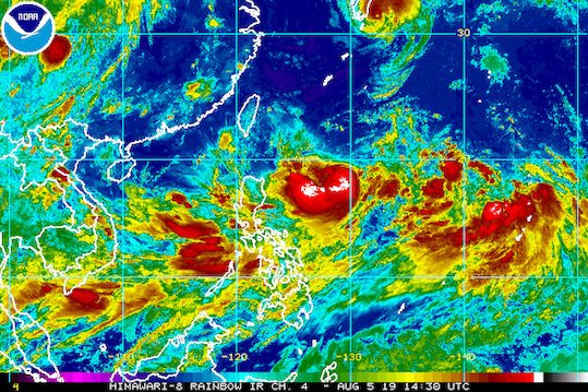
But the tropical storm continues to enhance the southwest monsoon or hanging habagat, which is still bringing rain to Luzon and the Visayas.
On Tuesday, August 6, and on Wednesday, August 7, these are the areas to be affected by the enhanced southwest monsoon:
- Moderate to heavy monsoon rain
- northern part of Palawan including Calamian and Cuyo islands
- Occidental Mindoro
- Oriental Mindoro
- Romblon
- Aklan
- Antique
- Scattered rainshowers and thunderstorms
- rest of Mimaropa
- Metro Manila
- Central Luzon
- Calabarzon
- Bicol
- Ilocos Region
- Cordillera Administrative Region
- rest of the Visayas
Residents of those areas must remain on alert for possible flash floods and landslides. (READ: FAST FACTS: Tropical cyclones, rainfall advisories)
PAGASA also warned fishermen and others with small vessels not to venture out into the western seaboards of Northern Luzon and Central Luzon, the seaboards of Southern Luzon and the Visayas, and the eastern seaboard of Mindanao.
Based on Hanna’s latest forecast track, it is expected to leave PAR on Friday, August 9.
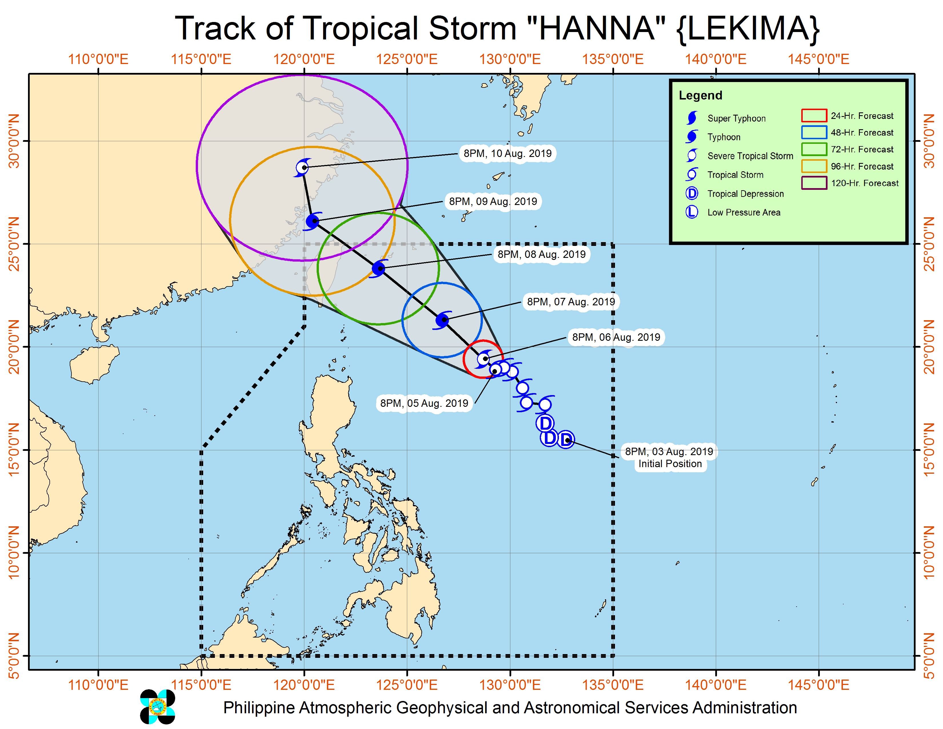
Meanwhile, an LPA outside PAR is now a tropical depression. The tropical depression is located 2,525 kilometers east of Northern Luzon, moving west northwest at 20 km/h.
It has maximum winds of 45 km/h and gustiness of up to 55 km/h.
PAGASA Weather Specialist Ezra Bulquerin said current models show the tropical depression is not expected to enter PAR, and it has no significant effect on the country at the moment. Updates will be given in case this scenario changes.
Hanna is the Philippines’ 8th tropical cyclone for 2019, and the 1st for the month of August. (READ: LIST: PAGASA’s names for tropical cyclones in 2019)
The country gets an average of 20 tropical cyclones annually, but since 2019 is an El Niño year, only 14 to 18 tropical cyclones are expected.
Below is the estimated number of tropical cyclones from August to December:
- August – 2 to 4
- September – 2 to 4
- October – 2 or 3
- November – 1 or 2
- December – 0 or 1
PAGASA declared the start of the rainy season last June 14. – Rappler.com
Add a comment
How does this make you feel?
There are no comments yet. Add your comment to start the conversation.