SUMMARY
This is AI generated summarization, which may have errors. For context, always refer to the full article.
What’s the weather like in your area? Tweet us at @rapplerdotcom.
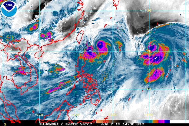
MANILA, Philippines – Typhoon Hanna (Lekima) gained more strength on Wednesday evening, August 7, while enhancing the southwest monsoon or hanging habagat.
In a bulletin issued 11 pm on Wednesday, the Philippine Atmospheric, Geophysical, and Astronomical Services Administration (PAGASA) said Hanna now has maximum winds of 155 kilometers per hour (km/h) from the previous 140 km/h and gustiness of up to 190 km/h from the previous 170 km/h.
The typhoon is already 510 kilometers east northeast of Basco, Batanes, moving northwest at a slightly faster 20 km/h from the previous 15 km/h. It is still heading toward the southern part of Japan’s Ryukyu Islands.
Hanna will not make landfall in the Philippines. Signal No. 1, however, remains raised in:
- Batanes
- Babuyan Group of Islands
PAGASA warned that Hanna’s outer rainbands are bringing light to heavy rain and gusty winds to Batanes and the Babuyan Group of Islands. These will persist until Thursday, August 8.
More rain from the enhanced southwest monsoon is also expected on Thursday, and even on Friday, August 9.
Thursday, August 8
- Moderate to heavy monsoon rain
- Metro Manila
- Ilocos Region
- Cordillera Administrative Region
- Zambales
- Bataan
- Rizal
- Cavite
- Laguna
- Batangas
- Occidental Mindoro
- Oriental Mindoro
- northern part of Palawan including Calamian and Cuyo islands
- Light to heavy rain
- rest of Luzon
- Western Visayas
Friday, August 9
- Moderate to heavy monsoon rain
- Ilocos Region
- Cordillera Administrative Region
- Zambales
- Bataan
- Cavite
- Batangas
- Occidental Mindoro
- Light to heavy rain
- rest of Luzon
- Western Visayas
Residents of those areas must stay on alert for possible flash floods and landslides. (READ: FAST FACTS: Tropical cyclones, rainfall advisories)
Some areas have already suspended classes for Thursday. (READ: #WalangPasok: Class suspensions, Thursday, August 8, 2019)
PAGASA added that occasional gusty conditions will continue in the western sections of Luzon and the Visayas due to the enhanced southwest monsoon.
Travel also remains risky in the seaboards of areas under Signal No. 1, seaboards of Luzon and the Visayas, and northern and eastern seaboards of Mindanao.
Based on Hanna’s latest forecast track, it is expected to leave the Philippine Area of Responsibility (PAR) on Friday.
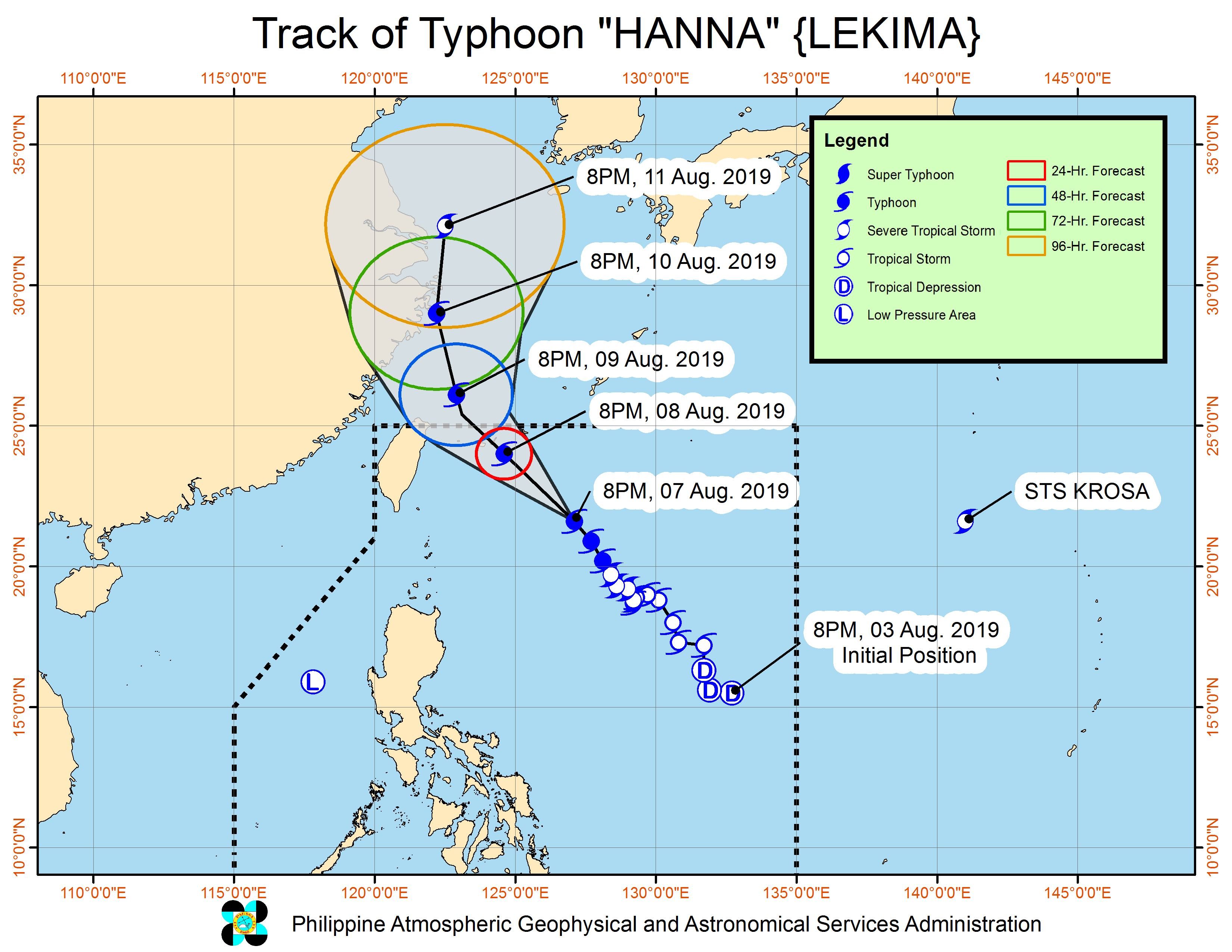
Hanna is the Philippines’ 8th tropical cyclone for 2019, and the 1st for the month of August. It is also the country’s 1st tropical cyclone to reach typhoon status in 2019. (READ: LIST: PAGASA’s names for tropical cyclones in 2019)
Aside from Hanna, PAGASA continues to monitor two other weather systems:
- low pressure area (LPA) inside PAR
- Severe Tropical Storm Krosa outside PAR
The LPA inside PAR is now 260 kilometers west of Dagupan City, Pangasinan. PAGASA said it is unlikely to develop into a tropical depression, but it is contributing to the enhancement of the southwest monsoon.
Meanwhile, Severe Tropical Storm Krosa is already 1,970 kilometers east of extreme Northern Luzon, moving north northwest at a slightly slower 10 km/h from the previous 15 km/h.
Krosa strengthened, now with maximum winds of 110 km/h from the previous 95 km/h and gustiness of up to 135 km/h from the previous 115 km/h.
The severe tropical storm is not expected to enter PAR, based on current models.
The country gets an average of 20 tropical cyclones annually, but since 2019 is an El Niño year, only 14 to 18 tropical cyclones are expected.
Below is the estimated number of tropical cyclones from August to December:
- August – 2 to 4
- September – 2 to 4
- October – 2 or 3
- November – 1 or 2
- December – 0 or 1
PAGASA declared the start of the rainy season last June 14. – Rappler.com
Add a comment
How does this make you feel?
There are no comments yet. Add your comment to start the conversation.