SUMMARY
This is AI generated summarization, which may have errors. For context, always refer to the full article.
What’s the weather like in your area? Tweet us at @rapplerdotcom.
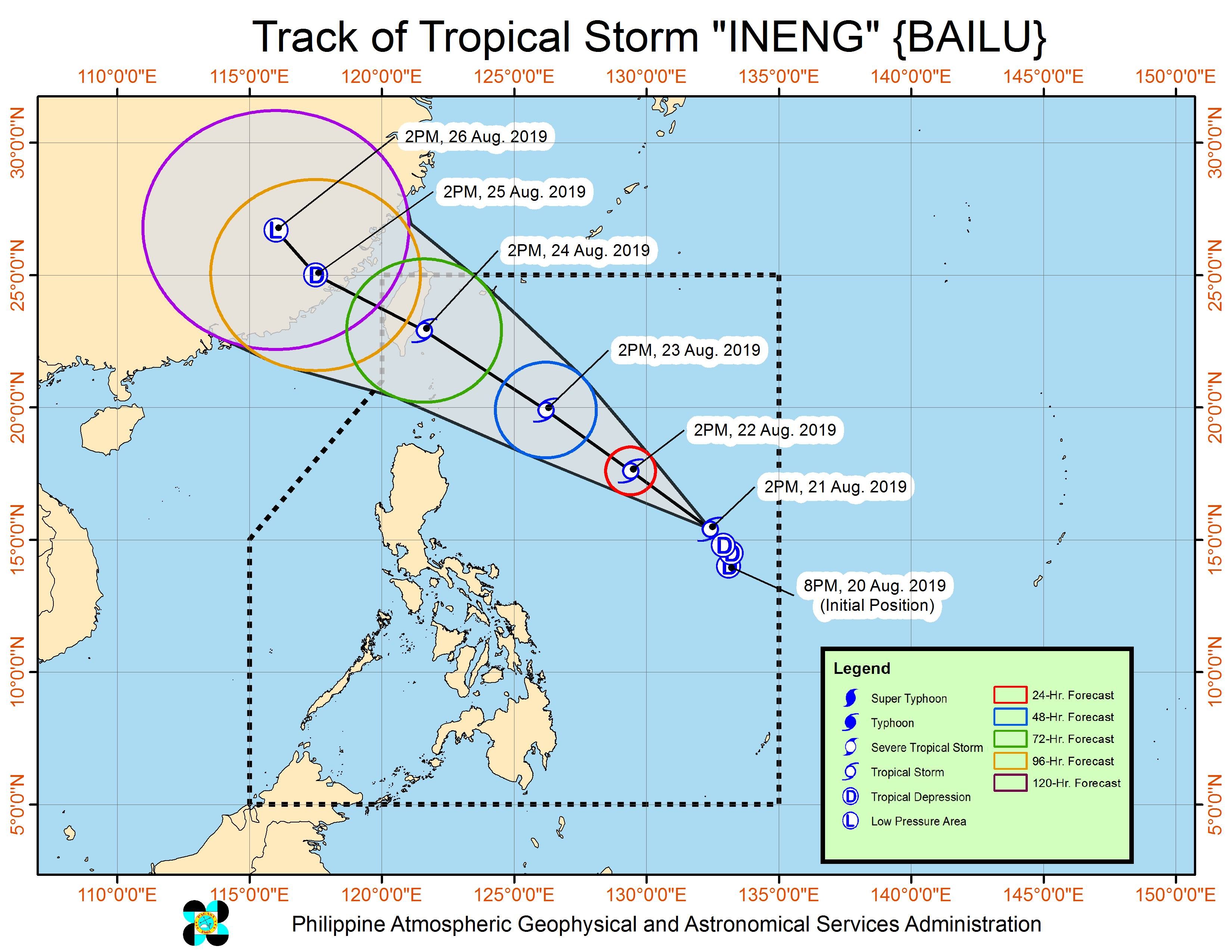
MANILA, Philippines – Ineng intensified from a tropical depression into a tropical storm on Wednesday afternoon, August 21. It has been given the international name Bailu.
In a briefing at 5 pm on Wednesday, the Philippine Atmospheric, Geophysical, and Astronomical Services Administration (PAGASA) said Tropical Storm Ineng (Bailu) now has maximum winds of 65 kilometers per hour (km/h) from the previous 55 km/h and gustiness of up to 80 km/h from the previous 70 km/h.
Ineng is expected to remain a tropical storm while inside the Philippine Area of Responsibility (PAR), meaning it is not seen to strengthen further.
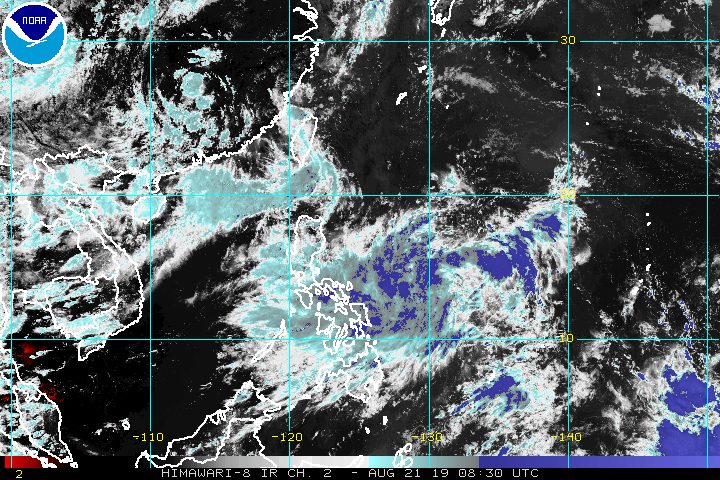
Ineng is already 1,135 kilometers east of Infanta, Quezon. It slightly accelerated, and is now moving northwest at 15 kilometers per hour (km/h) from its previous slow pace.
There are no tropical cyclone wind signals raised at the moment, since Ineng remains far from land. It is also unlikely to make landfall.
But the outer rainbands of the tropical storm are bringing scattered rainshowers and thunderstorms, ranging from light to heavy, to the following areas:
- Bicol
- Quezon
- Eastern Visayas
The southwest monsoon or hanging habagat, meanwhile, is affecting the western parts of Luzon and the Visayas. There will also be scattered rainshowers and thunderstorms in:
- Mimaropa
- Batanes
- Babuyan Group of Islands
- rest of the Visayas
PAGASA advised those areas to stay on alert for possible flash floods and landslides. (READ: FAST FACTS: Tropical cyclones, rainfall advisories)
The rest of the country, not affected by either Ineng’s outer rainbands or the southwest monsoon, will only have isolated rainshowers or localized thunderstorms.
There is no gale warning issued, but PAGASA warned that eastern sections of Southern Luzon, the Visayas, and Mindanao should watch out for moderate to rough seas.
Based on its latest forecast track, Ineng will leave PAR on Sunday, August 25.
Ineng is the Philippines’ 9th tropical cyclone for 2019 and the 2nd for August. (READ: LIST: PAGASA’s names for tropical cyclones in 2019)
The country gets an average of 20 tropical cyclones annually, but since 2019 is an El Niño year, only 14 to 18 tropical cyclones are expected.
Below is the estimated number of tropical cyclones from August to December:
- August – 2 to 4
- September – 2 to 4
- October – 2 or 3
- November – 1 or 2
- December – 0 or 1
PAGASA declared the start of the rainy season last June 14. – Rappler.com
Add a comment
How does this make you feel?
There are no comments yet. Add your comment to start the conversation.