SUMMARY
This is AI generated summarization, which may have errors. For context, always refer to the full article.
What’s the weather like in your area? Tweet us at @rapplerdotcom.
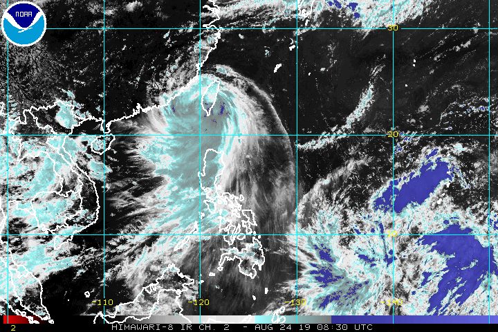
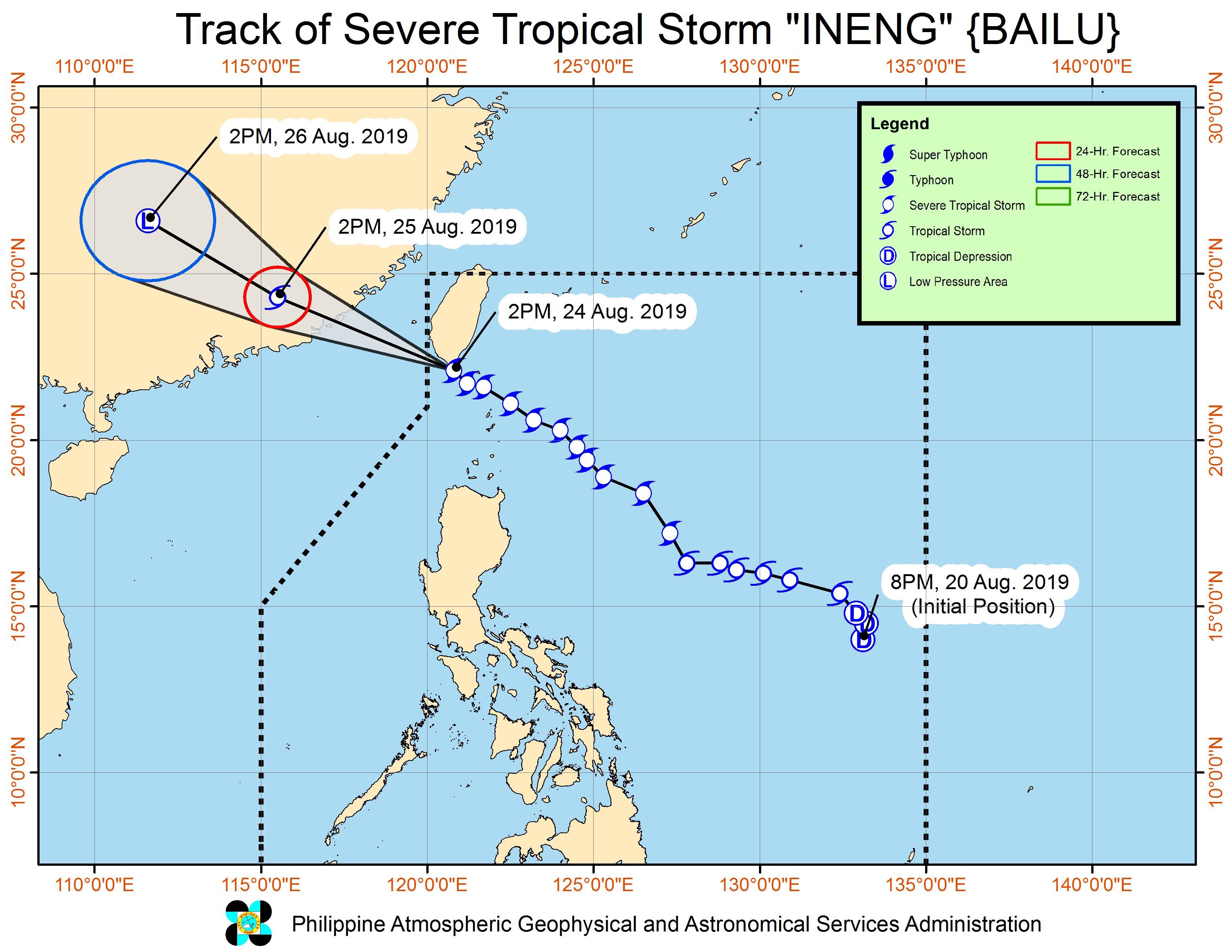
MANILA, Philippines – Severe Tropical Storm Ineng (Bailu) made landfall over Pingtung County in the southern part of Taiwan at 2 pm on Saturday, August 24, but it remains within the Philippine Area of Responsibility (PAR).
In a briefing past 5 pm on Saturday, the Philippine Atmospheric, Geophysical, and Astronomical Services Administration (PAGASA) said Ineng is already 275 kilometers north northwest of Basco, Batanes.
The severe tropical storm is expected to leave PAR late Saturday afternoon or early evening. But it slowed down, and is now moving west northwest at 20 kilometers per hour (km/h) from the previous 30 km/h.
It continues to have maximum winds of 100 km/h and gustiness of up to 125 km/h.
Only two areas remain under tropical cyclone wind signals.
Signal No. 2 (winds of 61 km/h to 120 km/h)
- Batanes
Signal No. 1 (winds of 30 km/h to 60 km/h)
- Babuyan Group of Islands
Ineng did not make landfall in the Philippines, but it has been bringing heavy rain and strong winds. It is also still enhancing the southwest monsoon or hanging habagat, which is another source of rain.
The rain from the enhanced southwest monsoon is not yet over. Here’s what to expect on Saturday evening:
Moderate to heavy rain
- Ilocos Region
- Cordillera Administrative Region
- Batanes
- northern part of Cagayan including Babuyan Group of Islands
- Zambales
- Bataan
Light to heavy rain
- Metro Manila
- Cavite
- Batangas
- Rizal
- Laguna
- Occidental Mindoro
- Oriental Mindoro
- northern part of Palawan including Calamian and Cuyo islands
- rest of Cagayan Valley
- rest of Central Luzon
Ilocos Norte is already under a state of calamity after heavy rain triggered floods. (IN PHOTOS: Floods hit Ilocos Norte, Metro Manila due to Ineng, monsoon)
Since the rain will persist, PAGASA advised residents to stay on alert for flash floods and landslides. (READ: FAST FACTS: Tropical cyclones, rainfall advisories)
Travel also remains risky in the seaboards of areas under Signal Nos. 1 and 2, as well as in the seaboards of Luzon.
Meanwhile, PAGASA continues to monitor a low pressure area (LPA) outside PAR. This LPA is now 1,790 kilometers east of Mindanao and could enter PAR by Monday, August 26.
The LPA may develop into a tropical depression and affect parts of Luzon. Updates will be given in the coming days.
Ineng is the Philippines’ 9th tropical cyclone for 2019 and the 2nd for August. (READ: LIST: PAGASA’s names for tropical cyclones in 2019)
The country gets an average of 20 tropical cyclones annually, but since 2019 is an El Niño year, only 14 to 18 tropical cyclones are expected.
Below is the estimated number of tropical cyclones from August to December:
- August – 2 to 4
- September – 2 to 4
- October – 2 or 3
- November – 1 or 2
- December – 0 or 1
PAGASA declared the start of the rainy season last June 14. – Rappler.com
Add a comment
How does this make you feel?
There are no comments yet. Add your comment to start the conversation.