SUMMARY
This is AI generated summarization, which may have errors. For context, always refer to the full article.
What’s the weather like in your area? Tweet us at @rapplerdotcom.
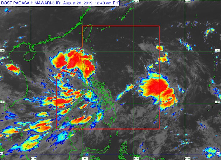
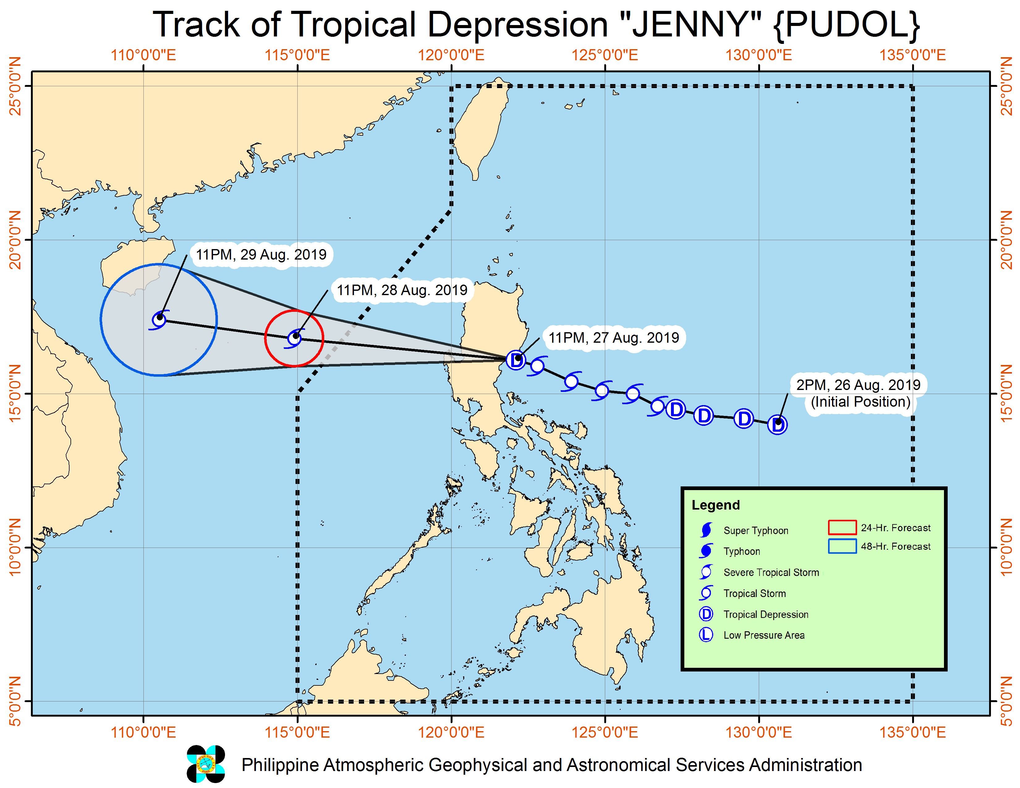
MANILA, Philippines (UPDATED) – Tropical Storm Jenny (Podul) made landfall in Casiguran, Aurora, at 10:40 pm on Tuesday, August 27, then weakened into a tropical depression.
The Philippine Atmospheric, Geophysical, and Astronomical Services Administration (PAGASA) announced the landfall at around 12:30 am on Wednesday, August 28.
Then in a bulletin issued 2 am on Wednesday, PAGASA said Jenny is already in the vicinity of Dinalungan, Aurora.
It is still moving west northwest at a relatively fast 35 kilometers per hour (km/h).
Jenny’s maximum winds are down to 55 km/h from the previous 65 km/h, while its gustiness remains up to 90 km/h.
Below are the latest areas under tropical cyclone wind signals. There are no more areas under Signal No. 2, and there are fewer areas under Signal No. 1.
Signal No. 1 (winds of 30 km/h to 60 km/h)
- Cagayan
- Isabela
- Quirino
- Nueva Vizcaya
- Apayao
- Abra
- Kalinga
- Mountain Province
- Ifugao
- Benguet
- Ilocos Norte
- Ilocos Sur
- La Union
- Pangasinan
- Zambales
- Tarlac
- Nueva Ecija
- Aurora
- Pampanga
- Bulacan
- northern part of Quezon including Polillo Island
PAGASA warned that gusty conditions may occur in areas under Signal No. 1. It added that the Visayas and other parts of Luzon may also experience occasional gusts due to the southwest monsoon or hanging habagat.
In terms of rainfall, here’s the latest on what to expect:
Early Wednesday morning to early Wednesday afternoon, August 28
- Moderate to heavy rain
- Ilocos Region
- Cordillera Administrative Region
- Cagayan
- Isabela
- Quirino
- Nueva Vizcaya
- Aurora
- Light to heavy rain
- Metro Manila
- Calabarzon
- Occidental Mindoro
- Oriental Mindoro
- Palawan
- rest of Cagayan Valley
- rest of Central Luzon
- Western Visayas
- Zamboanga Peninsula
Early Wednesday afternoon, August 28, to early Thursday afternoon, August 29
- Light to heavy rain due to the southwest monsoon
- Occidental Mindoro
- Oriental Mindoro
- northern part of Palawan including Calamian and Cuyo islands
- Zambales
- Bataan
- Western Visayas
Areas affected by Jenny must stay on alert for possible flash floods and landslides. (READ: FAST FACTS: Tropical cyclones, rainfall advisories)
Class suspensions were again declared for Wednesday in various areas. (READ: #WalangPasok: Class suspensions, Wednesday, August 28, 2019)
Travel also remains risky in the seaboards of areas under Signal No. 1 and in the seaboards of extreme Northern Luzon.
Based on its latest forecast track, Jenny will leave PAR on Wednesday.
Jenny is the Philippines’ 10th tropical cyclone for 2019, and the 3rd for August. (READ: LIST: PAGASA’s names for tropical cyclones in 2019)
The country gets an average of 20 tropical cyclones annually, but since 2019 is an El Niño year, only 14 to 18 tropical cyclones are expected.
Below is the estimated number of tropical cyclones from August to December:
- August – 2 to 4
- September – 2 to 4
- October – 2 or 3
- November – 1 or 2
- December – 0 or 1
PAGASA declared the start of the rainy season last June 14. – Rappler.com
Add a comment
How does this make you feel?
There are no comments yet. Add your comment to start the conversation.