SUMMARY
This is AI generated summarization, which may have errors. For context, always refer to the full article.
What’s the weather like in your area? Tweet us at @rapplerdotcom.
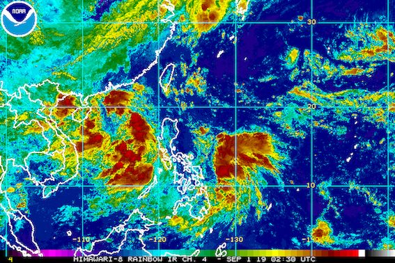
MANILA, Philippines (UPDATED) – Two tropical cyclones greeted the first day of September.
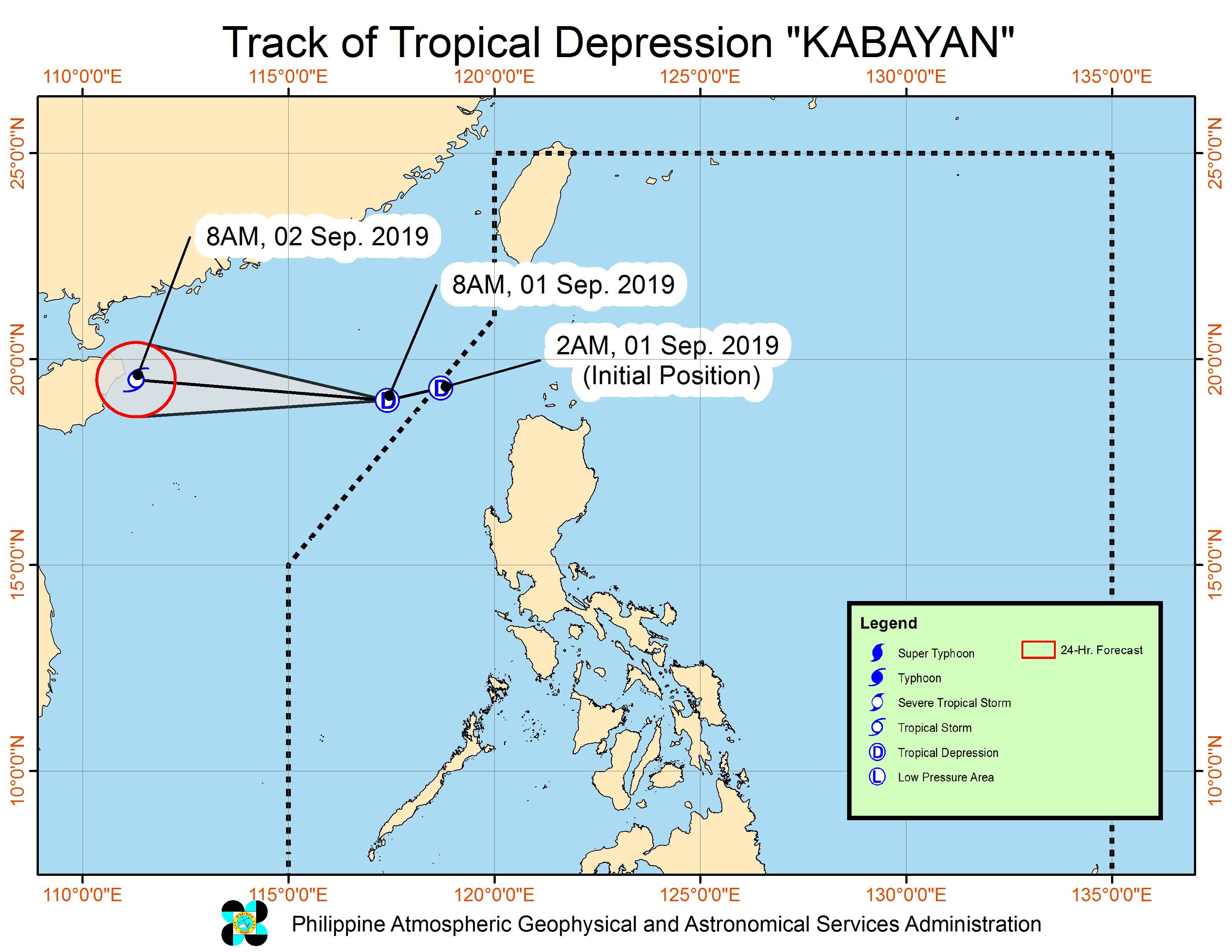
Tropical Depression Kabayan formed at 2 am on Sunday, September 1, then left the Philippine Area of Responsibility (PAR) just 4 hours later, at 6 am. It was previously a low pressure area (LPA) off Cagayan.
But at 8 am, the LPA east of Mindanao developed into Tropical Depression Liwayway.
Kabayan
In a bulletin issued past 11 am on Sunday, the Philippine Atmospheric, Geophysical, and Astronomical Services Administration (PAGASA) said Kabayan is already 390 kilometers west northwest of Laoag City, Ilocos Norte, outside PAR.
It slightly accelerated as it left, now moving west toward southern China at 25 kilometers per hour (km/h) from the previous 20 km/h.
The tropical depression maintained its strength, with maximum winds of 55 km/h and gustiness of up to 70 km/h. But it could later become a tropical storm. (READ: FAST FACTS: Tropical cyclones, rainfall advisories)
No areas were placed under tropical cyclone wind signals due to Kabayan.
Even though Kabayan is already outside PAR, however, it is still causing rough seas, along with the southwest monsoon or hanging habagat.
PAGASA said sea travel is not advised for small seacraft in the northern and western seaboards of Northern Luzon and the western seaboard of Central Luzon.
Liwayway
In a separate bulletin, PAGASA said Liwayway is 405 kilometers east northeast of Hinatuan, Surigao del Sur, or 510 kilometers east of Maasin City, Southern Leyte.
This new tropical depression is moving northwest at 20 km/h, with maximum winds of 45 km/h and gustiness of up to 55 km/h.
There are no tropical cyclone wind signals due to Liwayway, and it is unlikely to make landfall in the country. It will probably remain over the Philippine Sea.
But PAGASA said the trough or extension of the tropical depression may bring scattered rainshowers – ranging from light to heavy – to Caraga and the Davao Region on Sunday.
Residents of those two areas should watch out for possible flash floods and landslides.
Kabayan and Liwayway are the Philippines’ 11th and 12th tropical cyclones for 2019, and the 1st and 2nd for September. (READ: LIST: PAGASA’s names for tropical cyclones in 2019)
The country gets an average of 20 tropical cyclones annually, but since 2019 is an El Niño year, only 14 to 18 tropical cyclones are expected.
Below is the estimated number of tropical cyclones from September to December:
- September – 2 to 4
- October – 2 or 3
- November – 1 or 2
- December – 0 or 1
PAGASA declared the start of the rainy season last June 14. – Rappler.com
Add a comment
How does this make you feel?
There are no comments yet. Add your comment to start the conversation.