SUMMARY
This is AI generated summarization, which may have errors. For context, always refer to the full article.
What’s the weather like in your area? Tweet us at @rapplerdotcom.
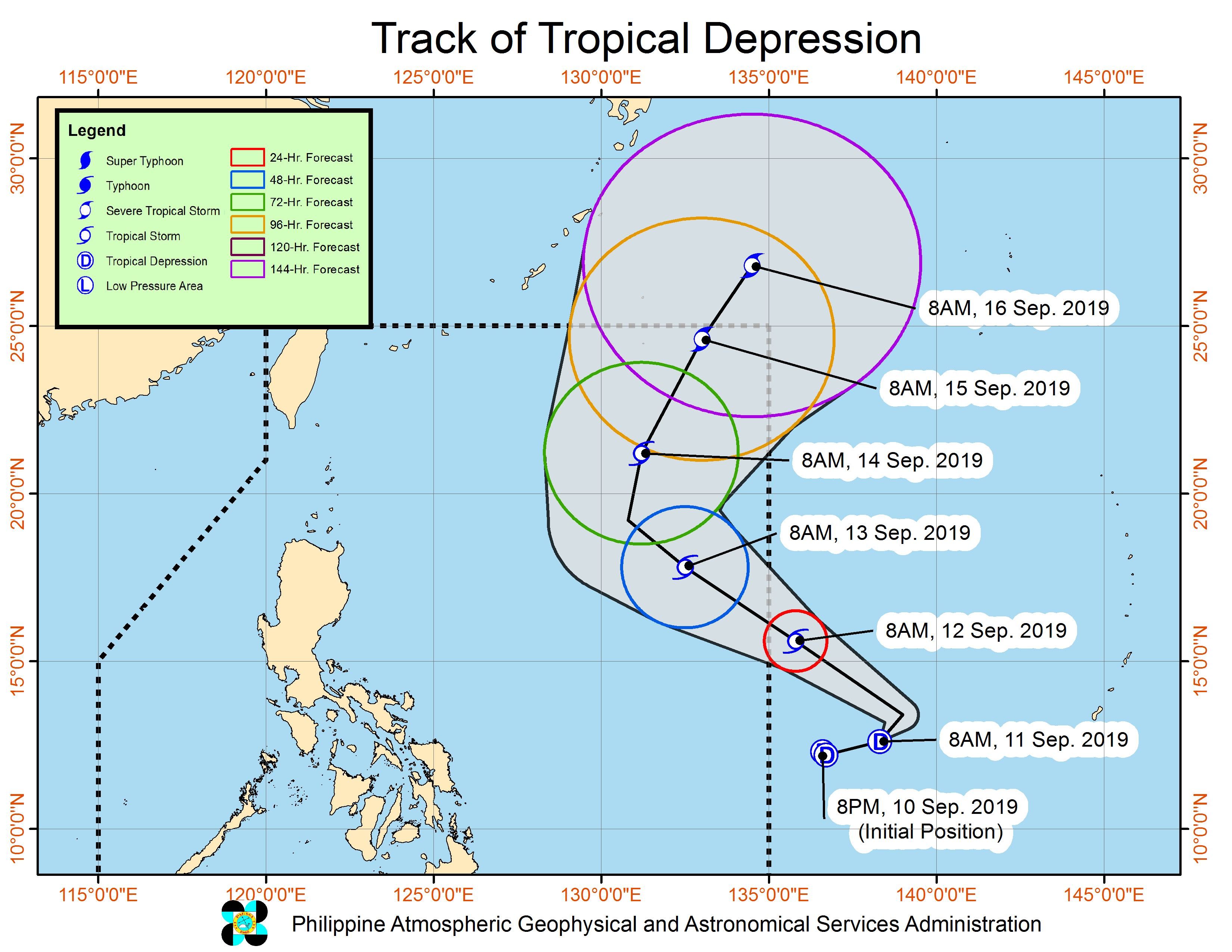
MANILA, Philippines – The low pressure area (LPA) outside the Philippine Area of Responsibility (PAR) is now a tropical depression, and it may enter PAR by Thursday, September 12.
The Philippine Atmospheric, Geophysical, and Astronomical Services Administration (PAGASA) announced on Wednesday, September 11, that the LPA developed into a tropical depression at 8 pm on Tuesday, September 10.
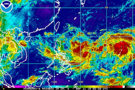
In a bulletin issued 11 am on Wednesday, PAGASA said the tropical depression is already 1,495 kilometers east of the Visayas.
It was previously stationary or stuck in the same spot, but is now moving east northeast at 15 kilometers per hour (km/h). (READ: FAST FACTS: Tropical cyclones, rainfall advisories)
The tropical depression has maximum winds of 55 km/h and gustiness of up to 70 km/h. It is expected to intensify into a tropical storm before entering PAR on Thursday.
When it enters PAR, it will be given the local name Marilyn. (READ: LIST: PAGASA’s names for tropical cyclones in 2019)
But even before its entry, the trough or extension of the tropical depression, combined with the southwest monsoon or hanging habagat, will already bring scattered rainshowers and thunderstorms.
The rain will mostly be light to moderate, but may be heavy at times, in the following areas:
- Occidental Mindoro
- Oriental Mindoro
- Romblon
- Marinduque
- northern part of Palawan including Calamian and Cuyo islands
- Bicol
- Visayas
The good news – the potential Marilyn is not expected to make landfall in the Philippines. It is likely to just stay east of the country until Sunday, September 15.
The Philippines has had 12 tropical cyclones in 2019, with 2 of those in September.
The country gets an average of 20 tropical cyclones annually, but since 2019 is an El Niño year, only 14 to 18 tropical cyclones are expected.
Below is the estimated number of tropical cyclones from September to December:
- September – 2 to 4
- October – 2 or 3
- November – 1 or 2
- December – 0 or 1
PAGASA declared the start of the rainy season last June 14. – Rappler.com
Add a comment
How does this make you feel?
There are no comments yet. Add your comment to start the conversation.