SUMMARY
This is AI generated summarization, which may have errors. For context, always refer to the full article.
What’s the weather like in your area? Tweet us at @rapplerdotcom.
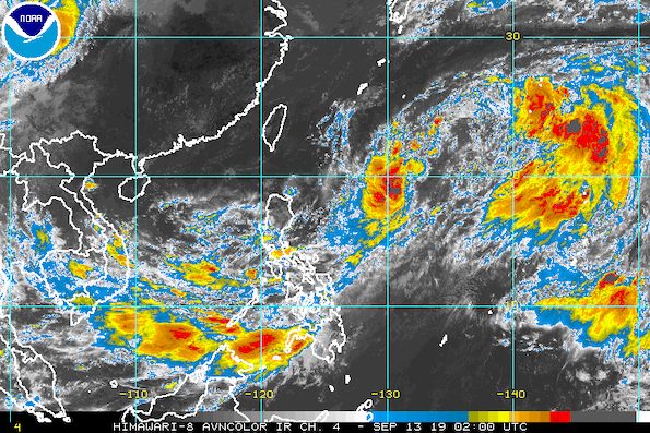
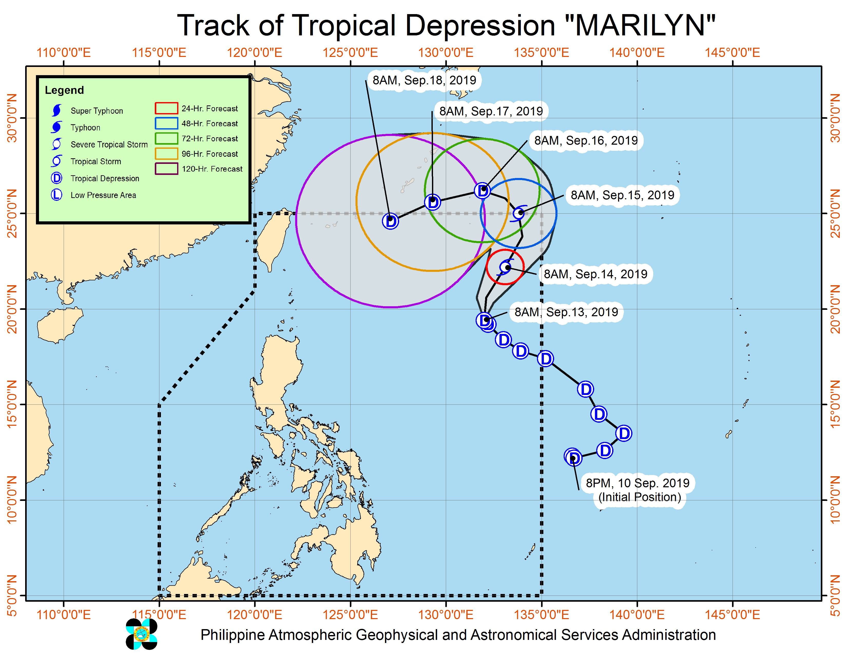
MANILA, Philippines – Tropical Depression Marilyn slowed down on Friday morning, September 13, while still maintaining its strength.
In a bulletin issued 11 am on Friday, the Philippine Atmospheric, Geophysical, and Astronomical Services Administration (PAGASA) said Marilyn is 1,045 kilometers east of Basco, Batanes.
It is now moving northwest at 10 kilometers per hour (km/h) from the previous 20 km/h.
The tropical depression still has maximum winds of 55 km/h and gustiness of up to 70 km/h. But it could intensify into a tropical storm while inside the Philippine Area of Responsibility (PAR).
There are no areas under tropical cyclone wind signals and Marilyn is unlikely to make landfall. However, PAGASA has said that the tropical depression has a very broad circulation and it is pulling the southwest monsoon or hanging habagat.
Here’s the latest on the expected rainfall:
Friday, September 13, until Saturday morning, September 14
- Frequent light to moderate rain, with occasional heavy rain
- Palawan
- Western Visayas
- Zamboanga Peninsula
- Bangsamoro Autonomous Region in Muslim Mindanao
- Occasional light to moderate rain, with at times heavy rain during thunderstorms
- Metro Manila
- Calabarzon
- Bicol
- rest of Mimaropa
- rest of Visayas
- Northern Mindanao
- Soccsksargen
Residents of those areas must stay on alert for possible flash floods and landslides. (READ: FAST FACTS: Tropical cyclones, rainfall advisories)
Classes were suspended in some areas on Friday. (READ: #WalangPasok: Class suspensions, Friday, September 13, 2019)
Travel also remains risky in the central and eastern seaboards of the Visayas and the seaboards of Mindanao.
Based on Marilyn’s latest forecast track, it will leave PAR on Sunday, September 15.
Marilyn is the Philippines’ 13th tropical cyclone for 2019, and the 3rd in September. (READ: LIST: PAGASA’s names for tropical cyclones in 2019)
The country gets an average of 20 tropical cyclones annually, but since 2019 is an El Niño year, only 14 to 18 tropical cyclones are expected.
Below is the estimated number of tropical cyclones from September to December:
- September – 2 to 4
- October – 2 or 3
- November – 1 or 2
- December – 0 or 1
PAGASA declared the start of the rainy season last June 14. – Rappler.com
Add a comment
How does this make you feel?
There are no comments yet. Add your comment to start the conversation.