SUMMARY
This is AI generated summarization, which may have errors. For context, always refer to the full article.
What’s the weather like in your area? Tweet us at @rapplerdotcom.
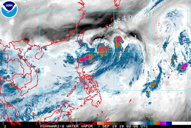
MANILA, Philippines – The trough or extension of Tropical Depression Nimfa as well as the southwest monsoon or hanging habagat continue to affect parts of Luzon on Thursday, September 19.
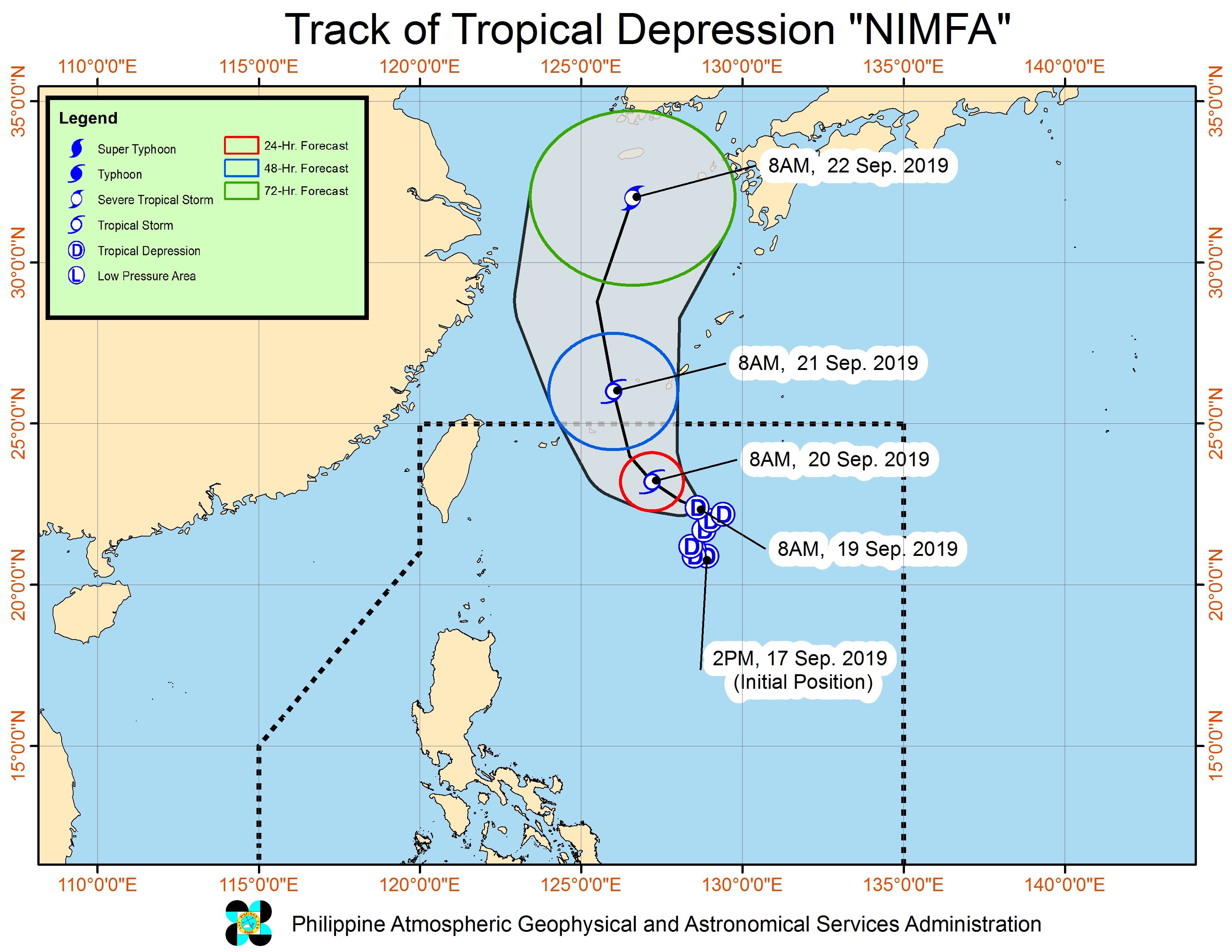
In a briefing past 11 am on Thursday, the Philippine Atmospheric, Geophysical, and Astronomical Services Administration (PAGASA) said Nimfa is 715 kilometers east northeast of Basco, Batanes.
It is now slowly moving west northwest over the Philippine Sea, from its previous direction of northeast in the early hours of Thursday.
Nimfa maintained its strength, with maximum winds of 55 kilometers per hour (km/h) and gustiness of up to 70 km/h. But it could intensify into a tropical storm within 24 hours, while still inside the Philippine Area of Responsibility (PAR).
Nimfa is not expected to make landfall in the country, and there are no areas under tropical cyclone wind signals.
But the tropical depression’s trough or extension is still triggering rain in Northern Luzon, while other parts of Luzon also have rain due to the southwest monsoon.
Below is the latest on the expected rainfall.
Thursday, September 19, until Friday morning, September 20
- Frequent light to moderate rain with occasional heavy rain
- Ilocos Region
- Cordillera Administrative Region
- Cagayan
- Zambales
- Bataan
- Occidental Mindoro
- Occasional light to moderate rain with at times heavy rain
- rest of Luzon
PAGASA warned that flash floods and landslides remain possible. (READ: FAST FACTS: Tropical cyclones, rainfall advisories)
Classes were suspended in some areas for Thursday. (READ: #WalangPasok: Class suspensions, Thursday, September 19, 2019)
Travel is also risky in the seaboards of Northern Luzon and the western seaboard of Central Luzon, with rough to very rough sea conditions. Most of the other seaboards of the country will remain moderate to rough, said PAGASA.
Based on Nimfa’s latest forecast track, it will leave PAR on Saturday, September 21.
Nimfa is the Philippines’ 14th tropical cyclone for 2019, and the 4th in September. (READ: LIST: PAGASA’s names for tropical cyclones in 2019)
The country gets an average of 20 tropical cyclones annually, but since 2019 is an El Niño year, only 14 to 18 tropical cyclones are expected.
Below is the estimated number of tropical cyclones from September to December:
- September – 2 to 4
- October – 2 or 3
- November – 1 or 2
- December – 0 or 1
PAGASA declared the start of the rainy season last June 14. – Rappler.com
Add a comment
How does this make you feel?
There are no comments yet. Add your comment to start the conversation.