SUMMARY
This is AI generated summarization, which may have errors. For context, always refer to the full article.
What’s the weather like in your area? Tweet us at @rapplerdotcom.
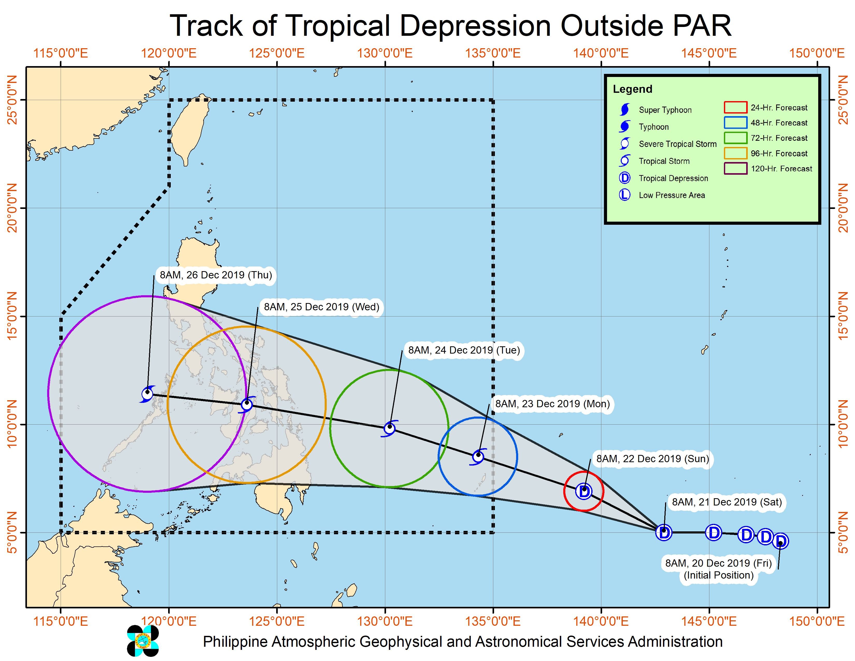
MANILA, Philippines – The tropical depression outside the Philippine Area of Responsibility (PAR) is now expected to enter between Sunday night, December 22, and Monday morning, December 23.
In a briefing past 4 pm on Saturday, December 21, the Philippine Atmospheric, Geophysical, and Astronomical Services Administration (PAGASA) said the tropical depression is already 1,810 kilometers east of Mindanao.
It is now moving west northwest at a slow 10 kilometers per hour (km/h), but it earlier accelerated to 40 km/h on Saturday morning.
At the moment, the tropical depression has maximum winds of 55 km/h and gustiness of up to 70 km/h. It is expected to intensify, however, since it remains over water.
When the tropical depression enters PAR between Sunday night and Monday morning, it will be given the local name Ursula. (READ: LIST: PAGASA’s names for tropical cyclones in 2019)
PAGASA warned that moderate to occasionally heavy rain may hit the Visayas and the northeastern part of Mindanao beginning Tuesday, December 24, Christmas Eve.
The potential Ursula could make landfall in Eastern Visayas or the Caraga area on Tuesday evening or on Wednesday, December 25, Christmas Day. It is too early to determine the exact area of landfall.
After the tropical cyclone’s landfall, it is projected to cross the Visayas.
Note though that the cone of uncertainty – shown in the image below – is still wide. The cone shows a tropical cyclone’s probable track. The track becomes more certain as a tropical cyclone nears. (READ: FAST FACTS: Tropical cyclones, rainfall advisories)
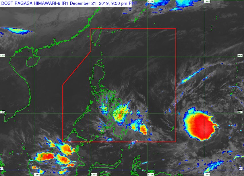
Aside from the potential Ursula, PAGASA continues to monitor the low pressure area (LPA) inside PAR.
This LPA is now 280 kilometers southeast of Hinatuan, Surigao del Sur.
It remains unlikely to become a tropical depression, but its trough or extension is still affecting the eastern parts of the Visayas and of Mindanao.
Scattered rainshowers and thunderstorms will persist in these areas until at least Sunday due to the LPA’s trough:
- Caraga
- Davao Region
- Eastern Visayas
Flash floods and landslides remain possible.
Meanwhile, the easterlies or warm winds blowing from the east are causing isolated rainshowers and thunderstorms in other parts of the country.
The Philippines has had 20 tropical cyclones in 2019 – the country’s yearly average.
The latest was Typhoon Tisoy (Kammuri), which left at least 4 people dead and 318 others injured in early December, according to the December 13 report of disaster management authorities.
In PAGASA’s latest climate outlook, the state weather bureau said it expects 1 or 2 tropical cyclones for December.
PAGASA declared the start of the rainy season last June 14. – Rappler.com
Add a comment
How does this make you feel?
There are no comments yet. Add your comment to start the conversation.