SUMMARY
This is AI generated summarization, which may have errors. For context, always refer to the full article.
What’s the weather like in your area? Tweet us at @rapplerdotcom.
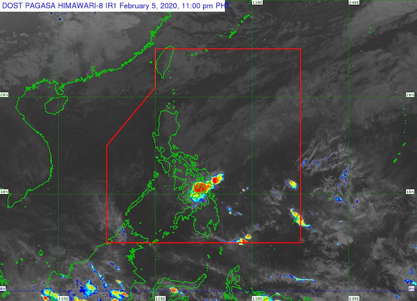
MANILA, Philippines – The trough or extension of a low pressure area (LPA) that entered the Philippine Area of Responsibility on Wednesday, February 5, is bringing rain to parts of the country.
In a bulletin issued Wednesday afternoon, the Philippine Atmospheric, Geophysical, and Astronomical Services Administration (PAGASA) said the LPA is 850 kilometers east of Davao City.
It remains far from land, but its trough is affecting the following areas:
- Eastern Visayas
- Caraga
- Davao Oriental
Scattered rainshowers and thunderstorms are expected. There could also be flash floods and landslides if the rain becomes moderate to heavy.
PAGASA Weather Specialist Ariel Rojas said the LPA is unlikely to become a tropical depression. It may just dissipate once it hits land.
The Philippines gets an average of 20 tropical cyclones per year. There have been none, so far, in 2020. (READ: FAST FACTS: Tropical cyclones, rainfall advisories)
Meanwhile, the northeast monsoon or hanging amihan is affecting Luzon and the Visayas. There will only be isolated light rain.
The northeast monsoon has also been causing temperatures to drop in the country. (READ: ‘Ang lamig!’: Here’s why your nights and mornings are cold) – Rappler.com
Add a comment
How does this make you feel?
There are no comments yet. Add your comment to start the conversation.