SUMMARY
This is AI generated summarization, which may have errors. For context, always refer to the full article.

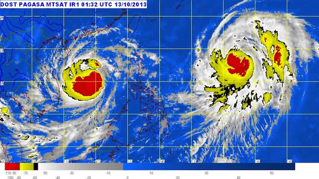
MANILA, Philippines (UPDATED) – Typhoon Santi (Nari) has left the Philippine Area of Responsibility (PAR) Sunday morning, October 13, as another storm moves closer to the area.
As of 10 am Sunday, Santi was located 550 kilometers west of Iba, Zambales (15.2°N, 114.3°E), carrying maximum sustained winds of 130 km/h near the center and gusts of up to 160 km/h.
It is moving west at a speed of 19 km/h, toward the general direction of Vietnam.
Santi tore into the country’s northeast coast early Saturday and cut a westward path through the farming regions of Luzon
As Santi exits, a new storm is poised to enter the PAR Monday. Typhoon Wipha was spotted 1,460 kilometers east of north Luzon as of Sunday morning, PAGASA said.
Wipha will have the Philippine codename Tino once it enters the PAR.
It is, however, not expected to make landfall in the country; it is forecast to pass by the PAR on its way to Japan. It is forecast to exit the area Tuesday, October 15.
Thirteen people were killed as the storm ripped off roofs of homes and buildings, toppling trees and triggering flash floods and landslides before blowing away into the South China Sea.
Many of the more than 43,000 people displaced by the storm had also begun returning home as the government lifted all storm warnings there. – With reports from Agence France-Presse/Rappler.com
Add a comment
How does this make you feel?
There are no comments yet. Add your comment to start the conversation.