SUMMARY
This is AI generated summarization, which may have errors. For context, always refer to the full article.
What’s the weather like in your area? Tweet us the situation: Use #weatheralert and tag @rapplerdotcom
MANILA, Philippines – Tropical Storm “Noul” has strengthened as it neared the Philippine Area of Responsibility (PAR) late afternoon on Wednesday, May 6.
According to state weather bureau PAGASA, the storm was spotted 1,210 kilometers east of Surigao del Norte at 4 pm on that day.
It packed maximum sustained winds of 100 kilometers/hour (km/h) near the center and gusts of up to 130 km/h.
The weather system also gained speed. It is now expected to move 13 km/h west northwest, said PAGASA in its Wednesday evening bulletin.
Noul is expected to enter the PAR on Thursday at which time it will be given the local name “Dodong.”
Independent weather monitoring group Weather Philippines says it could enter the PAR as early as Wednesday midnight or early Thursday morning.
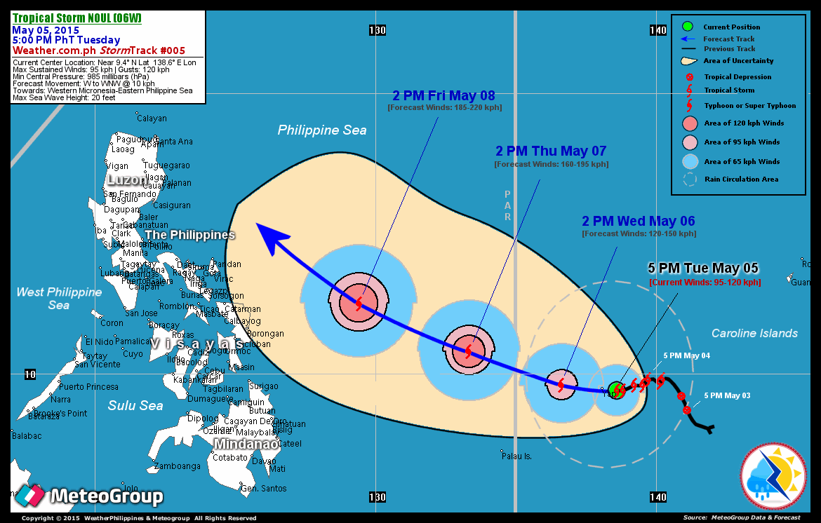
It said though that Noul’s effects won’t be felt in the Philippine landmass until after two or three days.
Weather Philippines also forecasts that by Friday, May 8, Noul could become a typhoon – a weather system with wind speeds at 118 to 220 km/h.
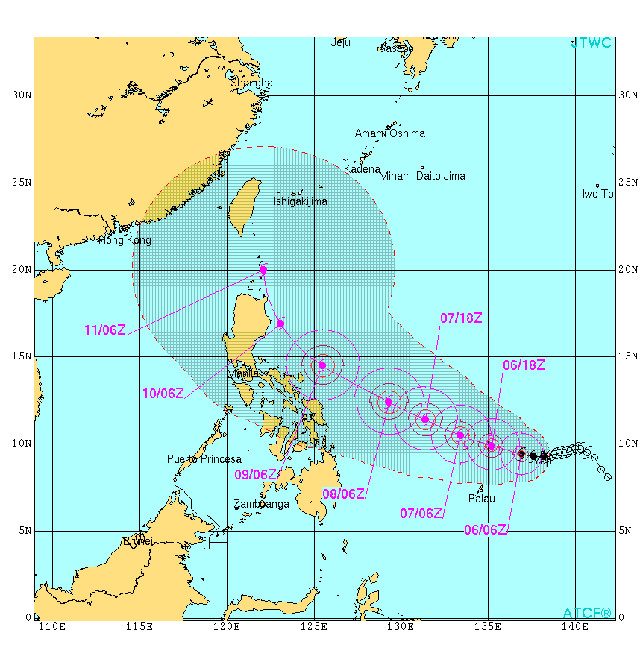
A forecast by US weather station Joint Typhoon Warning Center shows that the eye of Noul won’t cross the Philippine landmass. Instead, it skirts the eastern side of the country before veering northward, avoiding the Northern Luzon landmass.
However, forecasts this early will still be subject to sudden changes in weather patterns.
Thursday forecast
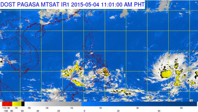
PAGASA says only isolated rainshowers or thunderstorms are predicted for the entire country on Thursday.
Moderate to occasionally strong winds will prevail in the eastern section of Visayas and Mindanao. Thus, ocean waters in these areas are likely to be moderate to rough.
Elsewhere, winds will be light to moderate leading to slight to moderate seas.
| City | Forecast | Temperature Range |
|
| Metro Manila |  |
Partly cloudy to cloudy skies with |
25°C-34°C |
| Tuguegarao | |
Partly cloudy to cloudy skies with rainshowers and/or thunderstorms |
25°C-37°C |
| Laoag | |
Partly cloudy to cloudy skies with rainshowers and/or thunderstorms |
23°C-32°C |
| Baguio | |
Partly cloudy to cloudy skies with rainshowers and/or thunderstorms |
17°C-24°C |
| Subic/Olongapo; Clark/Angeles | |
Partly cloudy to cloudy skies with rainshowers and/or thunderstorms |
25°C-32°C |
| Tagaytay | |
Partly cloudy to cloudy skies with |
22°C-32°C |
| Lipa | |
Partly cloudy to cloudy skies with rainshowers and/or thunderstorms |
23°C-34°C |
| Legazpi | |
Partly cloudy to cloudy skies with rainshowers and/or thunderstorms |
25°C-32°C |
| Puerto Princesa | |
Partly cloudy to cloudy skies with |
26°C-32°C |
| Iloilo/Bacolod | |
Partly cloudy to cloudy skies with |
26°C-33°C |
| Metro Cebu | |
Partly cloudy to cloudy skies with rainshowers and/or thunderstorms |
25°C-32°C |
| Tacloban | |
Partly cloudy to cloudy skies with |
24°C-32°C |
| Cagayan de Oro | |
Partly cloudy to cloudy skies with rainshowers and/or thunderstorms |
19°C-32°C |
| Metro Davao | |
Partly cloudy to cloudy skies with rainshowers and/or thunderstorms |
26°C-33°C |
| Zamboanga | |
Partly cloudy to cloudy skies with rainshowers and/or thunderstorms |
23°C-33°C |
– Rappler.com
Add a comment
How does this make you feel?
There are no comments yet. Add your comment to start the conversation.