SUMMARY
This is AI generated summarization, which may have errors. For context, always refer to the full article.

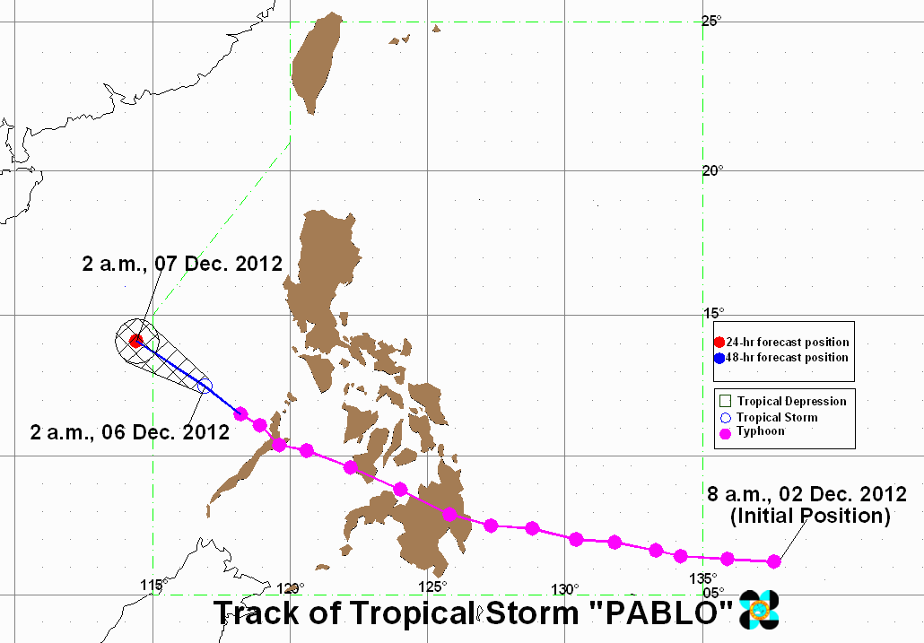
MANILA, Philippines (UPDATED) – Pablo (Bopha), the typhoon that ravaged Mindanao and the Visayas early this week, has significantly weakened and is now a tropical storm.
Pablo was spotted 380 km west of Coron, Palawan (12.4°N, 116.5°E) as of 10 am Thursday, carrying maximum sustained winds of 115 km/h near the center and gusts of up to 145 km/h.
It is moving west northwest at 9 km/h, and is expected to be outside the Philippine Area of Responsibility (PAR) by Friday, December 7.
All storm warning signals have been lowered.
Pablo is still packing heavy to intense rainfall (10-18 mm/h) within its 350 km diameter, and seacraft are still warned to watch out for big waves caused by the system.
Track uncertain
The PAGASA forecast track shows Pablo hovering over the West Philippine Sea (South China Sea) in the coming days, moving westward.
On the other hand, foreign weather agencies, such as the Japan Meteorological Agency, the Hong Kong Observatory, the Korea Meteorological Administration, and the Joint Typhoon Warning Center still label Pablo as a typhoon.
The said agencies forecast the weather system to remain in the South China Sea area, with the HKO predicting the typhoon to make a curve back east.


CNN reported that the uncertain track of the system is caused by the presence of a cold front just south of the China coast.
The cold front is preventing the storm from going further north, and it could either dissipate over water or move back east towards Luzon, CNN reported.
Thursday weather
As Pablo hovers west of Palawan, the area will experience stormy weather with rough to very rough seas. Mindoro will be rainy, with gusty winds accompanied by moderate to rough seas.
Due to the northeast monsoon (Amihan), the Cordilleras and the Cagayan Valley region will have cloudy skies with light rain.
The rest of the archipelago will have partly cloudy skies with brief rains.
Prevailing winds will come from the east to northeast.
PAGASA 24-Hour Public Weather Forecast, 6 Dec 2012, 5am
– Rappler.com
Add a comment
How does this make you feel?
There are no comments yet. Add your comment to start the conversation.