SUMMARY
This is AI generated summarization, which may have errors. For context, always refer to the full article.
What’s the weather like in your area? Tweet us at @rapplerdotcom.
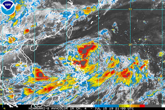
MANILA, Philippines – Tropical Depression Falcon appeared less likely to make landfall as it changed its direction before dawn on Tuesday, July 16. It will, however, still trigger rain, along with the enhanced southwest monsoon or hanging habagat.
In a briefing past 5 am on Tuesday, the Philippine Atmospheric, Geophysical, and Astronomical Services Administration (PAGASA) said Falcon is already 690 kilometers east of Tuguegarao City, Cagayan.
The tropical depression is now moving west from the previous direction of northwest, still at a relatively fast speed of 30 kilometers per hour (km/h). Generally, it continues to approach Extreme Northern Luzon, or the Batanes-Babuyan area, but now seems unlikely to hit land.
Falcon maintained its strength, with maximum winds of 55 km/h and gustiness of up to 65 km/h. But it could intensify into a tropical storm within 24 hours. (READ: FAST FACTS: Tropical cyclones, rainfall advisories)
Signal No. 1 remains raised in:
- Cagayan
- Batanes
- northern part of Isabela (1st and 6th Districts)
The tropical depression is also enhancing the southwest monsoon – another source of rain.
Here’s what to expect in terms of rainfall:
Tuesday, July 16
- Light to heavy monsoon rain
- Mimaropa
- Albay
- Masbate
- Sorsogon
- Western Visayas
- Northern Samar
Wednesday, July 17
- Moderate to heavy rain due to Falcon and the enhanced southwest monsoon combined
- Ilocos Region
- Cordillera Administrative Region
- Cagayan Valley
- Zambales
- Bataan
- Occidental Mindoro
- Oriental Mindoro
- Light to heavy monsoon rain
- Metro Manila
- Calabarzon
- rest of Central Luzon
- rest of Mimaropa
- Western Visayas
Thursday, July 18
- Moderate to heavy rain
- Ilocos Region
- Zambales
- Bataan
- Occidental Mindoro
- Oriental Mindoro
- Light to heavy monsoon rain
- Metro Manila
- Calabarzon
- rest of Central Luzon
- rest of Mimaropa
Residents of those areas must watch out for possible flash floods and landslides.
PAGASA also advised fishermen and those with small seacraft not to venture out into the seaboards of areas under Signal No. 1 and the eastern seaboards of Southern Luzon, the Visayas, and Mindanao.
Falcon is now expected to leave the Philippine Area of Responsibility on Friday, July 19. It was initially seen to exit on Thursday, July 18.
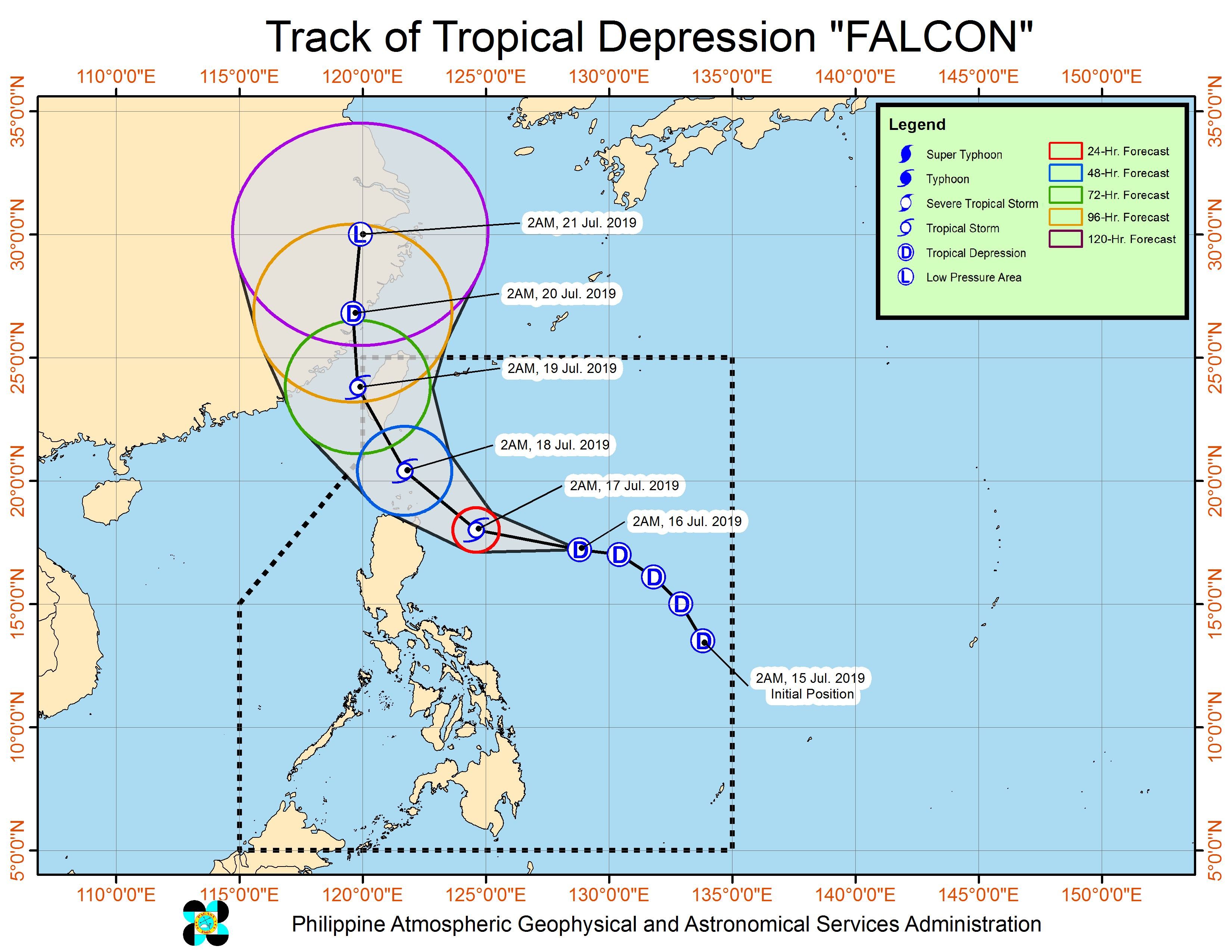
Falcon is the Philippines’ 6th tropical cyclone for 2019. The first 5 were all tropical depressions as well. (READ: LIST: PAGASA’s names for tropical cyclones in 2019)
The Philippines gets an average of 20 tropical cyclones annually, but since 2019 is an El Niño year, only 14 to 18 tropical cyclones are expected.
Below is the estimated number of tropical cyclones from July to December:
- July – 2 or 3
- August – 2 to 4
- September – 2 to 4
- October – 2 or 3
- November – 1 or 2
- December – 0 or 1
PAGASA declared the start of the rainy season last June 14. – Rappler.com
Add a comment
How does this make you feel?
There are no comments yet. Add your comment to start the conversation.