SUMMARY
This is AI generated summarization, which may have errors. For context, always refer to the full article.
What’s the weather like in your area? Tweet us at @rapplerdotcom.
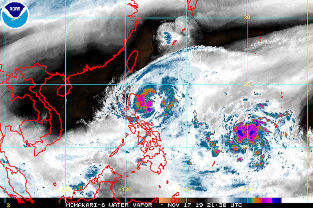
MANILA, Philippines – Tropical Storm Ramon (Kalmaegi) strengthened further as it moved closer to the northern part of Cagayan before dawn on Monday, November 18.
In a bulletin issued 5 am on Monday, the Philippine Atmospheric, Geophysical, and Astronomical Services Administration (PAGASA) said Ramon now has maximum winds of 85 kilometers per hour (km/h) from the previous 75 km/h and gustiness of up to 105 km/h from the previous 90 km/h.
The tropical storm is already 210 kilometers east northeast of Casiguran, Aurora, or 225 kilometers east of Tuguegarao City, Cagayan.
It slowed down compared to its speed on Saturday night, November 17, and is now moving northwest at 10 km/h from the previous 15 km/h.
Below is the latest list of areas under tropical cyclone wind signals.
Signal No. 2 (winds of 61 km/h to 120 km/h)
- Cagayan, including Babuyan Group of Islands
- northern part of Isabela (Sta Maria, San Pablo, Maconacon, Cabagan, Sto Tomas, Quezon, Delfin Albano, Tumauini, Divilacan)
- Apayao
- Kalinga
Signal No. 1 (winds of 30 km/h to 60 km/h)
- Batanes
- Ilocos Norte
- Ilocos Sur
- Abra
- Mountain Province
- Ifugao
- northern part of Aurora (Dilasag, Casiguran, Dinalungan)
- rest of Isabela
Here is PAGASA’s latest rainfall outlook:
Monday morning and afternoon, November 18
- Light to moderate rain with occasionally heavy rain
- eastern part of Cagayan
- eastern part of Isabela
- Light to moderate rain with intermittent heavy rain
- rest of Cagayan
- rest of Isabela
- Babuyan Group of Islands
- Apayao
- Kalinga
- Mountain Province
- Ifugao
- Abra
- Ilocos Norte
Monday evening, November 18
- Moderate rain with occasional to frequent heavy rain
- Cagayan, including Babuyan Group of Islands
- Apayao
- Light to moderate rain with intermittent heavy rain
- Batanes
- Isabela
- Kalinga
- Abra
- Ilocos Norte
Tuesday, November 19
- Light to moderate rain with occasionally heavy rain
- northern part of Cagayan, including Babuyan Group of Islands
- Batanes
- Apayao
- Ilocos Norte
- Light to moderate rain with intermittent heavy rain
- rest of Cagayan
- Isabela
- Kalinga
- Abra
- Ilocos Sur
Flash floods and landslides remain possible. (READ: FAST FACTS: Tropical cyclones, rainfall advisories)
Travel also remains risky, especially for small vessels, in the seaboards of areas under Signal Nos. 1 and 2, the western seaboard of Northern Luzon, and the eastern seaboards of Central Luzon and Southern Luzon.
Based on Ramon’s latest forecast track, it might make landfall in the northern part of Cagayan between Monday evening and Tuesday morning, November 19.
PAGASA said Ramon is likely to intensify further before making landfall, and then gradually weaken after hitting land.
It could leave the Philippine Area of Responsibility (PAR) on Wednesday evening, November 20.
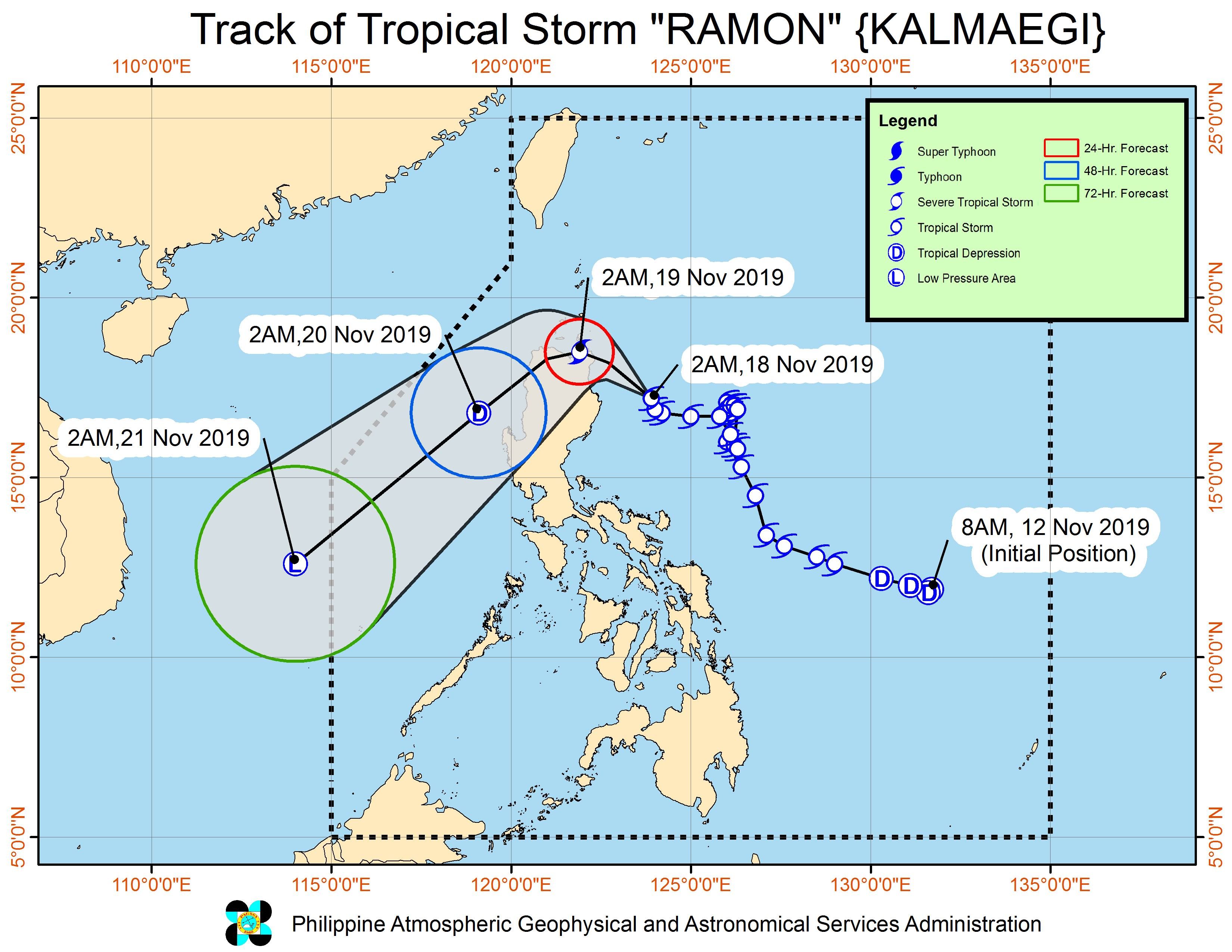
Ramon is the Philippines’ 18th tropical cyclone for 2019, and the 2nd for November.
Meanwhile, the low pressure area outside PAR is now 1,860 kilometers east of Eastern Visayas. It is expected to enter on Tuesday, possibly as a tropical depression already.
If it becomes a tropical depression and enters PAR, it would be given the local name Sarah. (READ: LIST: PAGASA’s names for tropical cyclones in 2019)
The country gets an average of 20 tropical cyclones annually, but since 2019 is an El Niño year, only 14 to 18 tropical cyclones are expected.
Below is the estimated number of tropical cyclones for the last two months of 2019:
- November – 1 or 2
- December – 0 or 1
PAGASA declared the start of the rainy season last June 14. – Rappler.com
Add a comment
How does this make you feel?
There are no comments yet. Add your comment to start the conversation.