SUMMARY
This is AI generated summarization, which may have errors. For context, always refer to the full article.
What’s the weather like in your area? Tweet us at @rapplerdotcom.
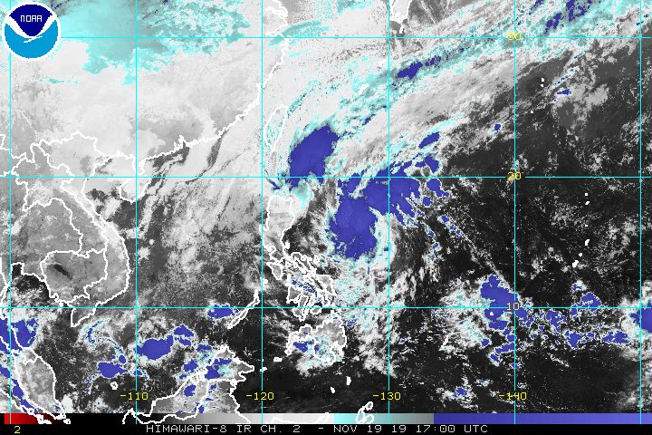
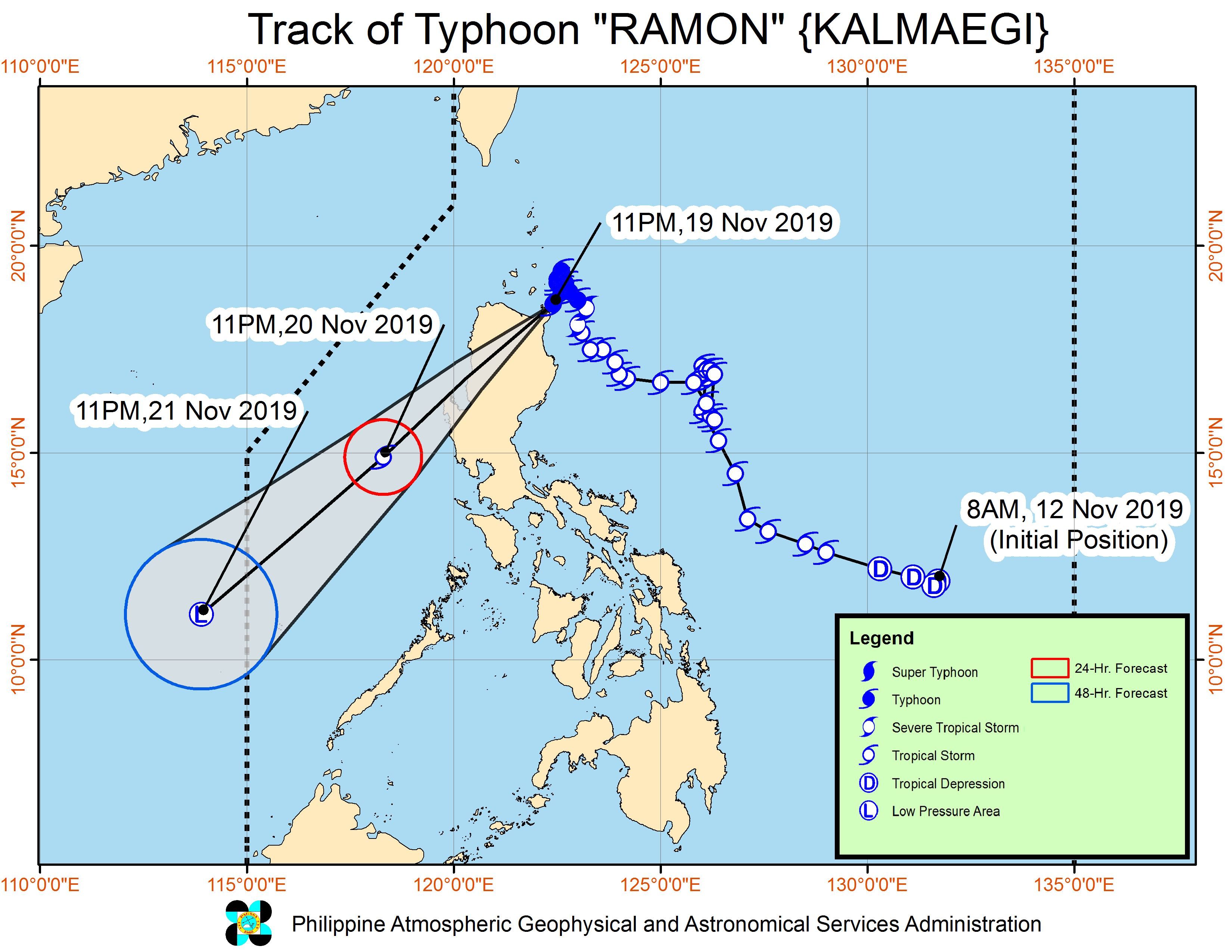
MANILA, Philippines – Typhoon Ramon (Kalmaegi) made landfall in Santa Ana, Cagayan, at 12:20 am on Wednesday, November 20.
In a bulletin issued 2 am on Wednesday, the Philippine Atmospheric, Geophysical, and Astronomical Services Administration (PAGASA) said Ramon is now in the vicinity of Santa Ana.
The typhoon is moving southwest, heading further inland, at only 10 kilometers per hour (km/h).
It still has maximum winds of 120 km/h and gustiness of up to 150 km/h. But PAGASA said Ramon is seen to “significantly weaken throughout the forecast period due to land interaction and the northeast monsoon.”
More municipalities in Cagayan have been placed under Signal No. 3. Below is the complete list of areas with tropical cyclone wind signals.
Signal No. 3 (winds of 121 km/h to 170 km/h)
- northern part of Cagayan (Santa Praxedes, Claveria, Sanchez Mira, Pamplona, Abulug, Ballesteros, Aparri, Calayan, Camalaniugan, Buguey, Santa Teresita, Gonzaga, Santa Ana, Allacapan, Lal-lo, Gattaran, Lasam, Baggao, Alcala, Santo Niño)
Signal No. 2 (winds of 61 km/h to 120 km/h)
- rest of Cagayan
- Batanes
- Apayao
- Kalinga
- Abra
- lIocos Norte
- Ilocos Sur
Signal No. 1 (winds of 30 km/h to 60 km/h)
- northern part of Isabela (Sta Maria, San Pablo, Maconacon, Cabagan, Sto Tomas, Quezon, Delfin Albano, Tumauini, Divilacan, Quirino, Roxas, Mallig, San Manuel, Burgos, Gamu, Ilagan City)
- Mountain Province
- Benguet
- Ifugao
- La Union
- Pangasinan
With Ramon’s landfall, residents of Northern Luzon should continue to brace for heavy rain.
Wednesday, November 20
- Moderate rain with frequent heavy rain
- Batanes
- Cagayan, including Babuyan Group of Islands
- Apayao
- Light to moderate rain with intermittent heavy rain
- Ilocos Norte
- Ilocos Sur
- Abra
- Mountain Province
- Kalinga
- northern part of Isabela
Thousands of residents earlier fled their homes, fearing possible flash floods and landslides from Ramon.
According to PAGASA, flooding may be experienced in coastal areas under Signal Nos. 2 and 3 due to high waves. (READ: FAST FACTS: Tropical cyclones, rainfall advisories)
Travel remains risky too, especially for small vessels, in the seaboards of areas under tropical cyclone wind signals, the seaboard of the southern part of Isabela, as well as the western seaboard of Zambales and Bataan.
Classes have been suspended in some areas for Wednesday. (READ: #WalangPasok: Class suspensions, Wednesday, November 20, 2019)
Ramon could leave the Philippine Area of Responsibility on Thursday, November 21. By then, it would have likely weakened into a low pressure area.
Ramon is the Philippines’ 18th tropical cyclone for 2019, and the 2nd for November.
Aside from Ramon, PAGASA is also monitoring Tropical Depression Sarah. Details of the latest forecast on Sarah, issued 11 pm on Tuesday, November 19, can be found here.
The country gets an average of 20 tropical cyclones annually, but since 2019 is an El Niño year, only 14 to 18 tropical cyclones had been projected. (READ: LIST: PAGASA’s names for tropical cyclones in 2019)
With Sarah’s arrival, the estimate has been exceeded for the year and also for the month of November.
These had been the projections for the last two months of 2019:
- November – 1 or 2
- December – 0 or 1
PAGASA declared the start of the rainy season last June 14. – Rappler.com
Add a comment
How does this make you feel?
There are no comments yet. Add your comment to start the conversation.