SUMMARY
This is AI generated summarization, which may have errors. For context, always refer to the full article.
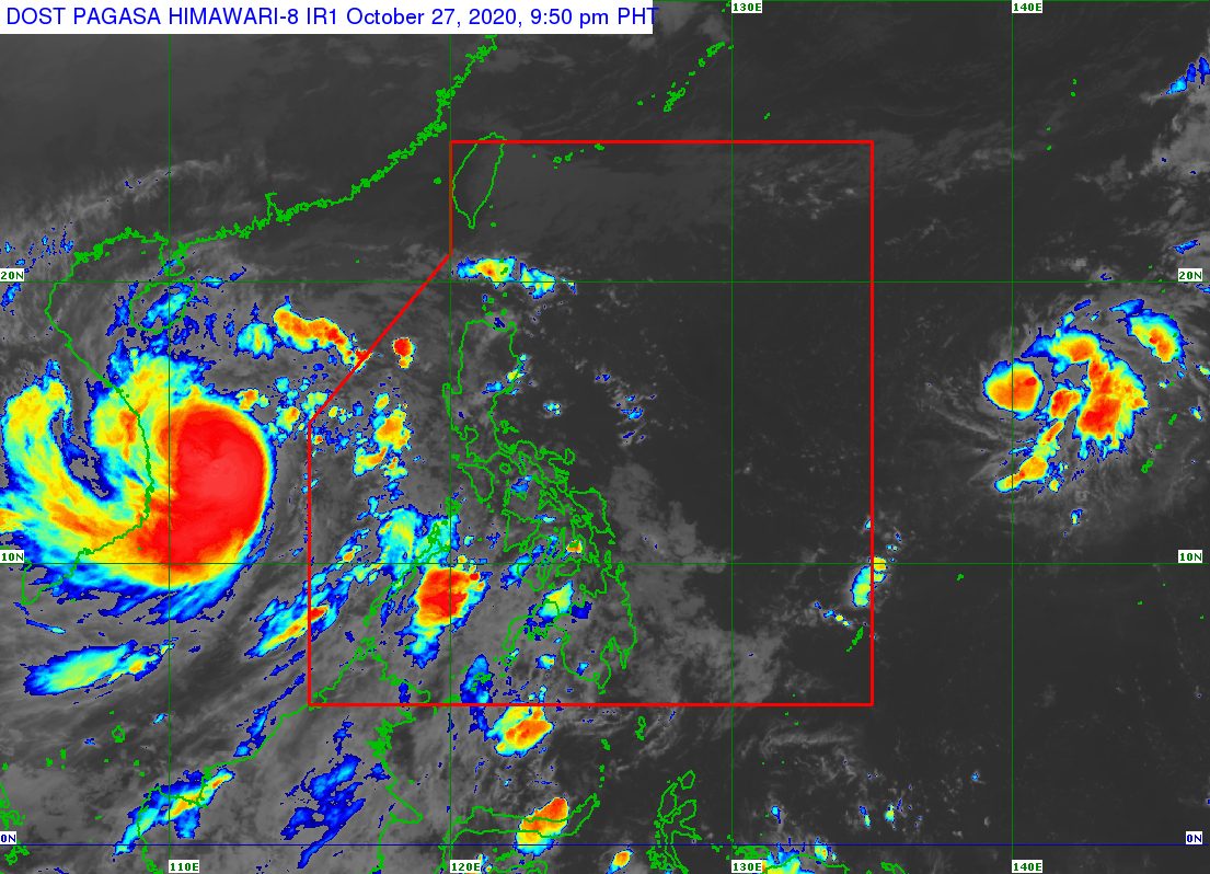
The low pressure area (LPA) located outside the Philippine Area of Responsibility (PAR) developed into a tropical depression on Tuesday, October 27.
In an online briefing past 5 pm on Tuesday, the Philippine Atmospheric, Geophysical, and Astronomical Services Administration (PAGASA) said the tropical depression is 2,125 kilometers east of Central Luzon.
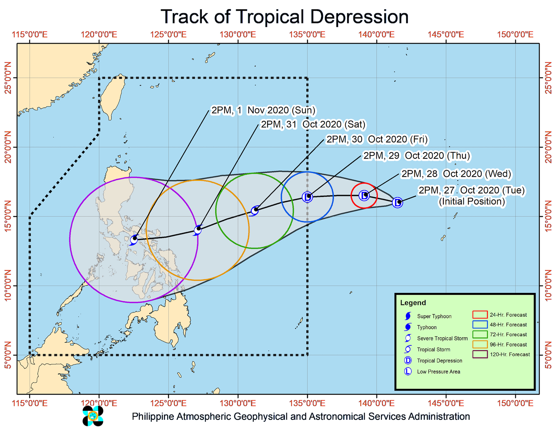
It is moving north northwest at 15 kilometers per hour (km/h), and at this rate, could enter PAR on Wednesday evening, October 28, or Thursday, October 29.
When it enters PAR, the tropical depression will be given the local name Rolly, as the Philippines’ 18th tropical cyclone for 2020. (READ: LIST: PAGASA’s names for tropical cyclones in 2020)
PAGASA Weather Specialist Ariel Rojas noted that the weather disturbance currently does not have an international name. Tropical depressions, the weakest type of tropical cyclone, do not get international names. (READ: FAST FACTS: Tropical cyclones, rainfall advisories)
At the moment, the tropical depression has maximum sustained winds of 45 km/h and gustiness of up to 55 km/h. But by Friday afternoon, October 30, it would likely already be a tropical storm, and then by Saturday afternoon, October 31, a severe tropical storm.
It could make landfall in the Bicol-Eastern Visayas area as a severe tropical storm between Saturday evening and Sunday morning, November 1.
Rojas stressed that the forecast may still change, given that the tropical depression remains outside PAR. There is a high degree of uncertainty since the weather disturbance is still far from the Philippines.
An average of 20 tropical cyclones form within or enter PAR each year.
These are PAGASA’s latest estimates for the number of tropical cyclones inside PAR in the next 6 months:
- November 2020 – 1 to 3
- December 2020 – 2 or 3
- January 2021 – 0 or 1
- February 2021 – 0 or 1
- March 2021 – 0 or 1
- April 2021 – 0 or 1
Last October 2, the state weather bureau warned Filipinos to expect more rain in the coming months due to the onset of La Niña.
The potential Rolly would come after Typhoon Quinta (Molave), which left PAR on Tuesday morning.
Several have been reported dead or missing due to Quinta, which pummeled parts of Luzon and the Visayas. (IN PHOTOS: Typhoon Quinta destroys houses, floods parts of Bicol and Mindoro)
Quinta was 310 kilometers north northwest of Kalayaan Islands, Palawan, on Tuesday afternoon, already outside PAR but with Signal No. 1 still raised in Kalayaan Islands due to the typhoon’s proximity.
Quinta or Molave is heading for Vietnam, where it is expected to make landfall on Wednesday afternoon.
Agence France-Presse reported that Vietnam, already ravaged by floods in recent weeks, has started to evacuate more than half a million people ahead of the typhoon’s arrival. – Rappler.com
Add a comment
How does this make you feel?
There are no comments yet. Add your comment to start the conversation.