SUMMARY
This is AI generated summarization, which may have errors. For context, always refer to the full article.
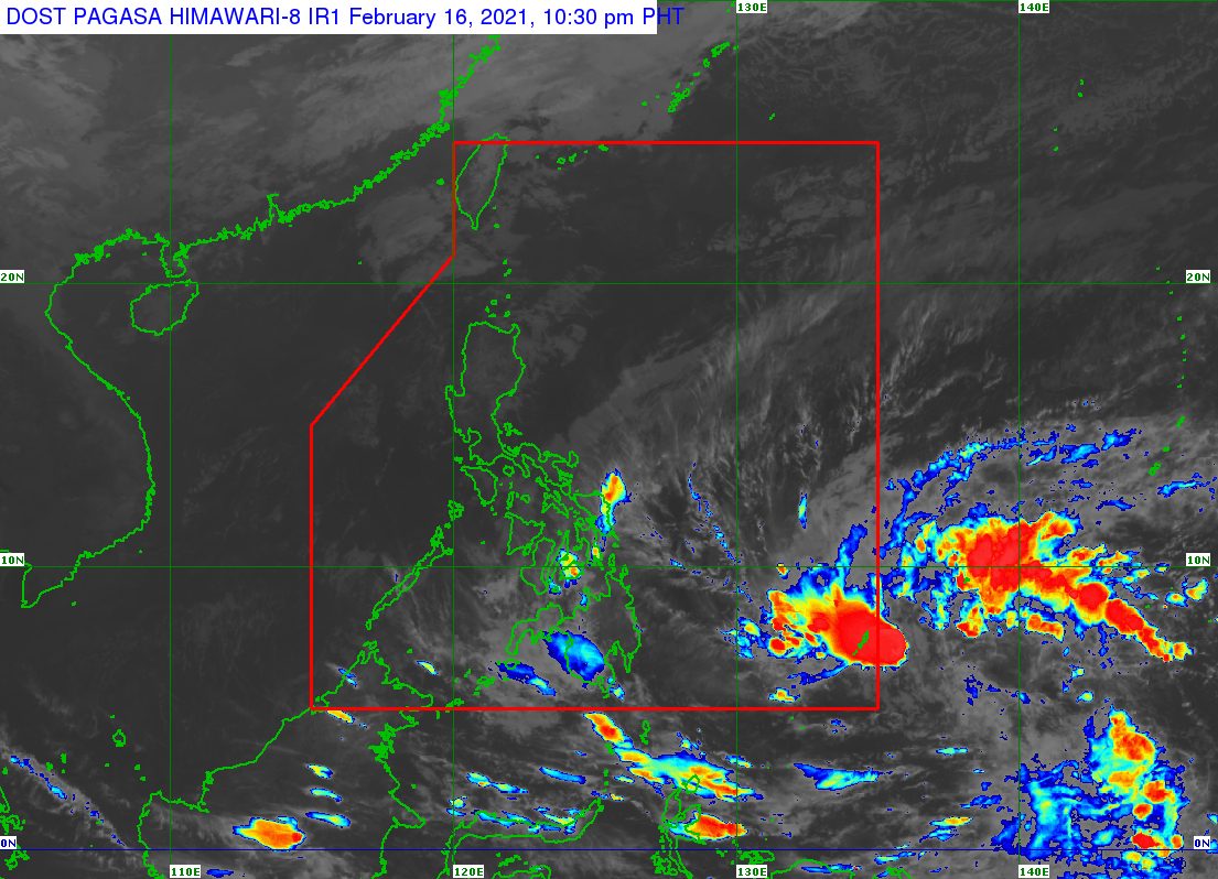
The Philippines is expected to soon have its first tropical cyclone for 2021, with a low pressure area (LPA) poised to enter the Philippine Area of Responsibility (PAR) and likely to develop into a tropical depression.
The Philippine Atmospheric, Geophysical, and Astronomical Services Administration (PAGASA) said in an 11 pm advisory on Tuesday, February 16, that the LPA it is monitoring is now 1,090 kilometers east of southeastern Mindanao.
At the moment, the LPA is still too far to affect any part of the country. But it is likely to enter PAR in the next 6 to 12 hours, or by Wednesday morning, February 17.
It could then develop into a tropical depression in the next 24 hours, or also on Wednesday, while moving over the Philippine Sea east of Mindanao.
Once it intensifies into a tropical depression inside PAR, it would be given the local name Auring.
It might also strengthen further into a tropical storm before hitting land. (READ: FAST FACTS: Tropical cyclones, rainfall advisories)
PAGASA said the potential Auring might make landfall as a tropical storm in the eastern coast of the Caraga-Davao Region area on Saturday, February 20.
Then it is likely to cross Caraga and the Visayas over the weekend, according to the state weather bureau.
PAGASA advised the following areas to prepare for heavy rain and strong winds this coming weekend:
- Visayas
- Bicol
- Caraga
- Northern Mindanao
- Davao Region
- Cotabato
- Lanao del Sur
PAGASA added that since the potential Auring is projected to make landfall, “the raising of tropical cyclone wind signals may result in the early disruption of maritime activities.”
But even before the weather disturbance’s arrival, parts of Mindanao and the Visayas are already experiencing rain due to the tail-end of a frontal system or shear line.
Below is PAGASA’s latest rainfall forecast for areas affected by the tail-end of a frontal system.
Tuesday evening, February 16
Light to moderate rain, with at times heavy rain
- Davao del Sur
- Davao Occidental
- Soccsksargen
- Maguindanao
- Lanao del Sur
Wednesday, February 17
Moderate to heavy rain
- Eastern Visayas
Light to moderate rain, with at times heavy rain
- Central Visayas
- Dinagat Islands
- Camiguin
- Surigao del Norte
PAGASA warned that floods and landslides could occur. – Rappler.com
Add a comment
How does this make you feel?
There are no comments yet. Add your comment to start the conversation.