SUMMARY
This is AI generated summarization, which may have errors. For context, always refer to the full article.
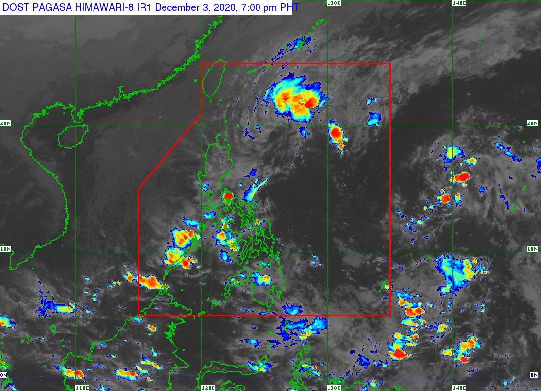
The low pressure area (LPA) that caused rain in parts of Luzon and the Visayas this week already dissipated at 2 pm on Thursday, December 3.
But the Philippine Atmospheric, Geophysical, and Astronomical Services Administration (PAGASA) is now monitoring a new LPA that formed outside the Philippine Area of Responsibility (PAR).
The new LPA was located 1,710 kilometers east of Mindanao on Thursday afternoon.
PAGASA Weather Specialist Ana Clauren said in an online briefing that the LPA could enter PAR in the coming days.
For now, it is still far from the Philippines and it is too early to tell with certainty how it could affect the country. (READ: FAST FACTS: Tropical cyclones, rainfall advisories)
While there is no longer an LPA inside PAR, the tail-end of a frontal system or shear line is still affecting the eastern part of Northern Luzon.
Scattered rain showers and thunderstorms are expected in these areas in the next 24 hours:
- Cagayan Valley
- Kalinga
- Apayao
- Mountain Province
- Ifugao
- Aurora
PAGASA warned that flash floods and landslides remain possible during periods of moderate to heavy rain.
Meanwhile, the northeast monsoon or hanging amihan will bring isolated light rain to the following areas:
- Ilocos Region
- Abra
- Benguet
- Zambales
- Bataan
PAGASA said there will be “no significant impact” due to the northeast monsoon.
The rest of the country will only have isolated rain showers.
The Philippines has had 21 tropical cyclones in 2020, exceeding the yearly average of 20. (READ: LIST: PAGASA’s names for tropical cyclones in 2020)
For the next 6 months, these are PAGASA’s estimates for tropical cyclones inside PAR:
- December 2020 – 1 or 2
- January 2021 – 0 or 1
- February 2021 – 0 or 1
- March 2021 – 0 or 1
- April 2021 – 0 or 1
- May 2021 – 0 or 1
La Niña has been underway since October, causing more rain than usual in the country.
The cold temperatures, usually experienced early morning, are due to the northeast monsoon and are seen to last until February 2021. – Rappler.com
Add a comment
How does this make you feel?
There are no comments yet. Add your comment to start the conversation.