SUMMARY
This is AI generated summarization, which may have errors. For context, always refer to the full article.
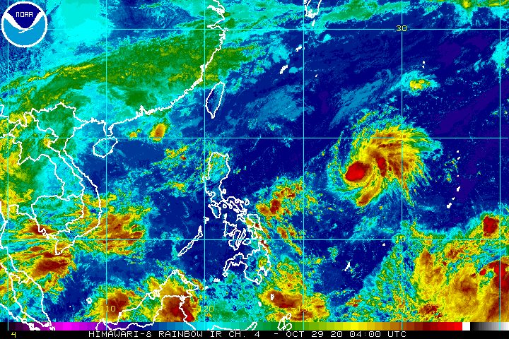
The tropical cyclone with the international name Goni intensified from a tropical storm into a severe tropical storm at 8 am on Thursday, October 29, ahead of its expected entry into the Philippine Area of Responsibility (PAR).
The Philippine Atmospheric, Geophysical, and Astronomical Services Administration (PAGASA) said in an online briefing shortly before noon on Thursday that Severe Tropical Storm Goni is already 1,545 kilometers east of Central Luzon.
It is moving west at 10 kilometers per hour (km/h), set to enter PAR on Thursday afternoon or evening.
When it enters PAR, the severe tropical storm will be given the local name Rolly, as the Philippines’ 18th tropical cyclone for 2020. It would also be the 5th tropical cyclone for October alone. (READ: LIST: PAGASA’s names for tropical cyclones in 2020)
Goni now has maximum sustained winds of 95 km/h from the previous 65 km/h and gustiness of up to 115 km/h from the previous 80 km/h.
Within the next 24 hours, it is expected to strengthen further into a typhoon, and continue intensifying while moving over the Philippine Sea. (READ: FAST FACTS: Tropical cyclones, rainfall advisories)
PAGASA noted that Goni has no direct effect yet on any part of the Philippines due to its distance from the country.
But the state weather bureau warned that once Goni or the soon-to-be Rolly moves toward the eastern parts of Central Luzon and Southern Luzon, it may bring heavy rain to those areas starting Friday, October 30, or this weekend.
In terms of tropical cyclone wind signals, Signal No. 1 could be raised over some provinces in the region of Bicol and in the province of Northern Samar by Friday evening, according to PAGASA.
A key development is that the tropical cyclone’s possible track has shifted upwards, with potential landfall now in the Quezon-Aurora area and not in Bicol as previously projected. The landfall may occur on Sunday, November 1.
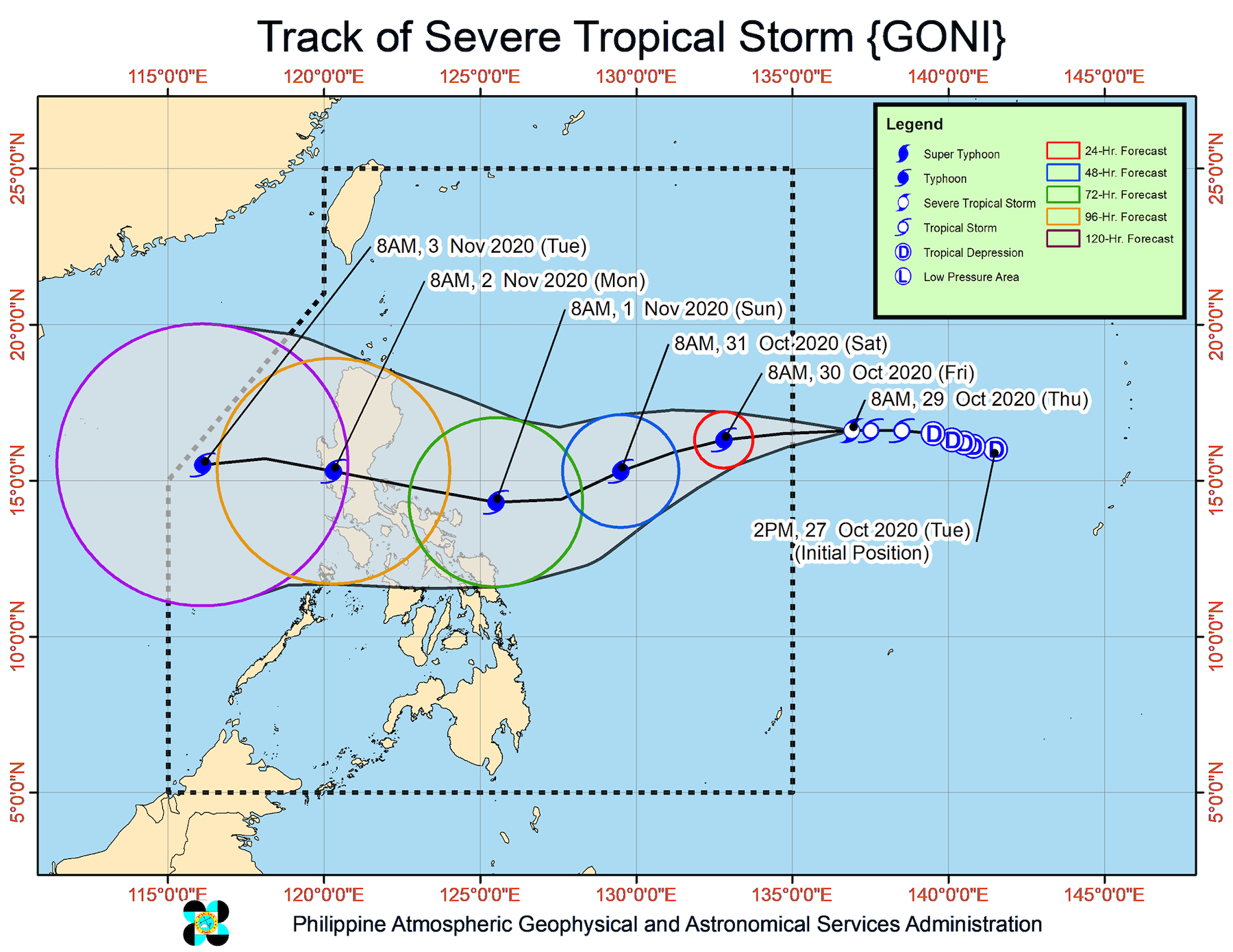
Meanwhile, the low pressure area (LPA) also outside PAR developed into a tropical depression at 8 am.
In its 11 am bulletin, PAGASA said the tropical depression is now 2,510 kilometers east of Mindanao.
It is moving west northwest at 15 km/h, and could enter PAR on Monday, November 2, or Tuesday, November 3. When it enters PAR, it will be given the local name Siony.
This means there could be two tropical cyclones simultaneously inside PAR, if Goni or Rolly has not yet left by then.
So far, the tropical depression has maximum sustained winds of 55 km/h and gustiness of up to 70 km/h. But PAGASA said it may intensify into a tropical storm within 24 hours.
An average of 20 tropical cyclones form within or enter PAR each year.
These are PAGASA’s latest estimates for the number of tropical cyclones inside PAR in the next 6 months:
- November 2020 – 1 to 3
- December 2020 – 2 or 3
- January 2021 – 0 or 1
- February 2021 – 0 or 1
- March 2021 – 0 or 1
- April 2021 – 0 or 1
Last October 2, the state weather bureau warned Filipinos to expect more rain in the coming months due to the onset of La Niña. – Rappler.com
Add a comment
How does this make you feel?
There are no comments yet. Add your comment to start the conversation.