SUMMARY
This is AI generated summarization, which may have errors. For context, always refer to the full article.

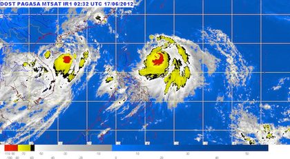
MANILA, Philippines – Typhoon Butchoy (international codename Guchol) intensified Sunday, June 17, accelerating in a north northwest direction away from northern Luzon, the state weather bureau PAGASA said.
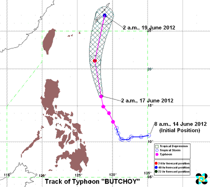
It was last spotted 490 kilometers east northeast of Casiguran, Aurora, with maximum sustained winds of 185 km per hour near the center, and gusts of up to 220 kph.
It is currently moving north northwest at 22 kph, and is expected to enhance the southwest monsoon, bringing rains over Luzon and the Visayas, and may trigger flash floods and landslides.
PAGASA estimated rainfall at 15 to 25 mm per hour (heavy) within Butchoy’s 500-km diameter.

By Monday morning, June 18, the typhoon is forecast to be 500 km east northeast of Basco Batanes, and will be out of the Philippine Area of Responsibility (PAR) by Tuesday.
It is forecast to be 280 km east northeast of Okinawa, Japan by Tuesday morning, June 19.
The state weather bureau is still advising fishing boats and other small seacraft not to venture into the Luzon, Visayas, and eastern Mindanao seaboards. This is due to the big waves expected from the combined effects of Butchoy, PAGASA said.
Meanwhile, Luzon and Visayas will experience occasional rains, while Mindanao will be partly cloudy to cloudy with isolated rainshowers and thunderstorms.
Moderate to strong winds from the southwest to south will prevail over most of the country, the bureau said.
The next PAGASA typhoon bulletin will be at 11 pm Sunday, June 17. – Rappler.com
Add a comment
How does this make you feel?
There are no comments yet. Add your comment to start the conversation.