SUMMARY
This is AI generated summarization, which may have errors. For context, always refer to the full article.
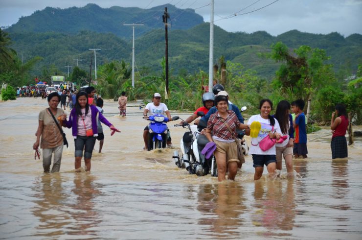
MANILA, Philippines – More roads and bridges in the Visayas and Mindanao are hardly or not at all passable to traffic due to obstructions and damages caused by Tropical Storm Seniang (international name: Jangmi).
In its latest bulleti, the National Disaster Risk Reduction and Management Council (NDRRMC) said on Friday, December 31, that a total of 24 bridges and 23 roads are affected by landslides, flooding, collapsing, or scouring in bridge approaches.
These roads and bridges are in the Seniang-affected areas of Regions VI, VII, VIII, X, and XIII.
DPWH said warning signs were already installed on some affected road sections, and restoration works are on-going.
Seniang entered the Philippine area of responsibility (PAR) on Sunday, December 28 and passed through the Visayas and Mindanao. It left PAR on Friday, January 1. – Rappler.com
Add a comment
How does this make you feel?
There are no comments yet. Add your comment to start the conversation.