SUMMARY
This is AI generated summarization, which may have errors. For context, always refer to the full article.
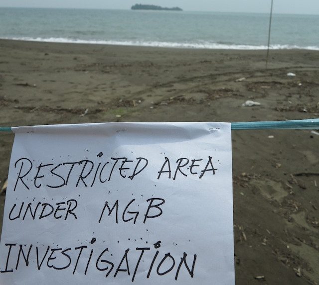
MANILA, Philippines – The Mines and Geosciences Bureau (MGB) aims to assess 15 municipalities in the country for sinkholes and land subsidence in 2015 as part of its expansion of its geohazard assessment program.
Last year, the bureau was able to assess 18 municipalities in Bohol and one in Negros Occidental. After the 2013 Visayas earthquake, MGB personnel found almost 100 sinkholes in Bohol. (READ: Gov’t geologists to map Bohol sinkholes)
A sinkhole is a cavern or empty space beneath the topsoil that collapses during an earthquake or heavy rain. Sinkholes may pose threats to people when structures are built over them.
Land or ground subsidence, meanwhile, is the lowering of the ground surface due to excessive extraction of water from the ground. Subsidence can harm a community by making it more susceptible to flooding.
The MGB, an agency under the Department of Environment and Natural Resources, has added sinkholes and ground subsidence to the geohazards it will identify all over the country. Other geohazards like landslides and flooding have already been identified by the MGB.
After the assessment is completed, the MGB says it will give subsidence susceptibility maps to the concerned local government units.
“Subsidence due to sinkhole collapse is one of the most dangerous geohazard because of its extreme unpredictability. This information can be used by local government planners and individual landowners to make decisions on where to build dwellings and other structures,” said the bureau in an announcement on its website.
They will also send threat advisories and recommendations to better prepare the communities.
Most PH towns susceptible
The assessment for sinkholes and ground subsidence will be conducted in areas with a high concentration of soluble rocks made of limestone and dolomite. The presence of soluble rocks increase the risk of these hazards.
A majority of the country’s municipalities – 1,171 out of the total 1,490 – sit on soluble rocks.
The MGB program uses a Ground Penetrating Radar (GPR) to detect sinkholes and ground subsidence with electromagnetic energy.
Geographic Information System technology spots limestone terrain and identifies the morphometric attributes of sinkholes. This is used together with field data and maps at a scale of 1:10,000.
To measure how susceptible an area is to ground subsidence, the MGB uses remote sensing data, specifically IFSAR-Diging Elevation Model and IFSAR-Orthorectified Radar Image. – Rappler.com
Add a comment
How does this make you feel?
There are no comments yet. Add your comment to start the conversation.