SUMMARY
This is AI generated summarization, which may have errors. For context, always refer to the full article.
What’s the weather like in your area? Report the situation through Rappler’s Agos or tweet us at @rapplerdotcom.
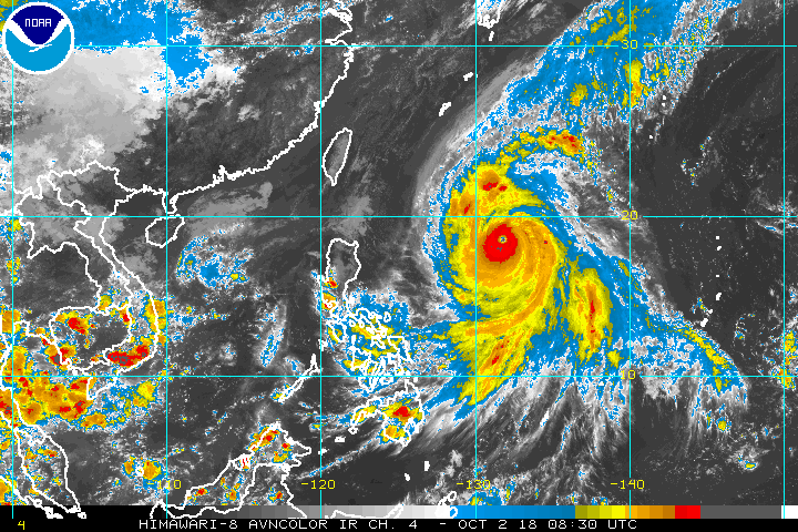
MANILA, Philippines – Typhoon Queenie (Kong-rey) maintained its strength on Tuesday afternoon, October 2, as it moved northwest in direction.
In a bulletin issued 4 pm on Tuesday, the Philippine Atmospheric, Geophysical, and Astronomical Services Administration (PAGASA) said Queenie still has maximum sustained winds of up to 200 kilometers per hour (km/h) and gustiness of up to 245 km/h. (READ: FAST FACTS: Tropical cyclones, rainfall advisories)
The eye of the typhoon was last located at 1,080 km east of Tuguegarao City, Cagayan. It is moving northwest at 15 km/h.
PAGASA weather specialist Gener Quitlong said Queenie could still strengthen in the next 24 to 36 hours.
“Maaari pa rin po itong maging isang super typhoon (This could still intensify into a super typhoon),” Quitlong said during PAGASA’s 5 pm press conference on Queenie.
He said if the typhoon maintains its current direction, it is not expected to make landfall in the Philippines, and there will be no hoisting of tropical cyclone warning signals in the next days.
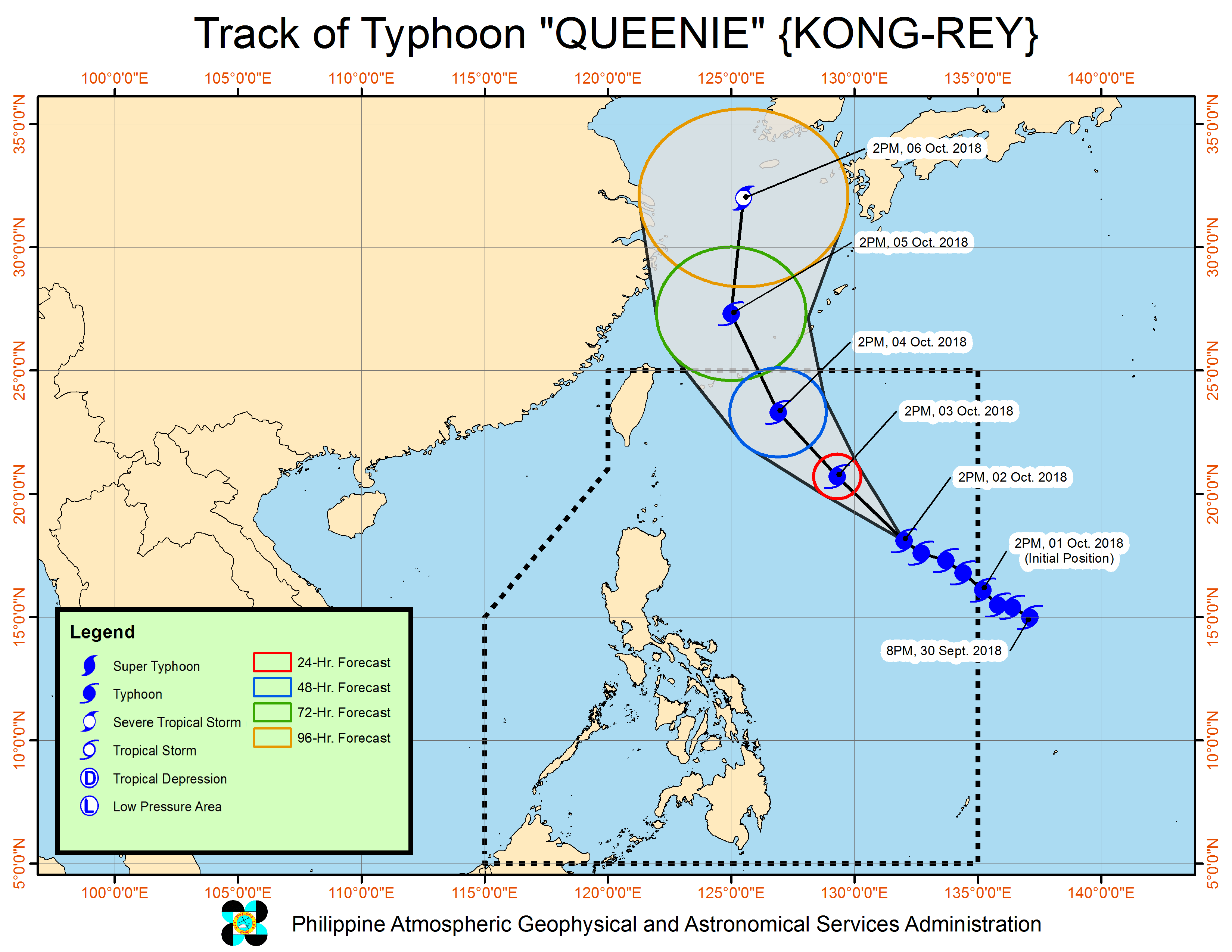
But Quitlong said if the direction changes into west northwest and if it maintains this direction for 24 hours, “posible pong magkaroon ng warning signals, lalo na po dito sa dulong hilagang Luzon (it is possible to raise [tropical cyclone] warning signals, especially over parts of extreme Northern Luzon).”
Queenie’s trough will bring light to at times moderate rain over the eastern section of the country. Cagayan Valley, Bicol Region, Eastern Visayas, and the provinces of Aurora and Quezon will experience cloudy skies with scattered rainshowers and thunderstorms.
Metro Manila and the rest of the country will have partly cloudy to cloudy skies with isolated rainshowers due to localized thunderstorms.
PAGASA again warned about strong to gale force winds over extreme Northern Luzon and the eastern seaboards of Luzon. Small sea vessels are advised against venturing out to sea.
Queenie is expected to leave the Philippine Area of Responsibility on Friday, October 5.
Queenie is the Philippines’ 17th tropical cyclone for 2018. The country usually gets an average of 20 tropical cyclones per year. (READ: LIST: PAGASA’s names for tropical cyclones in 2018)
For October alone, PAGASA said there could be 2 to 3 tropical cyclones. (READ: LIST: PAGASA’s names for tropical cyclones in 2018)
PAGASA declared the start of the rainy season last June 8. – Rappler.com
Add a comment
How does this make you feel?


There are no comments yet. Add your comment to start the conversation.