SUMMARY
This is AI generated summarization, which may have errors. For context, always refer to the full article.
What’s the weather like in your area? Tweet us at @rapplerdotcom.
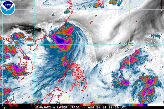
MANILA, Philippines – Severe Tropical Storm Ineng (Bailu) left the Philippine Area of Responsibility (PAR) at 6 pm on Saturday, August 24, but it continues to enhance the southwest monsoon or hanging habagat.
In a bulletin issued 8 pm on Saturday, the Philippine Atmospheric, Geophysical, and Astronomical Services Administration (PAGASA) said Ineng is already 395 kilometers northwest of Basco, Batanes.
It accelerated as it left PAR, now moving northwest at 25 kilometers per hour (km/h) from the previous 20 km/h. It is over the Taiwan Strait, heading for the southeastern part of China, after earlier making landfall in Taiwan’s Pingtung County.
The severe tropical storm maintained its strength, with maximum winds of 100 km/h and gustiness of up to 125 km/h.
Ineng did not make landfall in the Philippines, but it triggered heavy rain due to its outer rainbands. Tropical cyclone wind signals were also raised in parts of Luzon.
Even after Ineng’s exit, the enhanced southwest monsoon still poses a threat. Below is the latest list of affected areas:
Light to heavy rain
- Ilocos Region
- Cordillera Administrative Region
- Central Luzon
- Metro Manila
- Cavite
- Batangas
- Rizal
- Laguna
- Occidental Mindoro
- Oriental Mindoro
- northern part of Palawan including Calamian and Cuyo islands
Aside from the rain, PAGASA warned that gusty conditions will prevail over most of Luzon, especially over Northern Luzon.
Flash floods and landslides remain possible in areas affected by the enhanced southwest monsoon. (READ: FAST FACTS: Tropical cyclones, rainfall advisories)
Ilocos Norte is already under a state of calamity after heavy rain triggered floods. (IN PHOTOS: Floods hit Ilocos Norte, Metro Manila due to Ineng, monsoon)
A landslide in Ilocos Norte also left a 17-year-old girl dead and her two young cousins injured.
PAGASA added that travel remains risky in the seaboards of Luzon.
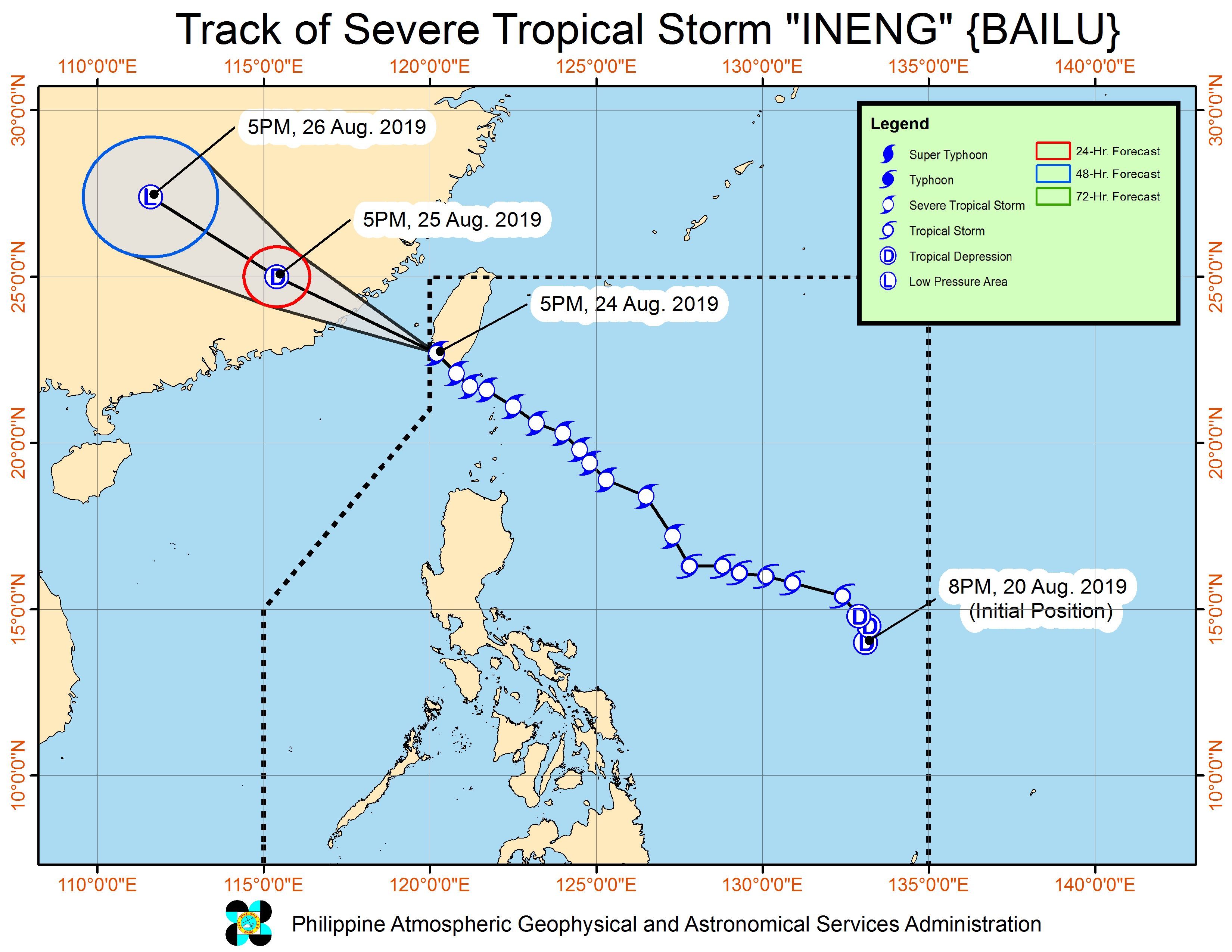
Meanwhile, PAGASA continues to monitor a low pressure area (LPA) outside PAR. It earlier said that the LPA is 1,790 kilometers east of Mindanao and could enter PAR by Monday, August 26.
The LPA may develop into a tropical depression and affect parts of Luzon. Updates will be given in the coming days.
Ineng was the Philippines’ 9th tropical cyclone for 2019 and the 2nd for August. (READ: LIST: PAGASA’s names for tropical cyclones in 2019)
The country gets an average of 20 tropical cyclones annually, but since 2019 is an El Niño year, only 14 to 18 tropical cyclones are expected.
Below is the estimated number of tropical cyclones from August to December:
- August – 2 to 4
- September – 2 to 4
- October – 2 or 3
- November – 1 or 2
- December – 0 or 1
PAGASA declared the start of the rainy season last June 14. – Rappler.com
Add a comment
How does this make you feel?
There are no comments yet. Add your comment to start the conversation.