SUMMARY
This is AI generated summarization, which may have errors. For context, always refer to the full article.
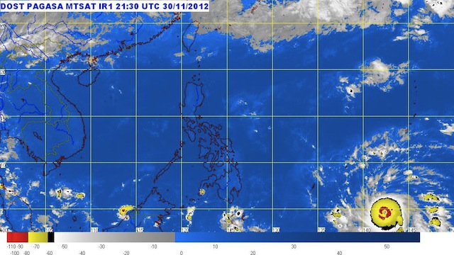
MANILA, Philippines (3rd UPDATE) – A typhoon with the international name “Bopha” is moving towards Mindanao and is expected to enter the Philippine Area of Responsibility (PAR) early Monday morning, the state weather bureau said.
As of 8 a.m. Saturday, the Philippine Atmospheric, Geophysical and Astronomical Services Administration (PAGASA) spotted Typhoon Bopha 1,690 km east of Southern Mindanao or at 4.7°N, 142.0ºE. It will be named “Pablo” once it enters PAR.
The typhoon regained strength as it moved 20 kph to the West towards the Philippines with maximum sustained winds of 165 kph and gustiness of up to 200 kph.
But at its current location and speed of movement, PAGASA said Typhoon Bopha is not expected to affect weather in the country within the next two days.
Since Friday, the National Disaster Risk Reduction and Management Council, has been on “blue alert” status, which requires 50% of its personnel to be ready for contingency efforts. Regional and local disaster management councils have been advised to disseminate weather information and take precautionary measures in their respective areas of responsibility.
The approaching typhoon is embedded along the Intertropical Convergence Zone affecting Southern Mindanao, bringing partly cloudy skies with isolated brief rainshowers or thunderstorms to the Bicol Region, Eastern Visayas and Mindanao.
Metro Manila, on the other hand, can expect fair weather. – Rappler.com
Add a comment
How does this make you feel?
There are no comments yet. Add your comment to start the conversation.