SUMMARY
This is AI generated summarization, which may have errors. For context, always refer to the full article.
What’s the weather like in your area? Tweet us at @rapplerdotcom.
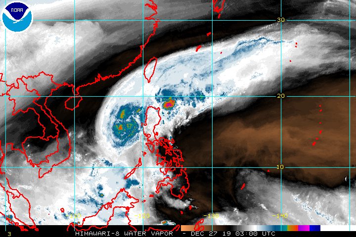
MANILA, Philippines – Typhoon Ursula (Phanfone) no longer has a direct effect on the Philippines, but the tail-end of a cold front is affecting parts of Northern Luzon on Friday, December 27.
The Philippine Atmospheric, Geophysical, and Astronomical Services Administration (PAGASA) defines the tail-end of a cold front as an “extended zone of converging winds from east to northeast that often brings thunderstorms and rainshowers.”
In a briefing at 11 am on Friday, PAGASA provided the following rainfall outlook for the next 24 hours:
Moderate to occasional heavy rain
- Batanes
- Cagayan
- Isabela
- Apayao
Light to moderate rain
- rest of Cagayan Valley
- rest of Cordillera Administrative Region
Residents of those areas are advised to be on alert for possible flash floods and landslides, especially if they live in high-risk zones. (READ: FAST FACTS: Tropical cyclones, rainfall advisories)
Travel is also risky in the seaboards of Batanes, Cagayan including the Babuyan Group of Islands, Ilocos Norte, and Ilocos Sur due to the northeast monsoon or hanging amihan.
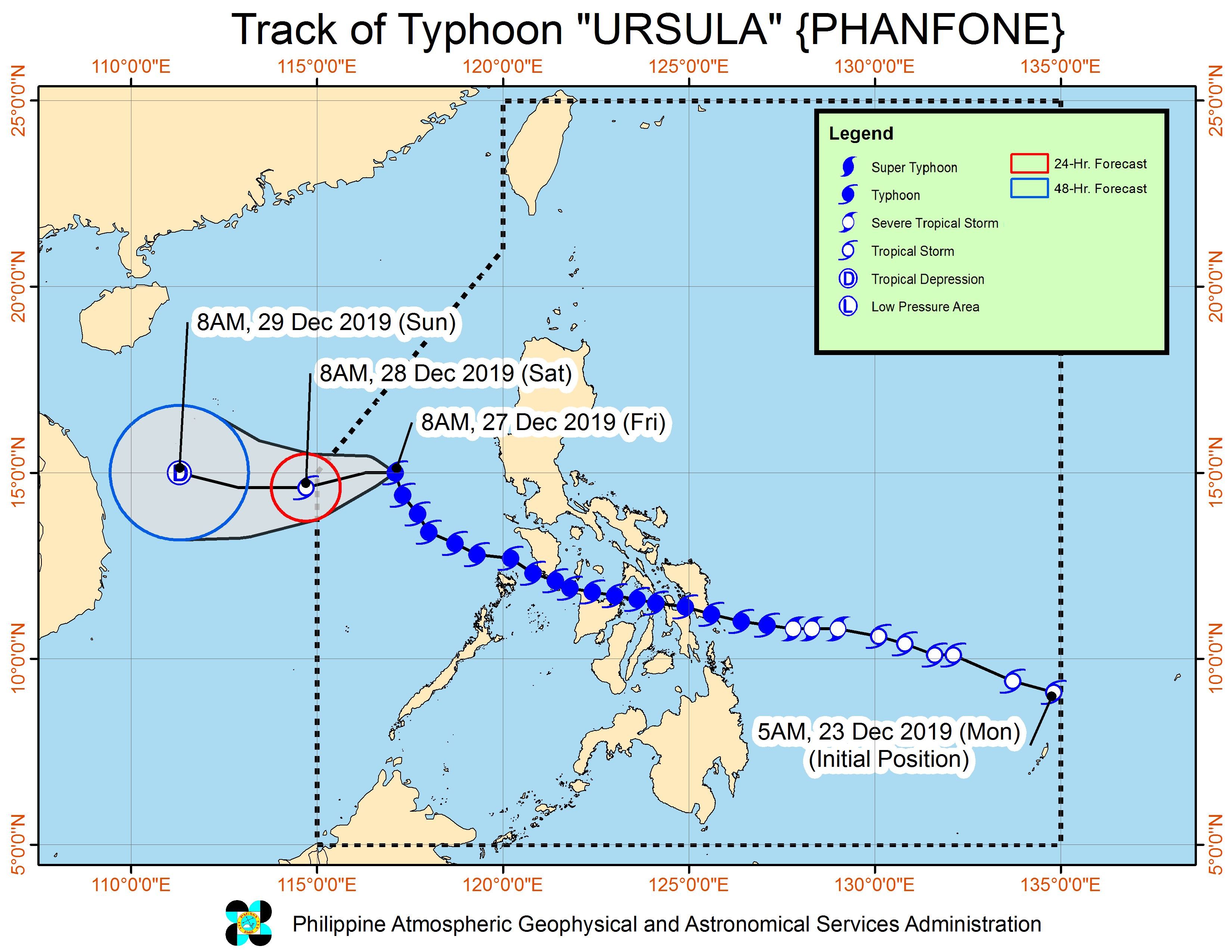
Meanwhile, Ursula is already 365 kilometers west of Subic, Zambales, still over the West Philippine Sea.
The typhoon continues to move away from the country, but at a slow pace of 10 kilometers per hour (km/h).
It still has maximum winds of 120 km/h and gustiness of up to 150 km/h. PAGASA expects it to gradually weaken in the next couple of days.
There have been no tropical cyclone wind signals raised since Thursday, December 26. (READ: Why is it now called tropical cyclone ‘wind’ – and not ‘warning’ – signals?)
On Friday, the death toll from Ursula across the Visayas rose to 28. Nearly half of the fatalities – 13 – were in Iloilo.
The typhoon had caused heavy flooding and serious damage. It also disrupted sea and air travel during the holiday rush, as well as downed communication and power lines. (READ: #ReliefPH: Help those affected by Typhoon Ursula)
Ursula’s first 3 landfalls were in Eastern Visayas on Christmas Eve, the next 3 in Western Visayas on Christmas Day, and the 7th in Oriental Mindoro, also on Christmas Day.
Tuesday, December 24
- Salcedo, Eastern Samar – 4:45 pm
- Tacloban City, Leyte – 7:30 pm
- Cabucgayan, Biliran – 9:15 pm
Wednesday, December 25
- Gigantes Islands, Carles, Iloilo – 2:30 am
- Ibajay, Aklan – 8:40 am
- Semirara Island, Caluya, Antique – 1 pm
- Bulalacao, Oriental Mindoro – 3 pm
Ursula is expected to leave the Philippine Area of Responsibility on Saturday morning, December 28.
Ursula is the Philippines’ 21st tropical cyclone for 2019, exceeding the yearly average of 20. (READ: LIST: PAGASA’s names for tropical cyclones in 2019)
Ursula is also the second tropical cyclone for December, after Typhoon Tisoy (Kammuri). PAGASA earlier said it was expecting one or two tropical cyclones during the month.
So far, there is no other weather disturbance – low pressure area or tropical cyclone – being monitored, according to PAGASA.
PAGASA declared the start of the rainy season last June 14. – Rappler.com
Add a comment
How does this make you feel?
There are no comments yet. Add your comment to start the conversation.