SUMMARY
This is AI generated summarization, which may have errors. For context, always refer to the full article.
What’s the weather like in your area? Tweet us the situation: Use #weatheralert and tag @rapplerdotcom.
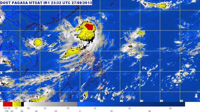
MANILA, Philippines – Tropical storm Nando (Kong-rey) continues to affect north Luzon Wednesday, August 28, with stormy weather expected in Batanes.
Nando was spotted 110 km east of Basco, Batanes (21.0°N, 123.0°E) as of 5 am, carrying maximum sustained winds of 85 km/h, and gusts of up to 100 km/h.
Storm warning signal #2 is still in effect over Batanes, while signal #1 is in effect over Cagayan.
Nando is moving north northwest at a speed of 15 km/h.
Batanes will experience stormy weather Wednesday, with rough to very rough seas, while the islands of Babuyan and Calayan will have rains with gusty winds and moderate to rough seas.
Zambales and the Ilocos and Cordillera regions will have cloudy skies with moderate to heavy rain, and the bureau warned residents of the area to be on the lookout for flash floods and landslides.
The rest of Luzon will have cloudy skies with light to moderate rain, while the rest of the country will experience partly cloudy to cloudy skies with isolated rain. – Rappler.com
Add a comment
How does this make you feel?
There are no comments yet. Add your comment to start the conversation.