SUMMARY
This is AI generated summarization, which may have errors. For context, always refer to the full article.
What’s the weather like in your area? Tweet us the situation: Use #weatheralert and tag @rapplerdotcom
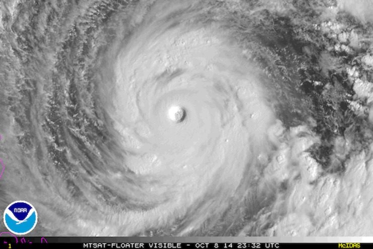
MANILA, Philippines – Super Typhoon Ompong (Vongfong) continues on its path towards Japan Thursday, October 9, as it now moves in a more northerly direction, away from the Philippines.
The storm – the strongest storm on the planet so far this year – was located 940 km east southeast of Calayan, Cagayan as of 4 am, carrying maximum sustained winds of 215 km/h and gusts of up to 250 km/h.
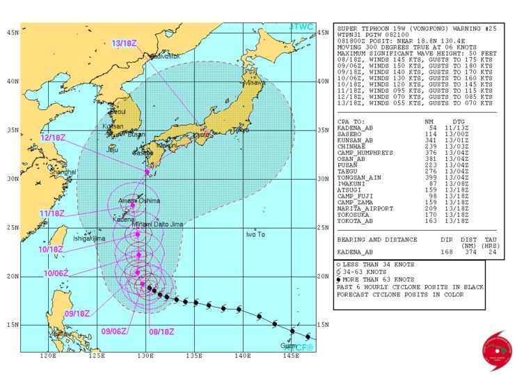
The slow-moving system – moving at a pace of 9 km/h – is going north northwest, towards the southern Japanese islands.
Data from the US Navy Joint Typhoon Warning Center (JTWC), which has labeled the typhoon a “super typhoon,” showed its winds have weakened a bit, but The Weather Channel said it is still equivalent to a Category 5 hurricane.
The latest estimated central pressure measured by the Japan Meteorological Agency (JMA), which is still categorizing the storm as “violent,” was at 900hPa (hectopascals).
Ompong is expected to remain within the Philippine Area of Responsibility (PAR) in the next few days, and is expected to hit Japan this weekend.
Meanwhile, as Ompong moves away from the Philippines, parts of the country will experience a rainy Thursday.
An intertropical convergence zone (ITCZ) is affecting Mindanao, and PAGASA forecasts cloudy skies with light to moderate rain and thunderstorms in Metro Manila, MIMAROPA, Calabarzon, Bicol, Visayas, and Mindanao.
Northern Luzon will have cloudy skies accompanied by light to moderate rain, and the rest of the country will have partly cloudy to cloudy skies with isolated rain. – Rappler.com
Add a comment
How does this make you feel?
There are no comments yet. Add your comment to start the conversation.