SUMMARY
This is AI generated summarization, which may have errors. For context, always refer to the full article.
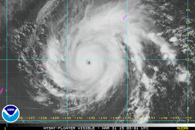
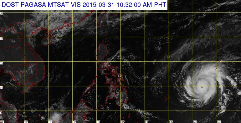
MANILA, Philippines – Typhoon Maysak has intensified further as it moves toward the general direction of the eastern Philippines Tuesday, March 31.
As of 10 am, state weather bureau PAGASA last located Maysak’s eye at approximately 1,820 km east of Northern Mindanao, with maximum sustained winds of 175 km/h near the center and gusts of up to 210 km/h.
Maysak is still outside of the Philippine Area of Responsibility (PAR), and is moving west northwest at a speed of 20 km/h, the bureau said in its 11 am weather advisory.
Currently, it is closing in on the Micronesian islands of Yap and Ulithi, independent weather organization Weather Philippines said in its Tuesday update.
The severe weather system is expected to enter PAR by Wednesday evening, April 1, or early Thursday, April 2. Once it is in the area, the bureau will give it the name Chedeng.
Weather Philippines said the storm could possibly reach super typhoon status within 12-24 hours, then weaken as it comes near Philippine landmass.
Residents of the country’s eastern seaboard – Eastern Luzon, Bicol, and Eastern Visayas, in particular – should “closely monitor” developments, the organization added.
PAGASA’s next update on Maysak will be included in the bureau’s 5 pm weather forecast. – Rappler.com
Add a comment
How does this make you feel?
There are no comments yet. Add your comment to start the conversation.