SUMMARY
This is AI generated summarization, which may have errors. For context, always refer to the full article.
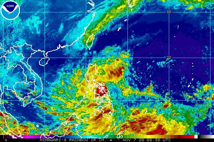
More rain is expected during the weekend as the low pressure area (LPA) inside the Philippine Area of Responsibility (PAR) will cross parts of the Visayas and Southern Luzon.
The Philippine Atmospheric, Geophysical, and Astronomical Services Administration (PAGASA) said in an online briefing past 4 pm on Saturday, November 7, that the LPA was 75 kilometers north northeast of Borongan City, Eastern Samar.
It is moving west and was poised to first hit Samar Island within the afternoon, said PAGASA Weather Specialist Ariel Rojas.
The LPA has been bringing rain on Saturday, and this will persist as the weather system moves over land. Affected areas, listed below, should be on alert for possible floods and landslides.
Moderate to heavy rain, with at times intense rain
- Bicol
- Quezon
- Aurora
- Eastern Visayas
Light to moderate rain, with at times heavy rain
- rest of Calabarzon
- rest of Central Luzon
- Metro Manila
- Mimaropa
- Isabela
- Quirino
- Nueva Vizcaya
- rest of Visayas
- Mindanao
Rojas said the LPA may become a tropical depression within 24 to 36 hours, either over the Sulu Sea or the West Philippine Sea. (READ: FAST FACTS: Tropical cyclones, rainfall advisories)
When the LPA becomes a tropical depression, it will be given the local name Tonyo, as the Philippines’ 20th tropical cyclone for 2020.
Signal No. 1 would be immediately raised in nearby areas.
The Philippines has had 19 tropical cyclones in 2020, with the latest one Severe Tropical Storm Siony (Atsani), which hit extreme Northern Luzon and left PAR at 12 am on Saturday.
An average of 20 tropical cyclones form within or enter PAR each year. (READ: LIST: PAGASA’s names for tropical cyclones in 2020)
For the next 6 months, these are PAGASA’s estimates for tropical cyclones inside PAR:
- November 2020 – 1 to 3
- December 2020 – 2 or 3
- January 2021 – 0 or 1
- February 2021 – 0 or 1
- March 2021 – 0 or 1
- April 2021 – 0 or 1
La Niña has been underway since October, which means “above normal rainfall” in the coming months.
The northeast monsoon or hanging amihan also began in November, signaling “surges of cold temperatures.”
PAGASA warned that La Niña may enhance the northeast monsoon, which could trigger floods and landslides. – Rappler.com
Add a comment
How does this make you feel?
There are no comments yet. Add your comment to start the conversation.