SUMMARY
This is AI generated summarization, which may have errors. For context, always refer to the full article.
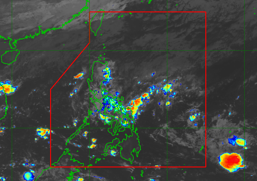
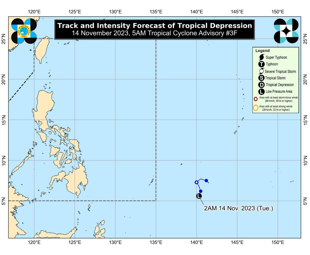
MANILA, Philippines – The tropical depression outside the Philippine Area of Responsibility (PAR) weakened into a low pressure area (LPA) at 2 am on Tuesday, November 14.
The LPA was located 1,620 kilometers east of southeastern Mindanao as of 4 am on Tuesday, moving south southwest at 10 kilometers per hour.
The Philippine Atmospheric, Geophysical, and Astronomical Services Administration (PAGASA) said in a 5 am advisory that the LPA will continue to move “erratically” and linger “near or around its present position in the next 24 hours as it remains highly disorganized.”
“[An] unfavorable environment may prevent this weather disturbance from significantly organizing during the same period,” added PAGASA.
The LPA, however, could eventually reorganize and redevelop into a tropical depression. It is also projected to speed up toward the west or west northwest, and enter PAR late Wednesday, November 15, or early Thursday, November 16.
If the LPA redevelops within or enters PAR as a tropical depression, it would be given the local name Kabayan.
PAGASA sees the weather system maintaining a westward movement until Friday, November 17, while slowly strengthening.
During the weekend, it may shift northwest over the waters east of Mindanao.
PAGASA emphasized that the threat of heavy rainfall still lies ahead.
It explained that “regardless of [the LPA’s] development trend, the interaction between this disturbance and a possible shear line related to the forecast surge of the northeast monsoon” may bring heavy rain.
The eastern part of Mindanao could be affected starting Friday, as well as Bicol and most of the Visayas beginning Saturday, November 18.
ALSO ON RAPPLER
- De Lima on Duterte: ‘God forgive him and God bless him’
- [OPINION] Women and Leila de Lima’s journey to freedom
- Too close and too cold, premature babies in grave peril at Gaza’s Al Shifa hospital
For coastal waters, the northeast monsoon is expected to cause rough to very rough seas in most seaboards of Luzon and the eastern seaboard of the Visayas in the next five days.
The potential tropical cyclone may also trigger moderate to rough seas in the eastern seaboard of Mindanao starting Friday.
“Mariners of small seacraft, especially of motor bancas and similarly-sized vessels, are advised to continue monitoring for updates,” PAGASA said.
The weather bureau earlier estimated that one or two tropical cyclones could enter or form within PAR in November. – Rappler.com
Add a comment
How does this make you feel?
There are no comments yet. Add your comment to start the conversation.