SUMMARY
This is AI generated summarization, which may have errors. For context, always refer to the full article.
What’s the weather like in your area? Tweet us at @rapplerdotcom.
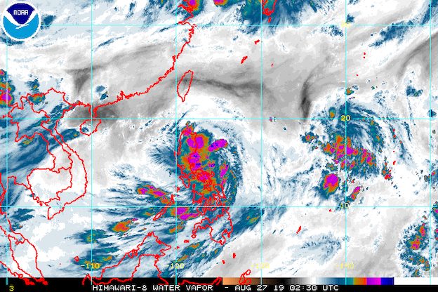
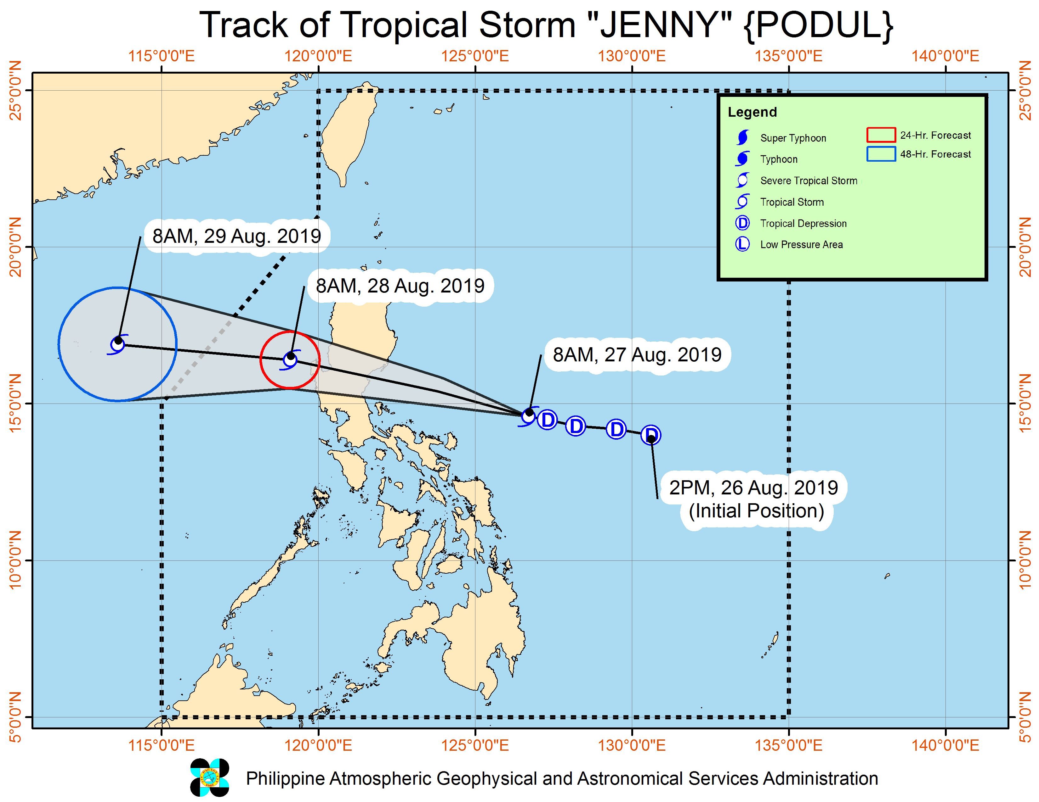
MANILA, Philippines – Jenny intensified from a tropical depression into a tropical storm late Tuesday morning, August 27, while moving toward Central Luzon. It has been given the international name Podul.
In a briefing past 11 am on Tuesday, the Philippine Atmospheric, Geophysical, and Astronomical Services Administration (PAGASA) said Tropical Storm Jenny (Podul) now has maximum winds of 65 kilometers per hour (km/h) from the previous 55 km/h and gustiness of up to 80 km/h from the previous 70 km/h.
It is likely to remain a tropical storm for the rest of its stay inside the Philippine Area of Responsibility (PAR).
Jenny is already 360 kilometers east northeast of Daet, Camarines Norte, or 490 kilometers east of Infanta, Quezon. It is moving west northwest at the same speed of 25 km/h.
Jenny might make landfall in Aurora on Tuesday evening or Wednesday morning, August 28.
Below are the tropical cyclone wind signals issued as of 11 am on Tuesday. Signal No. 2 has just been raised.
Signal No. 2 (winds of 61 km/h to 120 km/h)
- Isabela
- Aurora
- Quirino
Signal No. 1 (winds of 30 km/h to 60 km/h)
- Cagayan
- Nueva Vizcaya
- Apayao
- Abra
- Kalinga
- Mountain Province
- Ifugao
- Benguet
- Ilocos Norte
- Ilocos Sur
- La Union
- Pangasinan
- Nueva Ecija
- Tarlac
- Zambales
- Bataan
- Pampanga
- Bulacan
- Metro Manila
- Rizal
- northern part of Quezon including Polillo Island
- Cavite
- Laguna
- Camarines Norte
- northeastern part of Camarines Sur
- Catanduanes
PAGASA warned areas under Signal No. 2 to prepare for potentially strong winds, while gusty conditions may occur in areas under Signal No. 1. It added that the Visayas and other parts of Luzon may also experience gusty conditions due to the southwest monsoon or hanging habagat.
In terms of rainfall, here’s the latest on what to expect:
Tuesday morning to evening, August 27
- Moderate to heavy rain
- Bicol
- Quezon
- Rizal
- Bulacan
- Pampanga
- Aurora
- Nueva Ecija
- Nueva Vizcaya
- Quirino
- Isabela
- Cagayan
- Eastern Samar
- Northern Samar
- Samar
- Light to heavy rain
- rest of Luzon
- rest of the Visayas
- Zamboanga Peninsula
- Northern Mindanao
- Bangsamoro Autonomous Region in Muslim Mindanao
Tuesday evening, August 27, to Wednesday morning, August 28
- Moderate to heavy rain
- Central Luzon
- Metro Manila
- Rizal
- northern part of Quezon including Polillo Island
- Nueva Vizcaya
- Quirino
- Benguet
- Pangasinan
- La Union
- Light to heavy rain
- rest of Luzon
- Western Visayas
Wednesday morning to evening, August 28
- Light to heavy rain
- Occidental Mindoro
- Oriental Mindoro
- northern part of Palawan including Calamian and Cuyo islands
- Zambales
- Bataan
- Western Visayas
PAGASA warned that flash floods and landslides are possible in areas affected by the tropical storm. (READ: FAST FACTS: Tropical cyclones, rainfall advisories)
Classes are suspended for Tuesday in some areas. (READ: #WalangPasok: Class suspensions, Tuesday, August 27, 2019)
Travel is also risky in the seaboards of areas under Signal Nos. 1 and 2.
Based on its latest forecast track, Jenny will leave PAR on Wednesday.
Jenny is the Philippines’ 10th tropical cyclone for 2019, and the 3rd for August. (READ: LIST: PAGASA’s names for tropical cyclones in 2019)
The country gets an average of 20 tropical cyclones annually, but since 2019 is an El Niño year, only 14 to 18 tropical cyclones are expected.
Below is the estimated number of tropical cyclones from August to December:
- August – 2 to 4
- September – 2 to 4
- October – 2 or 3
- November – 1 or 2
- December – 0 or 1
PAGASA declared the start of the rainy season last June 14. – Rappler.com
Add a comment
How does this make you feel?
There are no comments yet. Add your comment to start the conversation.