SUMMARY
This is AI generated summarization, which may have errors. For context, always refer to the full article.
A total of 68 localities brace for storm surges, some reaching more than 5 meters (16.5 feet) high. Project Nationwide Operational Assessment of Hazards (Project NOAH) released a list of areas in the Philippines that may experience storm surges – floods caused by tides due to a tropical cyclone – from November 8 to November 9. Storm surges form when high-speed winds brush up against the ocean surface, causing water to pile up higher than the normal sea level. Based on the data, Eastern Samar will experience the highest storm surge. Matarinao Bay will see a 5.2-meter or 17-foot storm surge. Poro Island in Biliran will see the second highest storm surge – at 4.7 meters or 15.4 feet. For coastal communities, a storm surge is often the greatest threat to life and property caused by a hurricane. Yolanda not only threatens the Visayas region, it also renders areas in Caraga region in Mindanao vulnerable to landslides and floods. According to data provided by the Mines and Geosciences Bureau (MGB), among the regions affected by Yolanda, Caraga has the highest percentage of municipalities and barangays where landslides and floods will likely occur.
Here are some related stories.
Yolanda Storm Surges
Areas Prone to Floods and Landslide
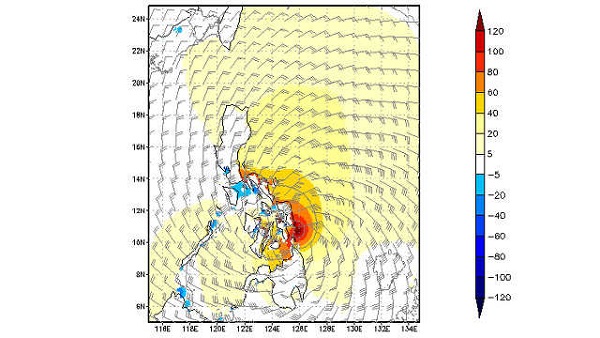
Yolanda Critical Map
Add a comment
How does this make you feel?
There are no comments yet. Add your comment to start the conversation.