SUMMARY
This is AI generated summarization, which may have errors. For context, always refer to the full article.
What’s the weather like in your area? Report the situation through Rappler’s Agos or tweet us at @rapplerdotcom.
MANILA, Philippines – More than two dozen areas are now under tropical cyclone warning signals as of early Saturday evening, December 24, due to Typhoon Nina (Nock-ten). These areas include Catanduanes, where Nina will make landfall, and also Metro Manila.
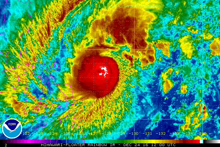
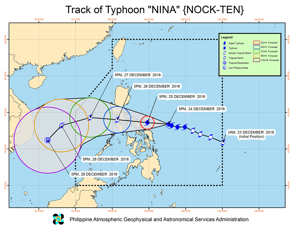
In a bulletin issued 8 pm on Saturday, state weather bureau PAGASA said Nina is already 355 kilometers east of Virac, Catanduanes. It is still moving west northwest at 15 kilometers per hour (km/h).
The typhoon maintained its strength, with maximum winds of up to 175 km/h and gustiness of up to 215 km/h.
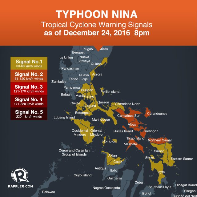
Signal number 2 is now raised in the following areas:
- Camarines Sur
- Masbate including Ticao and Burias Islands
- Catanduanes
- Albay
- Sorsogon
- Northern Samar
Signal number 1, meanwhile, is up over:
- Metro Manila
- Bulacan
- Cavite
- Laguna
- Batangas
- Rizal
- Quezon including Polillo Island
- Camarines Norte
- Aurora
- Romblon
- Marinduque
- Occidental Mindoro including Lubang Island
- Oriental Mindoro
- Aklan
- Capiz
- Samar
- Eastern Samar
- Biliran
- Leyte
- Bantayan Island
Nina is expected to make landfall in Catanduanes on Sunday, December 25 – Christmas Day – either in the afternoon or evening.
Aside from the Bicol Region, there will also be stormy weather in Metro Manila, Calabarzon, Bulacan, Pampanga, Bataan, Zambales, Marinduque, Oriental Mindoro, Occidental Mindoro, and Northern Samar from Sunday to Monday, December 26.
Moderate to heavy rain is expected within Nina’s 500-km diameter, which could bring floods and landslides. Strong winds may topple structures and trees, added PAGASA.
The state weather bureau also warned that storm surges up to 2.5 meters high are possible in coastal areas in Camarines Sur, Camarines Norte, and Catanduanes. Sea travel is generally risky in the seaboards of Luzon.
Nina is expected to leave the Philippine Area of Responsibility (PAR) on Wednesday, December 28.
– Rappler.com
Add a comment
How does this make you feel?


There are no comments yet. Add your comment to start the conversation.