SUMMARY
This is AI generated summarization, which may have errors. For context, always refer to the full article.
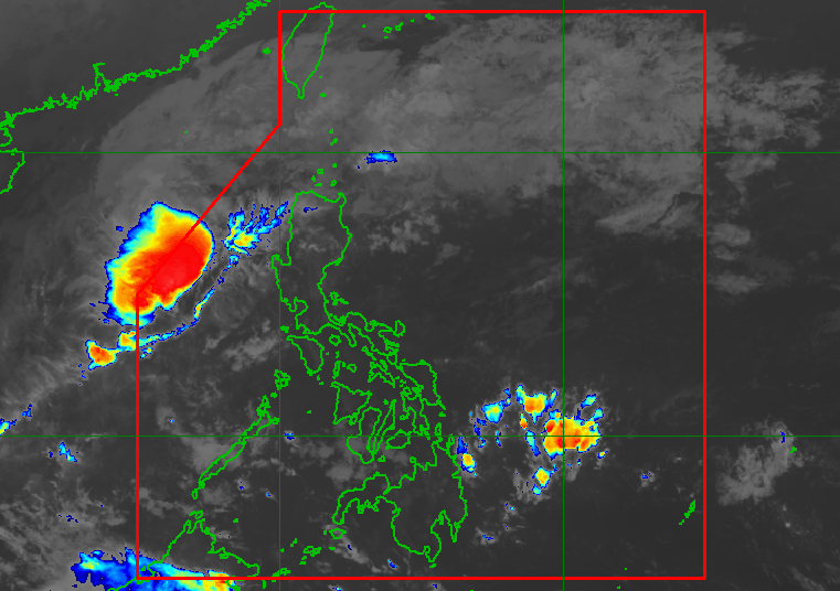
MANILA, Philippines – The low pressure area (LPA) that brought rain to parts of the country in recent days already left the Philippine Area of Responsibility (PAR), but the impact of the shear line and the easterlies will be felt on Friday, January 28.
The Philippine Atmospheric, Geophysical, and Astronomical Services Administration (PAGASA) said the LPA left PAR at 5 pm on Thursday, January 27.
The shear line is affecting Northern Luzon, causing scattered rain and thunderstorms in Cagayan Valley, Ilocos Norte, and Apayao on Friday.
The weather bureau warned that flash floods or landslides could occur due to moderate to heavy rain from the shear line.
Meanwhile, PAGASA Weather Specialist Benison Estareja said the easterlies, or warm winds from the Pacific Ocean, will cause localized thunderstorms in the rest of the country.
Severe thunderstorms may lead to flash floods or landslides, too.
Estareja said no tropical cyclone is expected in the last few days of January. The Philippines has yet to see a tropical cyclone in 2022. – Rappler.com
Add a comment
How does this make you feel?

There are no comments yet. Add your comment to start the conversation.