SUMMARY
This is AI generated summarization, which may have errors. For context, always refer to the full article.
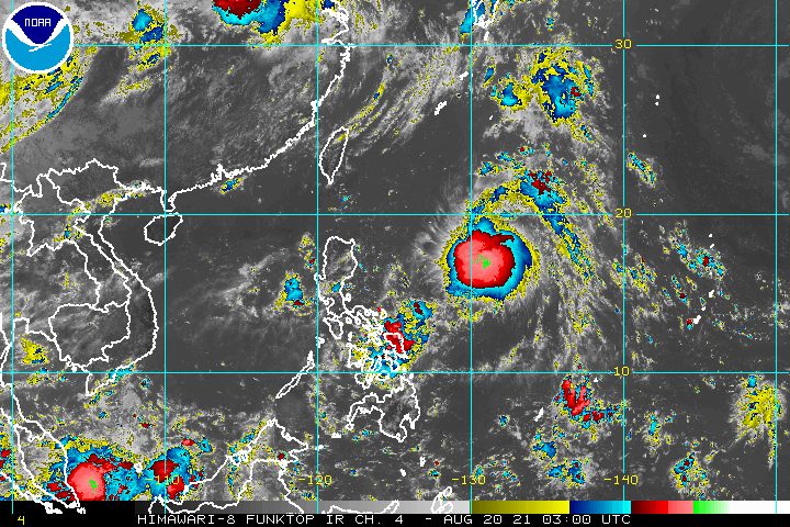
Tropical Depression Isang strengthened a bit while moving over the Philippine Sea on Friday morning, August 20.
In a briefing past 11 am on Friday, the Philippine Atmospheric, Geophysical, and Astronomical Services Administration (PAGASA) said Isang now has maximum sustained winds of 55 kilometers per hour and gustiness of up to 70 km/h.
It previously had maximum sustained winds of 45 km/h and gustiness of up to 55 km/h.
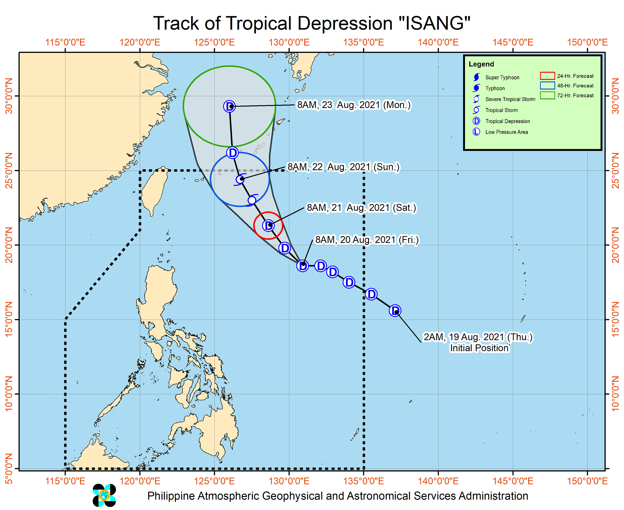
PAGASA now expects Isang to intensify further into a tropical storm on Saturday afternoon or evening, August 21. It was earlier seen to remain a tropical depression throughout its stay inside the Philippine Area of Responsibility (PAR).
Isang, fortunately, will remain far from the country. As of Friday morning, it was located 975 kilometers east of extreme Northern Luzon, moving west at 20 km/h.
The tropical depression is expected to move northwest until Saturday morning, then turn north northwest on Saturday afternoon, maintaining its distance from the Philippines.
Isang is not causing rain and there are no tropical cyclone wind signals in effect. It is also not enhancing the southwest monsoon or hanging habagat and not causing rough coastal waters.
Based on Isang’s latest forecast track, it may leave PAR on Sunday morning or afternoon, August 22.
Following its exit, it could weaken back into a tropical depression after passing Japan’s Ryukyu Islands and the East China Sea, according to PAGASA. (READ: FAST FACTS: Tropical cyclones, rainfall advisories)
Meanwhile, the easterlies or warm winds coming from the Pacific Ocean are still affecting the Philippines on Friday.
Isolated rain showers or thunderstorms are expected due to the easterlies. The thunderstorms can be severe, so flash floods and landslides are possible.
Isang is the Philippines’ ninth tropical cyclone for 2021 and the third for August.
An average of 20 tropical cyclones form within or enter PAR each year. (READ: LIST: PAGASA’s names for tropical cyclones in 2021)
These are PAGASA’s latest available estimates per month:
2021
- August – 2 or 3
- September – 2 or 3
- October – 2 or 3
- November – 2 or 3
- December – 1 or 2
2022
- January – 0 or 1
The rainy season has been underway since early June. – Rappler.com
Add a comment
How does this make you feel?


There are no comments yet. Add your comment to start the conversation.