SUMMARY
This is AI generated summarization, which may have errors. For context, always refer to the full article.
The state weather bureau raised Signal No. 1 for the first time due to Tropical Storm Ulysses (Vamco) on Monday evening, November 9.
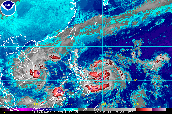
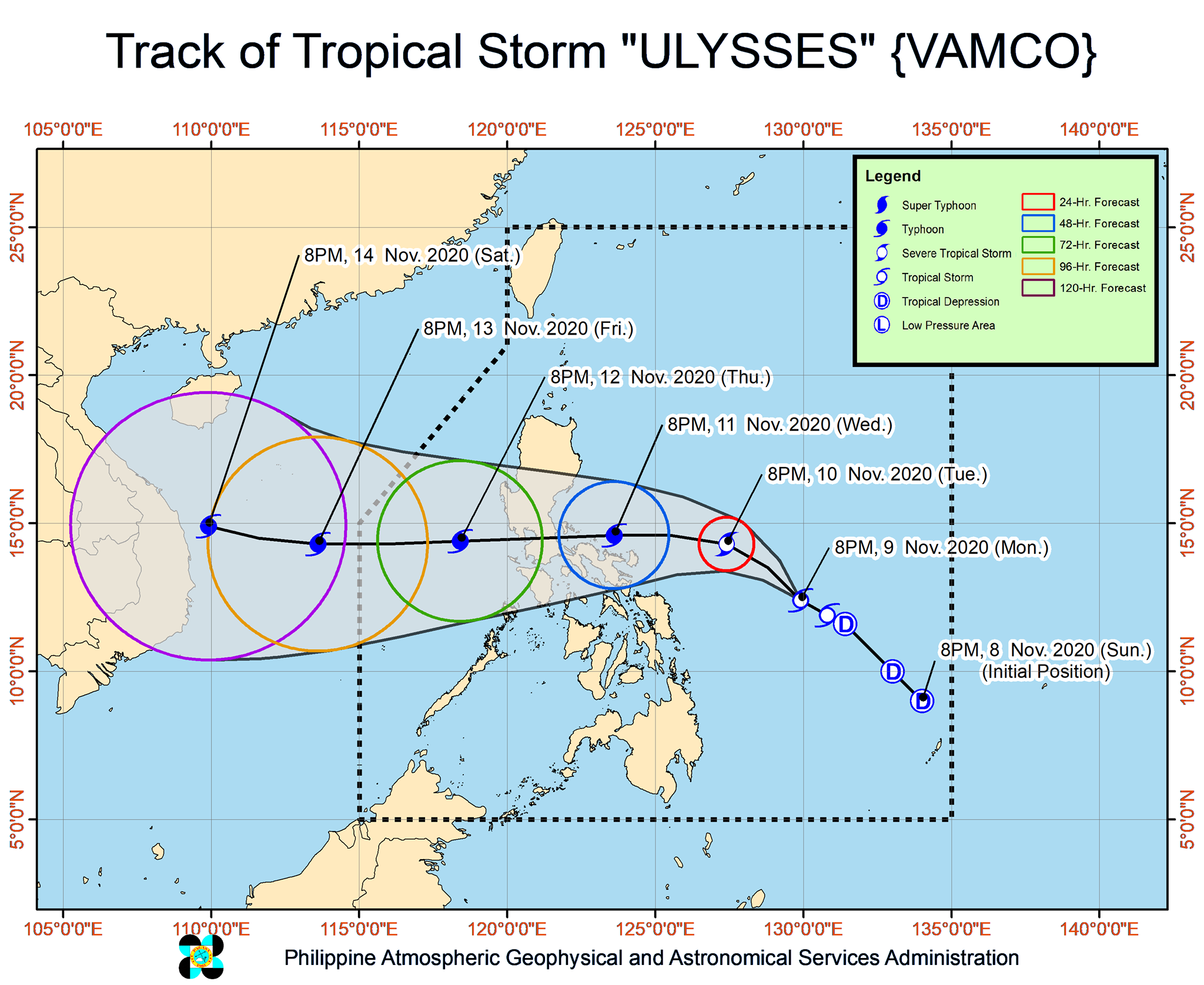
In a bulletin released past 11 pm on Monday, the Philippine Atmospheric, Geophysical, and Astronomical Services Administration (PAGASA) said Ulysses is now 485 kilometers east of Borongan City, Eastern Samar, or 560 kilometers east of Catarman, Northern Samar.
The tropical storm is moving west northwest at a slightly faster 20 kilometers per hour (km/h) from the previous 15 km/h. (READ: FAST FACTS: Tropical cyclones, rainfall advisories)
Ulysses maintained its strength on Monday evening, with maximum sustained winds of 65 km/h and gustiness of up to 80 km/h.
But PAGASA warned that Ulysses is likely to become a severe tropical storm in the next 24 hours, then a typhoon by Wednesday morning, November 11. It could reach a peak intensity of 140 to 155 km/h on Wednesday evening, then make landfall at or near that strength.
There are two possible scenarios for Ulysses’ landfall at the moment:
- Quezon between Wednesday evening, November 11, and Thursday morning, November 12 (more likely)
- Bicol around Wednesday afternoon or evening, November 11 (not ruled out)
The following areas in Bicol and Eastern Visayas are now under Signal No. 1 as of 11 pm on Monday:
- eastern part of Camarines Sur (Siruma, Tinambac, Goa, Tigaon, Sagñay, San Jose, Lagonoy, Garchitorena, Presentacion, Caramoan)
- eastern part of Albay (Tiwi, Malinao, Tabaco City, Malilipot, Santo Domingo, Bacacay, Rapu-Rapu, Manito)
- Catanduanes
- northeastern part of Sorsogon (Sorsogon City, Gubat, Prieto Diaz)
- eastern part of Northern Samar (Laoang, Palapag, Mapanas, Gamay, Lapinig)
Areas under Signal No. 1 should prepare for “strong breeze to near gale conditions.”
In terms of rainfall, there are currently two sources: Ulysses and the tail-end of a cold front. Both will trigger light to moderate rain, with at times heavy rain, on Tuesday, November 10.
Due to Ulysses
- Aurora
- Quezon
- Bicol
- Eastern Visayas
- Caraga
- Davao Region
Due to tail-end of a cold front
- Cagayan including Babuyan Islands
- eastern part of Isabela
- Apayao
PAGASA also warned that moderate to heavy rain from Ulysses will begin affecting Bicol and parts of Eastern Visayas on Wednesday.
Meanwhile, travel is risky in the next 24 hours, especially for small vessels, in the seaboards listed below.
Rough to very rough seas (waves 2.5 to 5 meters high)
Due to surge of northeast monsoon
- seaboards of Northern Luzon
- seaboards of Kalayaan Islands
Rough to very rough seas (waves 2.5 to 4.5 meters high)
Due to Ulysses
- seaboards of Aurora, northern Quezon (including the northern and eastern coastal waters of Polillo Island), and Camarines Norte
- northern seaboard of Camarines Sur
- eastern seaboards of Albay (including Rapu-Rapu Islands), Sorsogon, and Eastern Samar
- northern and eastern seaboards of Catanduanes and Northern Samar
Small vessels must take precautionary measures when venturing out to sea in the areas below, added PAGASA.
Moderate to rough seas
- western seaboards of Central Luzon and Southern Luzon
- eastern seaboard of Mindanao
Ulysses could exit the Philippine Area of Responsibility (PAR) on Friday, November 13.
Ulysses is the Philippines’ 21st tropical cyclone for 2020 – already above the yearly average of 20. (READ: LIST: PAGASA’s names for tropical cyclones in 2020)
For the next 6 months, these are PAGASA’s estimates for tropical cyclones inside PAR:
- November 2020 – 1 to 3
- December 2020 – 2 or 3
- January 2021 – 0 or 1
- February 2021 – 0 or 1
- March 2021 – 0 or 1
- April 2021 – 0 or 1
Since October, La Niña has been underway, which means there is more rain than usual.
Then in November, the northeast monsoon began, signaling “surges of cold temperatures.”
PAGASA warned that La Niña may enhance the northeast monsoon, which could trigger floods and landslides. – Rappler.com
Add a comment
How does this make you feel?


There are no comments yet. Add your comment to start the conversation.