SUMMARY
This is AI generated summarization, which may have errors. For context, always refer to the full article.
MANILA, Philippines – On September 21, 1999, Taiwan was struck by the magnitude 7.7 Chichi earthquake, one of the world’s deadliest temblors in that century, killing more than 2,000 people and inflicting damage to infrastructure amounting to several billions of dollars.
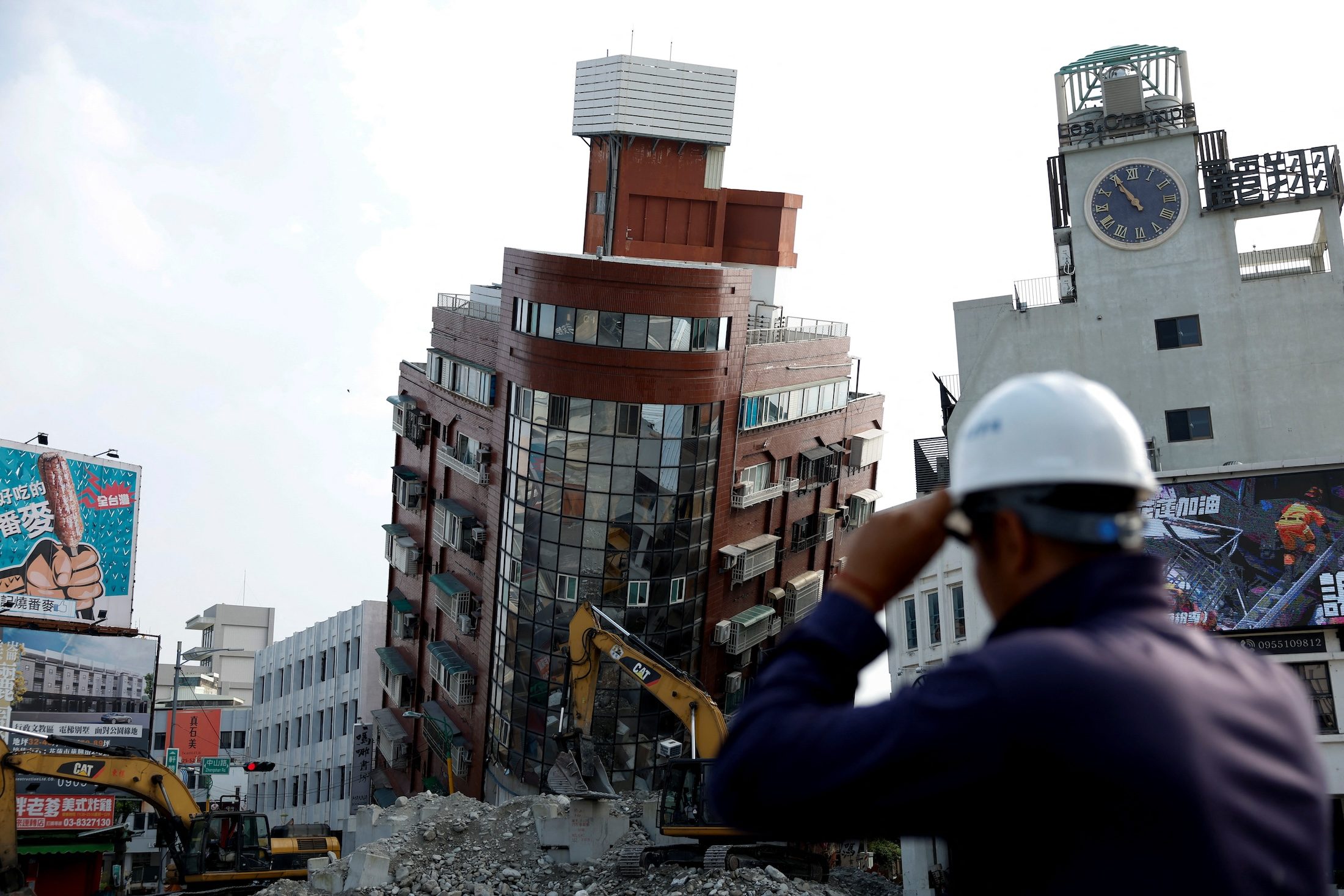
Almost 25 years later, as if to commemorate the silver anniversary of that disaster, the island state was shaken by a magnitude 7.4 tremor on April 3, 2024. It claimed the lives of a much lesser number of people but caused just as significant damage to infrastructure.
The remarkably much lower number of casualties may reflect a much better state of preparedness of the citizenry, which is seen by some observers as the result of an efficient top-down governance, meaning, the population placed their trust in state authorities and followed experts’ instructions.
Earthquake-prone Taiwan
Taiwan, like its neighbors Japan and the Philippines, is unfortunately earthquake-prone due to its tectonic setting. This bean-shaped island state results from the collision of the Luzon Arc and the eastern continental edge of the Eurasian plate.

1985). Right: Seismotectonic map of the magnitude 7.4 earthquake of April 3, 2024, explaining the characteristics of the seismic event that struck the eastern coast of the island state (Source: Institut de Physique
du Globe de Paris, France).
The Luzon Arc is a mountain range partly submerged in the strait between Taiwan and the Philippines. It is comprised of the Cordillera Mountains in northern Luzon, the Batanes volcanic chain, and an elongated strip of mountainous terrain in eastern Taiwan. This arc is a result of volcanism produced by the melting of the oceanic lithosphere of the Eurasian Plate as it slides underneath the oceanic lithosphere of the Philippine Sea Plate (see diagram). The eastern edge of the continental lithosphere of the Eurasian Plate protrudes eastwards from the main continental landmass that underlies Europe to the west and eastern Russia to the east.
Present-day plate dynamics is characterized by a mobile Philippine Sea Plate that is moving towards the relatively inert Eurasian Plate (red arrow in left figure of diagram above). Because of this converging motion between the plates and the relatively similar densities of the volcanic arc and the continental lithosphere, the Luzon Arc collides with the Eurasian Plate at the latitude of Taiwan. Collision between plates is accommodated by crustal fractures known as thrust faults – where one plate overrides another along an inclined plane. When such faults move, they generate earthquakes.
Neighbors shake a lot, too!
Like Taiwan, neighbors Japan and the Philippines are hosts to numerous thrust faults. When crustal stresses on such faults are high, the earthquakes that they generate release great amounts of energy resulting to large magnitudes. Such were the cases of the magnitude 7.2 Abra earthquake of July 27, 2022 that rocked northern Luzon in the Philippines, the magnitude 7.6 earthquake of Surigao del Sur of December 2, 2023 in the southern Philippines, and the magnitude 7.5 earthquake of January 1, 2024 that hit the Noto Peninsula in west-central Japan.
The thrust fault that ruptured in the 2022 Abra earthquake is part of a larger fault system called the Philippine Fault – a throughgoing fault that traverses the entire length of the Philippines for more than 1,200 kilometers from Bangui in Ilocos Norte all the way down to Mati in Davao Oriental. The 2023 Surigao del Sur earthquake was produced by a large thrust fault belonging to the subduction system of the Philippine Sea Plate underneath Mindanao along the Philippine Trench. For the 2024 New Year’s Day earthquake of Noto Peninsula, the culprit was a thrust fault cutting through the overriding plate.
Big steps in earthquake resilience
Four seismic events with magnitudes greater than 7 occurring within a span of less than three years inside a radius of not more than 2,000 kilometers are reminders of the severe seismic threats to this region of the world. But the remarkably low number of casualties of all four earthquakes (none going over two-digit casualty figures), compared to recent events in other parts of the world such as in Turkey, Morocco, and Haiti, where casualty figures reached as high as a few hundreds of thousands, may signify that the Philippines, Taiwan, and Japan are gaining much ground in improving their capacity to minimize damage and casualty during earthquake events, which is key to attaining successful disaster preparedness and earthquake resilience. – Rappler.com
Mario A. Aurelio, PhD is a professor at the National Institute of Geological Sciences-University of the Philippines, interested in the study of earthquakes. He is part of a UP team engaged in developing strategies to enhance disaster resilience against earthquakes in the country.
Add a comment
How does this make you feel?


There are no comments yet. Add your comment to start the conversation.