SUMMARY
This is AI generated summarization, which may have errors. For context, always refer to the full article.

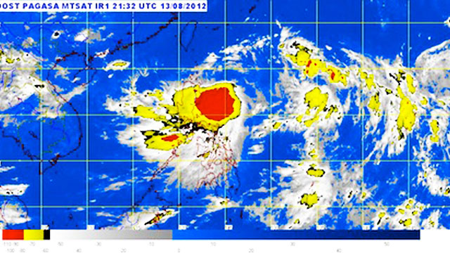
Tropical Storm “Helen” (international codename Kai-tak) has maintained its strength and is still on course towards northern Luzon, putting more areas are under public storm warning signal #2. The estimated rainfall within the 500 km diameter of the tropical storm is about 15-25 mm per hour, considered heavy to intense. As of 11 a.m. August 14, Helen’s center was last spotted at 230 kilometers east northeast of Casiguran, Aurora, with maximum sustained winds of 75 km/h near its center and gustiness of up to 90 km/h. Pagasa forecasts that Helen will continue to move toward the west northwest at 13 km/h and is estimated to be 50 km north northeast of Tuguegarao City by evening of August 15.
Read more on Rappler
Add a comment
How does this make you feel?
There are no comments yet. Add your comment to start the conversation.