SUMMARY
This is AI generated summarization, which may have errors. For context, always refer to the full article.
What’s the weather like in your area? Report the situation through Rappler’s Agos or tweet us at @rapplerdotcom.
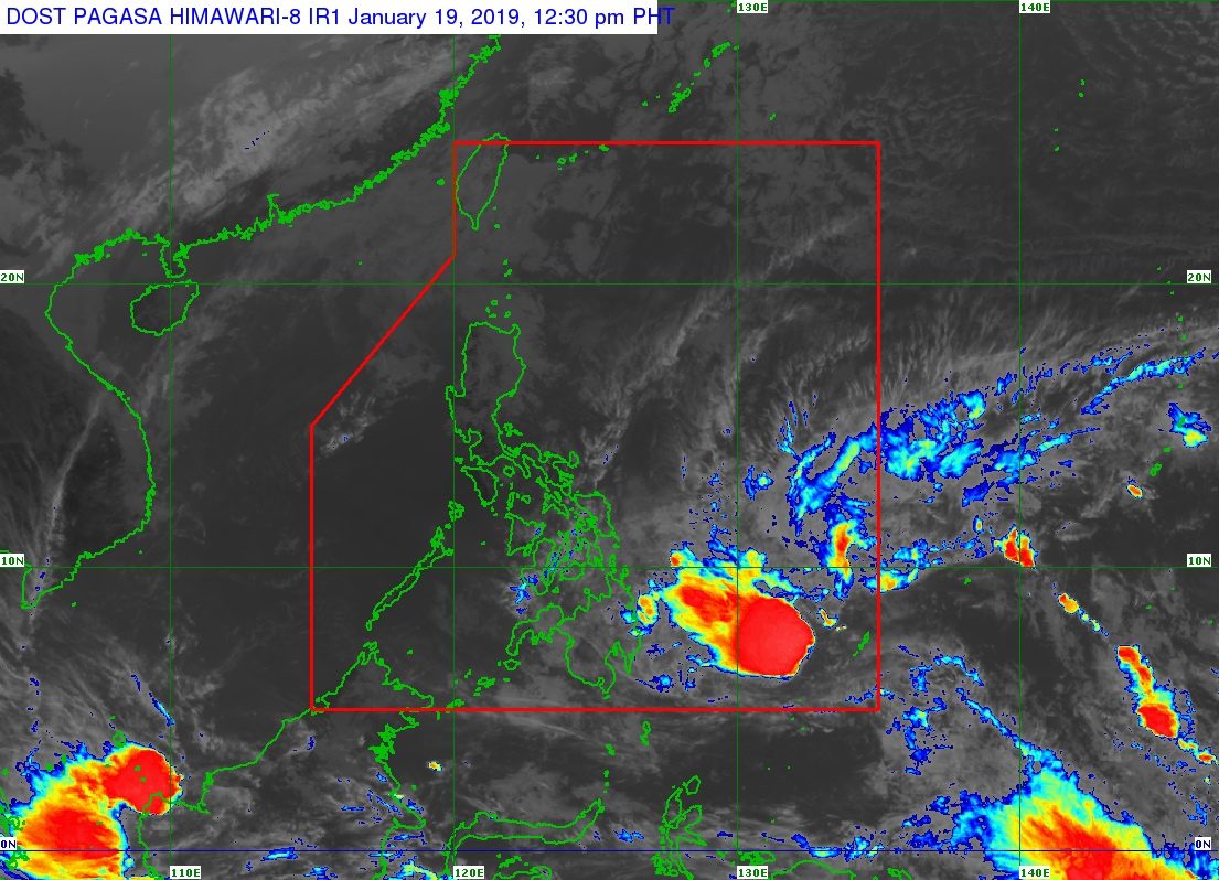
MANILA, Philippines – The low pressure area (LPA) that forecasters have been monitoring entered the Philippine Area of Responsibility (PAR) at 10 am on Saturday, January 19.
In a briefing around 12:30 pm on Saturday, the Philippine Atmospheric, Geophysical, and Astronomical Services Administration (PAGASA) said the LPA is located 860 kilometers east of Hinatuan, Surigao del Sur.
It might become a tropical depression in the next 24 to 36 hours while heading for the region of Caraga.
If the LPA develops into a tropical depression, it would become the Philippines’ first tropical cyclone for 2019 and would be given the local name Amang. (READ: LIST: PAGASA’s names for tropical cyclones in 2019)
The potential Amang’s landfall could be in Surigao del Norte on Sunday evening, January 20.
After hitting land, it might return to being an LPA by early Monday morning, January 21, but would still bring hazards.
PAGASA earlier emphasized that weather disturbances such as LPAs and tropical depressions can still trigger heavy rain, so officials and residents should watch out for flash floods and landslides.
Here’s what to expect in terms of rainfall, according to PAGASA:
- late Saturday afternoon to evening – moderate to heavy rain in Caraga, Davao Oriental, Compostela Valley, Camiguin, Misamis Oriental
- Sunday – moderate to heavy rain in Caraga, Northern Mindanao, Eastern Visayas, Central Visayas, Bicol, southern part of Quezon, Romblon, Marinduque
- Monday – moderate to heavy rain in the Visayas, Bicol, southern part of Quezon, Romblon, Marinduque
Residents of those regions and provinces should be on alert for possible flash floods and landslides, especially if they live in low-lying communities, near rivers, or in mountainous areas.
Sea travel is also risky in the northern and western seaboards of Northern Luzon, and in the eastern seaboard of the Philippines. This is due to the combined effects of the approaching LPA and the surge of the northeast monsoon or hanging amihan.
The Philippines gets an average of 20 tropical cyclones per year. The forecast for January is zero to one tropical cyclone. (READ: FAST FACTS: Tropical cyclones, rainfall advisories) – Rappler.com
Add a comment
How does this make you feel?


There are no comments yet. Add your comment to start the conversation.