SUMMARY
This is AI generated summarization, which may have errors. For context, always refer to the full article.
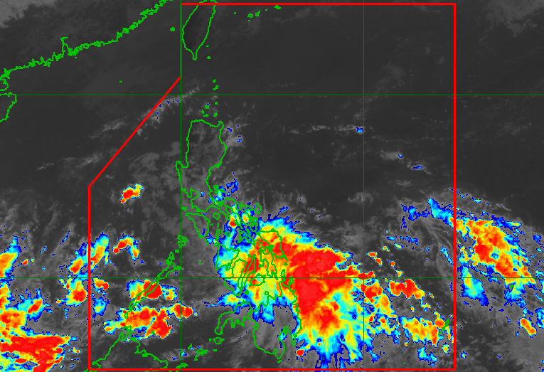
MANILA, Philippines – The intertropical convergence zone and the low pressure area (LPA) embedded along the ITCZ continue to dump heavy rain in parts of the country on Friday, November 18.
The LPA was located 320 kilometers east southeast of General Santos City on Friday morning. It initially formed inside the Philippine Area of Responsibility on Wednesday, November 16; left PAR early Thursday, November 17; then reentered on Thursday evening.
The Philippine Atmospheric, Geophysical, and Astronomical Services Administration (PAGASA) said in its 11 am advisory on Friday that the LPA is less likely to develop into a tropical depression within 24 hours.
But the ITCZ and the LPA combined are still affecting much of the country, particularly the following areas:
Moderate to heavy rain
- Eastern Visayas
- Central Visayas
- Soccsksargen
- Caraga
- Davao Region
Light to moderate rain, with at times heavy rain
- Palawan
- Bicol
- Western Visayas
- rest of Mindanao
Affected areas must stay on alert for floods and landslides.
The ITCZ is a belt near the equator where the trade winds of the Northern Hemisphere and Southern Hemisphere meet. It is considered a breeding ground for tropical cyclones.
The Philippines has yet to have a tropical cyclone in November. PAGASA earlier said there may be two or three tropical cyclones during the month. – Rappler.com
Add a comment
How does this make you feel?


There are no comments yet. Add your comment to start the conversation.