SUMMARY
This is AI generated summarization, which may have errors. For context, always refer to the full article.
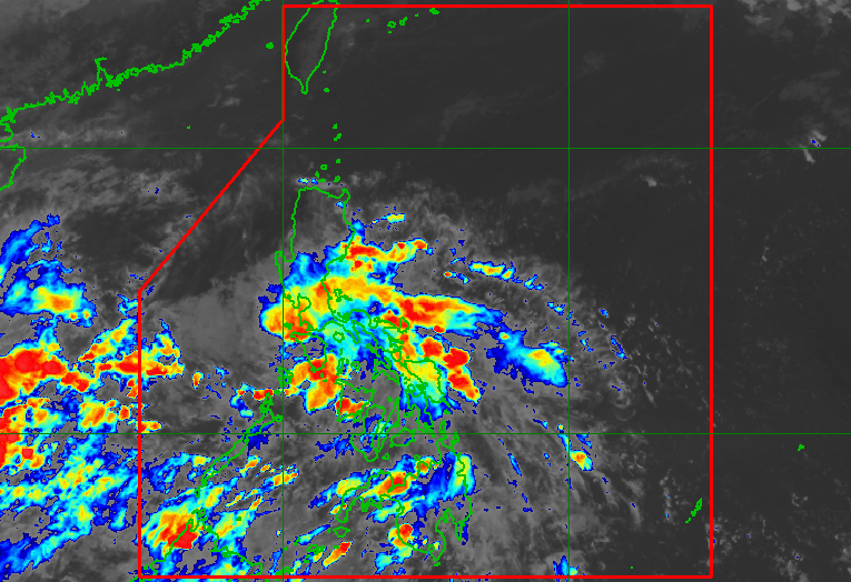
MANILA, Philippines – The low pressure area east of General Santos City dissipated on Saturday, November 19, but the intertropical convergence zone (ITCZ) will continue to bring rain.
The Philippine Atmospheric, Geophysical, and Astronomical Services Administration (PAGASA) said in its 4 pm bulletin on Saturday that the following areas will still have scattered rain showers and thunderstorms due to the ITCZ:
- Metro Manila
- Calabarzon
- Bicol
- Mimaropa
- Aurora
- Visayas
- Mindanao
Flash floods and landslides remain possible during periods of moderate to heavy rain.
The ITCZ is a belt near the equator where the trade winds of the Northern Hemisphere and Southern Hemisphere meet. It is considered a breeding ground for tropical cyclones.
So far, the Philippines has seen 16 tropical cyclones in 2022. There have been none yet in November.
The yearly average is 20. – Rappler.com
Add a comment
How does this make you feel?


There are no comments yet. Add your comment to start the conversation.