SUMMARY
This is AI generated summarization, which may have errors. For context, always refer to the full article.
MANILA, Philippines – The low pressure area (LPA) that used to be Tropical Depression Agaton (Megi) dissipated at 10 am on Wednesday, April 13.
The Philippine Atmospheric, Geophysical, and Astronomical Services Administration (PAGASA) said in an 11 am advisory, however, that scattered rain showers will still hit these areas on Wednesday:
- Bicol
- Quezon
- Oriental Mindoro
- Marinduque
- Romblon
- Visayas
At its peak, Agaton was a tropical storm. It made landfall twice in the Philippines:
- Calicoan Island, Guiuan, Eastern Samar – 7:30 am on Sunday, April 10 (as a tropical storm)
- Basey, Samar – 4 pm on Monday, April 11 (as a tropical depression)
Agaton had lingered for days in Eastern Visayas, dumping heavy to torrential rain that triggered massive floods and landslides in the region.
In Baybay City, Leyte, the death toll rose to 36 on Tuesday, April 12, based on the local government’s count. The extent of the tropical cyclone’s impact continues to be assessed in various areas.
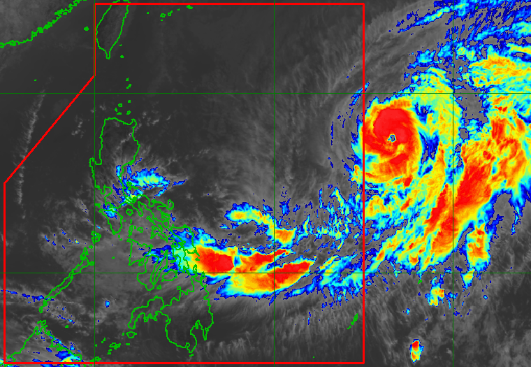
In Wednesday’s advisory, PAGASA also warned of swells caused by Typhoon Basyang (Malakas), which entered then quickly exited the Philippine Area of Responsibility on Tuesday. Swells are waves that have left their generating area, as defined by the World Meteorological Organization.
Swells from Basyang will cause rough seas in the northern and eastern seaboards of Luzon and the eastern seaboards of the Visayas and Mindanao on Wednesday. Waves are 2.8 to 3.7 meters high, making travel risky for most vessels.
PAGASA advised small vessels to remain in port and larger vessels to take precautionary measures or, if possible, avoid venturing out to sea. – Rappler.com
Add a comment
How does this make you feel?


There are no comments yet. Add your comment to start the conversation.