SUMMARY
This is AI generated summarization, which may have errors. For context, always refer to the full article.
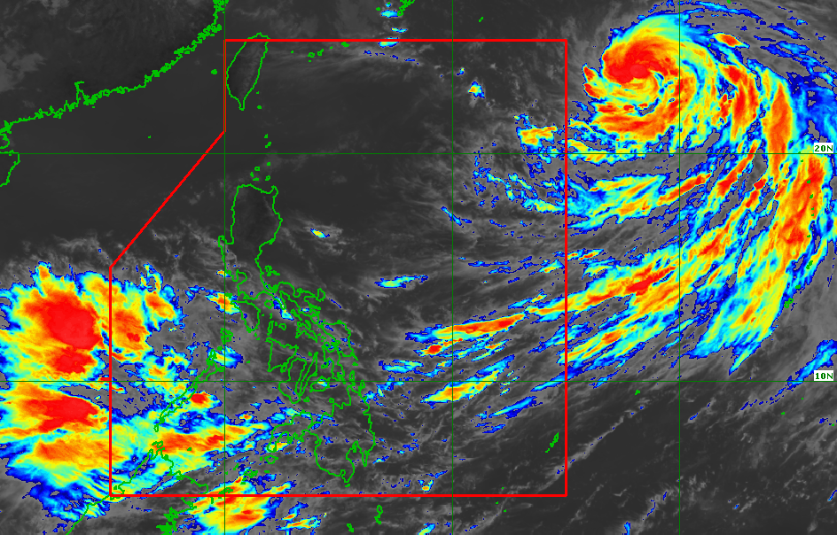
MANILA, Philippines – Rain is expected in parts of the country on Thursday, September 15, due to the southwest monsoon or hanging habagat being enhanced by Severe Tropical Storm Nanmadol, which remains outside the Philippine Area of Responsibility (PAR).
The Philippine Atmospheric, Geophysical, and Astronomical Services Administration (PAGASA) issued an advisory for the southwest monsoon at 11 am on Thursday.
Here is PAGASA’s rainfall forecast:
Moderate to heavy rain, with at times intense rain
- Antique
- Aklan
- Negros Occidental
- Occidental Mindoro
- Palawan including Cuyo, Calamian, and Kalayaan Islands
Light to moderate rain, with at times heavy rain
- rest of Western Visayas
- Oriental Mindoro
- Zamboanga Peninsula
- Bangsamoro Autonomous Region in Muslim Mindanao
The weather bureau warned that scattered floods and landslides are likely.
Meanwhile, Nanmadol slightly intensified on Thursday morning. It now has maximum sustained winds of 110 kilometers per hour from the previous 95 km/h, and its gustiness went up to 135 km/h from 115 km/h.
PAGASA said Nanmadol may strengthen into a typhoon within 12 to 24 hours.
The severe tropical storm was located 1,760 kilometers east northeast of extreme Northern Luzon on Thursday morning, still moving west northwest at 15 km/h.
It is projected to keep moving west northwest from Thursday to Friday, September 16, then turn northwest on Saturday, September 17.
PAGASA said Nanmadol is still expected to enter PAR on Thursday evening or Friday morning. It will be given the local name Josie.
It is not seen to make landfall in the country and will not directly affect the weather, but it may continue enhancing the southwest monsoon.
The weather bureau also said gusty conditions may be felt in these areas due to the southwest monsoon:
- Mimaropa
- Bicol
- Visayas
- northern and western parts of Mindanao

Nanmadol or the potential Josie would be the Philippines’ 10th tropical cyclone for 2022.
It would also be the second tropical cyclone for September, after Typhoon Inday (Muifa), which did not make landfall.
PAGASA expects 7 to 11 tropical cyclones to enter or develop inside PAR from September 2022 to February 2023. Per month, these are the weather bureau’s estimates:
- September 2022 – 2 or 3
- October 2022 – 2 to 4
- November 2022 – 2 or 3
- December 2022 – 1 or 2
- January 2023 – 0 or 1
- February 2023 – 0 or 1
– Rappler.com
Add a comment
How does this make you feel?


There are no comments yet. Add your comment to start the conversation.