SUMMARY
This is AI generated summarization, which may have errors. For context, always refer to the full article.
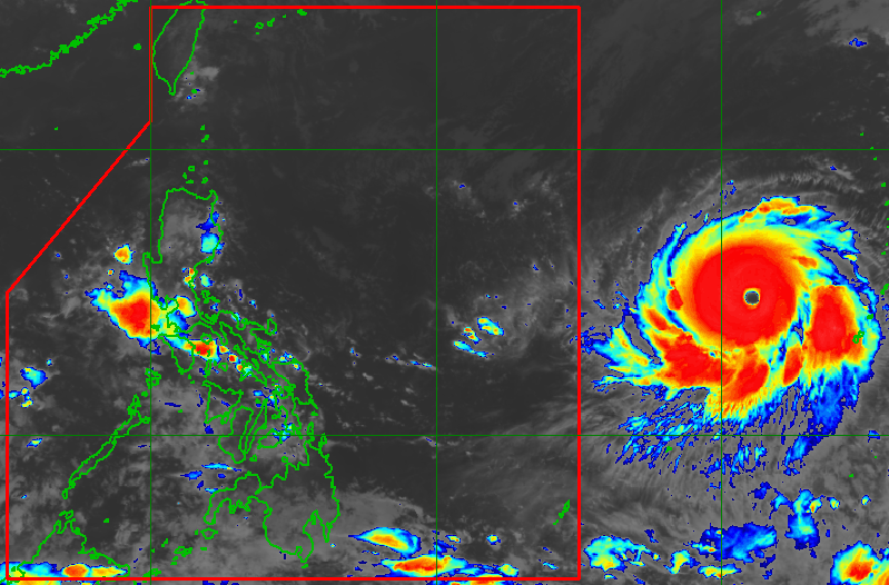
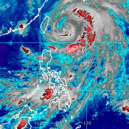
MANILA, Philippines – Super Typhoon Mawar continued to intensify on Thursday evening, May 25, with its maximum sustained winds already reaching 205 kilometers per hour (km/h).
Mawar’s gustiness also increased to 250 km/h, said the Philippine Atmospheric, Geophysical, and Astronomical Services Administration (PAGASA) in an advisory issued past 11 pm on Thursday.
As of Thursday evening, the super typhoon was located 1,840 kilometers east of southeastern Luzon, over the Philippine Sea but still outside the Philippine Area of Responsibility (PAR).
Mawar is heading west toward PAR at 20 km/h. It is expected to maintain this direction while accelerating until Friday, May 26, before turning more west northwest on Saturday, May 27.
At that pace, the super typhoon is still projected to enter PAR on Friday evening or Saturday morning. It would be given the local name Betty.
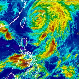
On Sunday, May 28, Mawar may slow down as it begins to move closer toward the waters east of extreme Northern Luzon, PAGASA said.
“The center of Mawar’s eye is forecast to be within 300 kilometers of the Batanes-Babuyan archipelago by early next week during the slowdown period,” added the weather bureau.
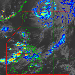
While Mawar’s eye might not move over Philippine landmass – no landfall, in other words – the super typhoon remains a threat.
PAGASA warned that Mawar may bring heavy rain to Northern Luzon starting late Sunday or Monday, May 29. Floods and landslides are possible.
The weather bureau could also raise tropical cyclone wind signals in parts of Northern Luzon as early as Friday or Saturday, to warn affected areas that severe winds are expected to be felt in 36 hours.

Mawar is also seen to enhance the southwest monsoon or habagat. Monsoon rain may hit the western parts of Central Luzon, Southern Luzon, and the Visayas beginning Sunday or Monday.
The Metropolitan Manila Development Authority has begun preparing for the possibility of enhanced monsoon rain.
Some local government units also suspended classes for Friday, even before Mawar’s entry into PAR.
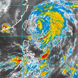
PAGASA said on Thursday evening that Mawar could reach its peak intensity within 24 to 36 hours.
There may be slight weakening by Saturday, but Mawar is expected to remain a super typhoon until Sunday or early Monday, according to the weather bureau.
Then by Monday or Tuesday, May 30, Mawar could weaken “at a slightly faster rate” due to increasing wind shear, cooler sea surface temperatures, and dry air intrusion – conditions which PAGASA described as “unfavorable” for tropical cyclones.
Mawar would be the Philippines’ second tropical cyclone for 2023, after Tropical Depression Amang in April.
Rainshowers and thunderstorms experienced in parts of the country in recent days were due to the southwesterly windflow.
In General Trias City, Cavite, two minors died on Thursday after being struck by lightning in separate locations. – Rappler.com
Add a comment
How does this make you feel?

There are no comments yet. Add your comment to start the conversation.